Holme Moss
| Holme Moss | |
|---|---|
|
Holme Moss towards Holme Moss transmitting station | |
| Highest point | |
| Elevation | 524 m (1,719 ft) |
| Coordinates | 53°31′58.87″N 1°51′26.61″W / 53.5330194°N 1.8573917°WCoordinates: 53°31′58.87″N 1°51′26.61″W / 53.5330194°N 1.8573917°W |
| Geography | |
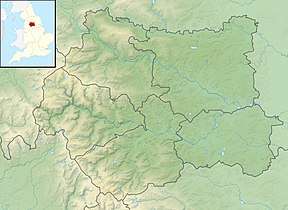 Holme Moss Location of Holme Moss in West Yorkshire | |
| Location |
Holme Valley, West Yorkshire, England |
| Parent range | Peak District |
| OS grid | SE095040 |
Holme Moss (1,719 feet or 524 metres a.s.l.[1]) is high moorland on the border between the Holme Valley district of Kirklees in West Yorkshire and the High Peak district of Derbyshire in England. Historically on the boundary between the West Riding of Yorkshire and Cheshire, it is just inside the boundary of the Peak District National Park. The A6024 road between Holmfirth and Longdendale crosses the moor near its highest point close to Holme Moss transmitting station's prominent mast.[1]
Watershed
Water seeping from the surrounding moorland into Rake Dike is the source of the River Holme. Rake Dike rising from Kay Edge on the moor flows through the village of Holme into Brownhill Reservoir, about a mile below the moor, and passes down through the Holme Valley to Huddersfield, where it flows into the River Colne. The upper part of the moor continues into Black Hill which is crossed by the Pennine Way north–south footpath.
Transmitting station
Holme Moss transmitting station is the highest in England. When erected it transmitted television signals that travelled much further than its intended service area. They were received on the Isle of Man and in parts of the Irish Republic, mainly Dublin and Wicklow. Now it provides VHF coverage for FM and DAB to a wide area around the transmitter including Derbyshire, Greater Manchester and West Yorkshire. The FM signals operate at 250 kW from one of the most powerful transmitters in the country with reception available as far north as the Borders, as far south as Birmingham, and to the east and west coasts. Emley Moor (55.44°, 15.53 km) and Moorside Edge (348.22°, 11.56 km) transmitters can be seen from the location.
.JPG)
Transport
In the winter Holme Moss frequently gets a covering of snow and the road over the moor is often the first in the area to be blocked. Kirklees Highways department clears the road as far as the border with Derbyshire. Derbyshire County Council Highways Authority is responsible for clearing the southern side.[2]
Sport
Athletics
Holmfirth Harriers Athletics Club organise an annual "Holme Moss Fell Race" on and around Holme Moss in the summer. The race starts at Cartworth Moor cricket ground, crosses Ramsden Clough to Holme Moss, crosses and descends to Crowden before returning via Bareholme Moss, Laddow Rocks and Black Hill.
.JPG)
Cycling
To British cycling enthusiasts, Holme Moss has become synonymous with the A6024 (Woodhead Road) which crosses the moor, between the village of Holmbridge to the north and the Woodhead Reservoir to the south. The northern side in particular is one of England's best known bicycle ascents, and has acquired a reputation as among the country's more difficult climbs. It has often been used for domestic competition in British road racing[3] and mountain biking.[4]
Climbs
Starting from Holmfirth, to the north, the climb is 7 km (4.3 mi) long, gaining 394 m (1,293 ft) in altitude, at an average gradient of 5.6%, although the penultimate kilometre is at a gradient of 11%.[5]
From the south, the climb starts at the junction with the A628, from where it is 4 km (2.5 mi) long, with a height gain of 274 m (899 ft) at an average gradient of 6.9%.[6]
"Le Col de Moss"
Although not comparable in distance with the cols of European bicycle racing, the length and difficulty of Holme Moss relative to other British climbs has made it a frequent and popular inclusion in British races, including the Tour of Britain. For many years the (now defunct) Leeds Classic race saw internationally renowned riders (many of them, such as Bjarne Riis, veterans of the Tour de France) tackling the climb.[4][7]
Tour de France
The second stage of the 2014 Tour de France followed the route across the Pennines to Derbyshire.[8] The leader over the summit was Blel Kadri from France.[9]
References
| Wikimedia Commons has media related to Holme Moss. |
- 1 2 OL1 Dark Peak Area (Map). 1:25000. Explorer. Ordnance Survey. Retrieved 12 September 2012.
- ↑ "Roads and traffic". Derbyshire County Council. Retrieved 15 July 2014.
- ↑ "Snake Pass & Holme Moss Loop". British Cycling.org.uk. Retrieved 15 July 2014.
- 1 2 "Le Col de Moss". Mountain Bike Rider. Retrieved 15 July 2014.
- ↑ "Holme Moss - Holmfirth". climbbybike. Retrieved 14 July 2014.
- ↑ "Holme Moss - A 628 - Barnsley". climbbybike. Retrieved 14 July 2014.
- ↑ "Tour de France 2014: Stage 2 – Steep stuff with 33% at Jenkins Road". Cycling Stage.com. Retrieved 15 July 2014.
- ↑ Fortheringham, William (17 January 2013). "Tour de France 2014: Leeds chosen for start as English route is unveiled". The Guardian. Retrieved 18 January 2013.
- ↑ "Shark attack in Sheffield". Tour de France. Amaury Sport Organisation. 6 July 2014. Retrieved 14 July 2014.