Rileysburg, Indiana
| Rileysburg, Indiana | |
|---|---|
| Unincorporated community | |
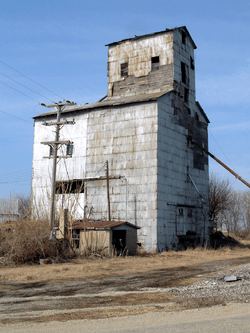 The old Rileysburg grain elevator | |
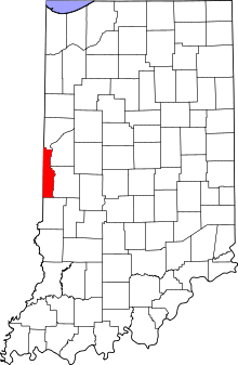 Vermillion County's location in Indiana | |
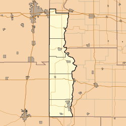 Rileysburg Rileysburg's location in Vermillion County | |
| Coordinates: 40°06′15″N 87°31′33″W / 40.10417°N 87.52583°WCoordinates: 40°06′15″N 87°31′33″W / 40.10417°N 87.52583°W | |
| Country | United States |
| State | Indiana |
| County | Vermillion |
| Township | Highland |
| Elevation[1] | 650 ft (198 m) |
| Time zone | UTC-5 (Eastern (EST)) |
| • Summer (DST) | UTC-4 (EDT) |
| ZIP code | 47932 |
| Area code(s) | 765 |
| GNIS feature ID | 442041 |
Rileysburg is a small unincorporated community in Highland Township, Vermillion County, in the U.S. state of Indiana.[2] The town is served by the post office in Covington in nearby Fountain County. The county seat is located in Newport.
History
A post office was established at Rileysburg in 1887, and remained in operation until it was discontinued in 1934.[3] The town plat was officially filed in 1904.[4]
Geography
Rileysburg is located in the far northwest part of the county, 1 mile (1.6 km) south of Interstate 74 and about .25 miles (0.40 km) east of the Indiana-Illinois state line. A CSX Transportation railway runs northwest through town toward Danville, Illinois. Coal Branch Creek, which flows south through the county to the Vermilion River, has its head near Rileysburg.
References
- ↑ "US Board on Geographic Names". United States Geological Survey. October 25, 2007. Retrieved 2016-07-15.
- ↑ "Rileysburg, Indiana". Geographic Names Information System. United States Geological Survey. Retrieved August 1, 2017.
- ↑ "Vermillion County". Jim Forte Postal History. Retrieved 1 October 2015.
- ↑ Baker, Ronald L. (October 1995). From Needmore to Prosperity: Hoosier Place Names in Folklore and History. Indiana University Press. p. 280. ISBN 978-0-253-32866-3.
...was platted on June 4, 1904.
Municipalities and communities of Vermillion County, Indiana, United States | ||
|---|---|---|
| City | ||
| Towns | ||
| Townships | ||
| CDPs | ||
| Other unincorporated communities | ||
| Ghost towns | ||
| Footnotes | ‡This populated place also has portions in an adjacent county or counties | |