Flat Iron, Indiana
| Flat Iron, Indiana | |
|---|---|
| Unincorporated community | |
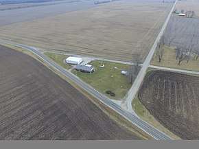 Flat Iron from the air | |
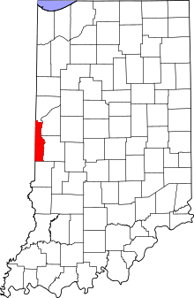 Vermillion County's location in Indiana | |
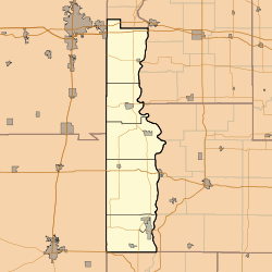 Flat Iron Flat Iron's location in Vermillion County | |
| Coordinates: 40°03′12″N 87°29′24″W / 40.05333°N 87.49000°WCoordinates: 40°03′12″N 87°29′24″W / 40.05333°N 87.49000°W | |
| Country | United States |
| State | Indiana |
| County | Vermillion |
| Township | Highland |
| Elevation[1] | 617 ft (188 m) |
| Time zone | UTC-5 (Eastern (EST)) |
| • Summer (DST) | UTC-4 (EDT) |
| ZIP code | 47974 |
| Area code(s) | 765 |
| GNIS feature ID | 434564 |
Flat Iron is a small, unincorporated community in Highland Township, Vermillion County, in the U.S. state of Indiana.[2]
Geography
Flat Iron is an Unincorporated community located at 40°3′11″N 87°29′21″W / 40.05306°N 87.48917°W (40.052930, -87.489130). State Road 32, County Road 100W ("Flat Iron Road") and County Road 1150N come together at this point to enclose a triangular, iron-shaped area of flat ground, giving the site its name. A house and a pole barn occupy the site, along with a sign reading, "Flat Iron, population 1." In the past the site had an additional residence and a general store, and a population of six. Highland Airport, which closed in the late 1980s, was located just across the field to the north and east of Flat Iron. The closest incorporated town is Perrysville, approximately three miles east. The unincorporated town of Gessie is about two miles north.
References
- ↑ "US Board on Geographic Names". United States Geological Survey. October 25, 2007. Retrieved 2016-07-15.
- ↑ "Flat Iron, Indiana". Geographic Names Information System. United States Geological Survey. Retrieved July 31, 2017.
Municipalities and communities of Vermillion County, Indiana, United States | ||
|---|---|---|
| City | ||
| Towns | ||
| Townships | ||
| CDPs | ||
| Other unincorporated communities | ||
| Ghost towns | ||
| Footnotes | ‡This populated place also has portions in an adjacent county or counties | |