Klondyke, Indiana
| Klondyke, Indiana | |
|---|---|
| Unincorporated community | |
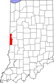 Vermillion County's location in Indiana | |
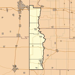 Klondyke Klondyke's location in Vermillion County | |
| Coordinates: 39°40′10″N 87°26′12″W / 39.66944°N 87.43667°WCoordinates: 39°40′10″N 87°26′12″W / 39.66944°N 87.43667°W | |
| Country | United States |
| State | Indiana |
| County | Vermillion |
| Township | Clinton |
| Elevation[1] | 600 ft (183 m) |
| Time zone | UTC-5 (Eastern (EST)) |
| • Summer (DST) | UTC-4 (EDT) |
| ZIP code | 47842 |
| Area code(s) | 765 |
| GNIS feature ID | 437381 |
Klondyke is an unincorporated community in Clinton Township, Vermillion County, in the U.S. state of Indiana.[2]
History
The town was named for the local Klondyke Mines, which were active in the early 1900s.[3]
Geography
Klondyke is located at 39°40′6″N 87°26′16″W / 39.66833°N 87.43778°W (39.668400, -87.437790).
References
- ↑ "US Board on Geographic Names". United States Geological Survey. October 25, 2007. Retrieved 2016-07-15.
- ↑ "Klondyke, Indiana". Geographic Names Information System. United States Geological Survey. Retrieved July 31, 2017.
- ↑ Baker, Ronald L.; Marvin Carmony (1975). Indiana Place Names. Indiana University Press. pp. 82–83. ISBN 0-253-14167-2.
Municipalities and communities of Vermillion County, Indiana, United States | ||
|---|---|---|
| City | ||
| Towns | ||
| Townships | ||
| CDPs | ||
| Other unincorporated communities | ||
| Ghost towns | ||
| Footnotes | ‡This populated place also has portions in an adjacent county or counties | |
This article is issued from
Wikipedia.
The text is licensed under Creative Commons - Attribution - Sharealike.
Additional terms may apply for the media files.