Helt Township, Vermillion County, Indiana
| Helt Township | |
|---|---|
| Township | |
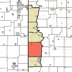 Location in Vermillion County | |
| Coordinates: 39°45′32″N 87°27′21″W / 39.75889°N 87.45583°WCoordinates: 39°45′32″N 87°27′21″W / 39.75889°N 87.45583°W | |
| Country | United States |
| State | Indiana |
| County | Vermillion |
| Government | |
| • Type | Indiana township |
| Area | |
| • Total | 72.18 sq mi (186.9 km2) |
| • Land | 71.64 sq mi (185.5 km2) |
| • Water | 0.54 sq mi (1.4 km2) 0.75% |
| Elevation[1] | 650 ft (198 m) |
| Population (2010) | |
| • Total | 2,610 |
| • Density | 36.4/sq mi (14.1/km2) |
| Time zone | UTC-5 (Eastern (EST)) |
| • Summer (DST) | UTC-4 (EDT) |
| ZIP codes | 47842, 47847, 47854 |
| Area code(s) | 765 |
| GNIS feature ID | 453404 |
Helt Township is one of five townships in Vermillion County, Indiana, United States. As of the 2010 census, its population was 2,610 and it contained 1,181 housing units.[2]
History
Helt Township was named for Daniel Helt, a pioneer who settled in Vermillion County in 1818.[3]
The Possum Bottom Covered Bridge and Salem Methodist Episcopal Church are listed on the National Register of Historic Places.[4]
Geography
According to the 2010 census, the township has a total area of 72.18 square miles (186.9 km2), of which 71.64 square miles (185.5 km2) (or 99.25%) is land and 0.54 square miles (1.4 km2) (or 0.75%) is water.[2]
Cities
Unincorporated towns
- Alta at 39°46′20″N 87°23′12″W / 39.7722603°N 87.3866837°W
- Bono at 39°45′37″N 87°29′38″W / 39.7603143°N 87.4939082°W
- Highland at 39°47′40″N 87°23′45″W / 39.7944824°N 87.3958502°W
- Hillsdale at 39°47′09″N 87°23′25″W / 39.7858714°N 87.3902947°W
- Jonestown at 39°42′33″N 87°30′14″W / 39.7092028°N 87.5039089°W
- Saint Bernice at 39°42′33″N 87°31′17″W / 39.7092027°N 87.5214094°W
- Summit Grove at 39°43′28″N 87°23′21″W / 39.7244822°N 87.3891843°W
- West Clinton at 39°41′40″N 87°31′31″W / 39.6944803°N 87.5252986°W
(This list is based on USGS data and may include former settlements.)
Extinct towns
- Early Station at 39°45′48″N 87°23′07″W / 39.7633714°N 87.3852949°W
- Montezuma Station at 39°47′42″N 87°23′12″W / 39.7950382°N 87.3866834°W
- Randall at 39°46′29″N 87°31′21″W / 39.7747585°N 87.5225199°W
- Toronto at 39°46′54″N 87°29′44″W / 39.7817032°N 87.4955747°W
- West Dana at 39°48′11″N 87°31′28″W / 39.8030920°N 87.5244640°W
Cemeteries
The township contains nine cemeteries: Andrews, Bales, Bogart, Dinsmore, Helts Prairie, Higbie, Highland, Hollingsworth and Pisgah.
Airports and landing strips
- Clinton Airport
Landmarks
- Miller Park
School districts
- South Vermillion Community School Corporation
Political districts
- Indiana's 8th congressional district
- State House District 42
- State Senate District 38
References
- ↑ "US Board on Geographic Names". United States Geological Survey. October 25, 2007. Retrieved 2017-05-09.
- 1 2 "Population, Housing Units, Area, and Density: 2010 - County -- County Subdivision and Place -- 2010 Census Summary File 1". United States Census. Retrieved 2013-05-10.
- ↑ History of Parke and Vermillion Counties, Indiana. B.F. Bowen & Cos. 1913. p. 405.
- ↑ National Park Service (2010-07-09). "National Register Information System". National Register of Historic Places. National Park Service.
External links
Places adjacent to Helt Township, Vermillion County, Indiana | |
|---|---|
Municipalities and communities of Vermillion County, Indiana, United States | ||
|---|---|---|
| City | ||
| Towns | ||
| Townships | ||
| CDPs | ||
| Other unincorporated communities | ||
| Ghost towns | ||
| Footnotes | ‡This populated place also has portions in an adjacent county or counties | |