Richmond–Warm Springs/South Fremont line
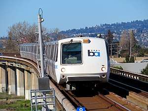
The Richmond–Warm Springs/South Fremont line (formerly the Richmond–Fremont line) is a Bay Area Rapid Transit (BART) line in the San Francisco Bay Area that runs from Warm Springs/South Fremont station to Richmond station. It has 19 stations in Richmond, El Cerrito, Berkeley, Oakland, San Leandro, Hayward, Union City, and Fremont. It is the only of the five mainline BART services that does not run through the Transbay Tube to San Francisco; however, it shares tracks with the four other services in the East Bay. The line is colored orange on maps; however, BART does not use colored names for its services.
The Richmond–Fremont line was the first BART line to open. Initial services between MacArthur and Fremont began on September 11, 1972, with full service to Richmond on January 29, 1973.[2] The extension to Warm Springs/South Fremont station opened on March 25, 2017.[3] Until September 10, 2018, weekday service on the line only ran to Fremont station until direct San Francisco service ended around 6pm.[4]
A further extension to Berryessa/North San José station as part of the Silicon Valley extension project is projected to open at the end of 2019. The line is planned to eventually extend to Santa Clara station.[5]
Stations
| Station | Jurisdiction | County | Opened | Other BART lines |
|---|---|---|---|---|
| Richmond | Richmond | Contra Costa | January 29, 1973 | |
| El Cerrito del Norte | El Cerrito | |||
| El Cerrito Plaza | ||||
| North Berkeley | Berkeley | Alameda | ||
| Downtown Berkeley | ||||
| Ashby | ||||
| MacArthur | Oakland | September 11, 1972 | ||
| 19th Street Oakland | ||||
| 12th Street Oakland City Center | ||||
| Lake Merritt | ||||
| Fruitvale | ||||
| Coliseum | ||||
| San Leandro | San Leandro | |||
| Bay Fair | ||||
| Hayward | Hayward | |||
| South Hayward | ||||
| Union City | Union City | |||
| Fremont | Fremont | |||
| Warm Springs/South Fremont | March 25, 2017 |
References
- ↑ "BART Sustainable Communities Operations Analysis" (PDF). San Francisco Bay Area Rapid Transit District. Retrieved 28 May 2018.
- ↑ "BART Chronology January 1947 – March 2009" (PDF). San Francisco Bay Area Rapid Transit District. March 2009. Archived from the original (PDF) on October 13, 2013.
- ↑ "Community celebrates ribbon cutting of Warm Springs" (Press release). Bay Area Rapid Transit District. March 24, 2017.
- ↑ "Direct service to/from Warm Springs now available as part of schedule change" (Press release). Bay Area Rapid Transit District. September 7, 2018.
- ↑ Woolfolk, John (September 7, 2018). "BART to San Jose delayed again, parts mistake puts Berryessa service at end of 2019". Mercury News.
Route map:
| Current lines |
| ||||||||||||
|---|---|---|---|---|---|---|---|---|---|---|---|---|---|
| Stations |
| ||||||||||||
| Infrastructure | |||||||||||||
| History | |||||||||||||
| General Managers |
| ||||||||||||
| Connecting services |
| ||||||||||||
| Other | |||||||||||||