Ratkovská Lehota
| Ratkovská Lehota | |
| Village | |
| Country | Slovakia |
|---|---|
| Region | Banská Bystrica |
| District | Rimavská Sobota |
| Elevation | 285 m (935 ft) |
| Coordinates | 48°33′N 20°06′E / 48.550°N 20.100°ECoordinates: 48°33′N 20°06′E / 48.550°N 20.100°E |
| Area | 5.595335 km2 (2.16 sq mi) |
| Population | 80 (2011) |
| Density | 14/km2 (36/sq mi) |
| First mentioned | 1413 |
| Postal code | 982 64 |
| Area code | +421-47 |
| Car plate | RS |
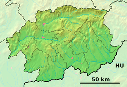 Location of Ratkovská Lehota in the Banská Bystrica Region  Ratkovská Lehota (Slovakia) | |
| Statistics: | |
| Website: www.ratkovskalehota.ocu.sk/ | |
Ratkovská Lehota is a village and municipality in the Rimavská Sobota District of the Banská Bystrica Region of southern Slovakia.[1] In the second half of the 16th century the village was pillaged, but resettled by the end of the 17th century. Main engagement of the locals is agriculture. Interesting sightseeing is evangelical church from 1787.
References
- ↑ "Statistical Office of the Slovak Republic" (PDF). Výsledky SODB 2011. Štatistický úrad SR. Retrieved 9 August 2012.
External links
- https://web.archive.org/web/20160730235001/http://ratkovskalehota.e-obce.sk/
- http://svinica.ou.sk/ratkovska-lehota-o48-uvod.html%5Bpermanent+dead+link%5D
- Blog about life in Ratkovská Lehota
This article is issued from
Wikipedia.
The text is licensed under Creative Commons - Attribution - Sharealike.
Additional terms may apply for the media files.