Nižný Skálnik
| Nižný Skálnik | |
| Village | |
| Country | Slovakia |
|---|---|
| Region | Banská Bystrica |
| District | Rimavská Sobota |
| Elevation | 236 m (774 ft) |
| Coordinates | 48°27′N 19°58′E / 48.450°N 19.967°ECoordinates: 48°27′N 19°58′E / 48.450°N 19.967°E |
| Area | 5.302 km2 (2.05 sq mi) |
| Population | 200 (2011) |
| Density | 38/km2 (98/sq mi) |
| First mentioned | 1334 |
| Postal code | 980 52 |
| Area code | +421-47 |
| Car plate | RS |
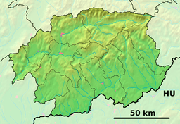 Location of Nižný Skálnik in the Banská Bystrica Region  Nižný Skálnik (Slovakia) | |
| Statistics: MOŠ/MIS | |
| Website: www.e-obce.sk/obec/niznyskalnik/nizny-skalnik.html | |
Nižný Skálnik is a village and municipality in the Rimavská Sobota District of the Banská Bystrica Region of southern Slovakia.[1] Located between hilly and flat area, agriculture played an important role in local economy. The village is first mentioned in 1334. During the Hussite wars on Slovak territory, the hill above the village had been fortified by the Hussites, who constructed Maginhrad fortress, now in ruins.[2] Most important sightseeing is classical Lutheran church from 1802.
Village is a birthplace of 19th-century Slovak historians Matej Holko and Ján Feješ.
References
- ↑ "Statistical Office of the slovak Republic" (PDF). Výsledky SODB 2011. Štatistický úrad SR. Archived from the original (PDF) on October 12, 2013. Retrieved 9 August 2012.
- ↑ http://www.hrady.sk/maginhrad.php
External links
- Article about Carnival in Nižný Skálnik
- Article about Maginhrad
- http://www.e-obce.sk/obec/niznyskalnik/4-kulturne_dedicstvo.html
This article is issued from
Wikipedia.
The text is licensed under Creative Commons - Attribution - Sharealike.
Additional terms may apply for the media files.