Kociha
| Kociha | |
| Village | |
| Country | Slovakia |
|---|---|
| Region | Banská Bystrica |
| District | Rimavská Sobota |
| Elevation | 248 m (814 ft) |
| Coordinates | 48°24′N 19°56′E / 48.400°N 19.933°ECoordinates: 48°24′N 19°56′E / 48.400°N 19.933°E |
| Area | 11.408 km2 (4.40 sq mi) |
| Population | 209 (2011) |
| Density | 18/km2 (47/sq mi) |
| First mentioned | 1298 |
| Postal code | 980 52 |
| Area code | +421-47 |
| Car plate | RS |
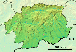 Location of Kociha in the Banská Bystrica Region  Kociha (Slovakia) | |
| Statistics: MOŠ/MIS | |
| Website: www.kociha.ocu.sk/-sucasnost | |
Kociha is a village and municipality in the Rimavská Sobota District of the Banská Bystrica Region of southern Slovakia.[1] Part of the village is settlement Suchý potok, which is gradually developing as agrotourim settlement.[2] Important sightseeing is late classical evangelical church.
See also
References
- ↑ "Statistical Office of the slovak Republic" (PDF). Výsledky SODB 2011. Štatistický úrad SR. Archived from the original (PDF) on 2013-10-12. Retrieved 2012-08-09.
- ↑ http://www.kociha.ocu.sk/-historia
Genealogical resources
The records for genealogical research are available at the state archive "Statny Archiv in Banska Bystrica, Slovakia"
- Lutheran church records (births/marriages/deaths): 1713-1883 (parish B)
- Reformated church records (births/marriages/deaths): 1771-1896 (parish B)
External links
- http://www.e-obce.sk/obec/kociha/kociha.html
- Kociha photo gallery
- Surnames of living people in Kociha
This article is issued from
Wikipedia.
The text is licensed under Creative Commons - Attribution - Sharealike.
Additional terms may apply for the media files.