Čierny Potok
| Čierny Potok | |
| Village | |
 Municipal Office | |
| Country | Slovakia |
|---|---|
| Region | Banská Bystrica |
| District | Rimavská Sobota |
| Elevation | 208 m (682 ft) |
| Coordinates | 48°17′N 19°56′E / 48.283°N 19.933°ECoordinates: 48°17′N 19°56′E / 48.283°N 19.933°E |
| Area | 5.905699 km2 (2.28 sq mi) |
| Population | 156 (2011) |
| Density | 26/km2 (67/sq mi) |
| First mentioned | 1955 |
| Postal code | 980 31 |
| Area code | +421-47 |
| Car plate | RS |
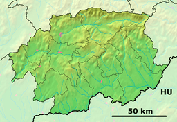 Location of Čierny Potok in the Banská Bystrica Region  Čierny Potok (Slovakia) | |
| Statistics: MOŠ/MIS | |
| Website: www.ciernypotok.gemer.org | |
Čierny Potok (Hungarian: Feketepatak) is a village and municipality in the Rimavská Sobota District of the Banská Bystrica Region of southern Slovakia.
History
The village arose in 1955 by separation from Hodejov. During Hungarian occupation in World War II, many inhabitants were deported to concentration camps.
External links
- http://www.statistics.sk/mosmis/eng/run.html
- http://www.e-obce.sk/obec/ciernypotok/cierny-potok.html
This article is issued from
Wikipedia.
The text is licensed under Creative Commons - Attribution - Sharealike.
Additional terms may apply for the media files.