Ramsden Corner Plantation
| Site of Special Scientific Interest | |
 | |
| Area of Search | Northamptonshire |
|---|---|
| Grid reference | SP 623 564 [1] |
| Interest | Biological |
| Area | 3.2 hectares[1] |
| Notification | 1986[1] |
| Location map | Magic Map |
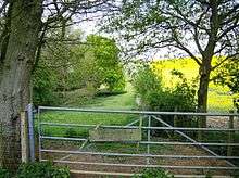
Ramsden Corner Plantation is a 3.2 hectare biological Site of Special Scientific Interest west of Northampton.[1][2] It is managed by the Wildlife Trust for Bedfordshire, Cambridgeshire and Northamptonshire.[3]
A stream runs through this valley site, which is acidic grassland, woodland and scrub on clay and sand. Plants such as wood millet, wood-sorrel and wood vetch are indicators of ancient woodland. Opposite-leaved golden-saxifrage is found in wet flushes.[4]
The Macmillan Way runs along its southern boundary. There is access from Main Street between Farthingstone and Upper Stowe.
References
- 1 2 3 4 "Designated Sites View: Ramsden Corner Plantation". Sites of Special Scientific Interest. Natural England. Retrieved 24 December 2016.
- ↑ "Map of Ramsden Corner Plantation". Sites of Special Scientific Interest. Natural England. Retrieved 24 December 2016.
- ↑ "Ramsden Corner". Wildlife Trust for Bedfordshire, Cambridgeshire and Northamptonshire. Retrieved 24 December 2016.
- ↑ "Ramsden Corner Plantation citation" (PDF). Sites of Special Scientific Interest. Natural England. Retrieved 24 December 2016.
This article is issued from
Wikipedia.
The text is licensed under Creative Commons - Attribution - Sharealike.
Additional terms may apply for the media files.