Ramon Magsaysay, Zamboanga del Sur
| Ramon Magsaysay | |
|---|---|
| Municipality | |
| Municipality of Ramon Magsaysay | |
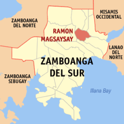 Map of Zamboanga del Sur with Ramon Magsaysay highlighted | |
.svg.png) Ramon Magsaysay Location within the Philippines | |
| Coordinates: 8°00′00″N 123°29′00″E / 8°N 123.4833333°ECoordinates: 8°00′00″N 123°29′00″E / 8°N 123.4833333°E | |
| Country |
|
| Region | Zamboanga Peninsula (Region IX) |
| Province | Zamboanga del Sur |
| District | 1st District |
| Founded | February 13, 1957 |
| Barangays | 27 (see Barangays) |
| Government [1] | |
| • Type | Sangguniang Bayan |
| • Mayor | Leonilo D. Borinaga Sr. |
| • Electorate | 15,632 voters (2016) |
| Area [2] | |
| • Total | 113.70 km2 (43.90 sq mi) |
| Population (2015 census)[3] | |
| • Total | 26,606 |
| • Density | 230/km2 (610/sq mi) |
| Time zone | UTC+8 (PST) |
| ZIP code | 7024 |
| PSGC | 097323000 |
| IDD : area code | +63 (0)62 |
| Climate type | Tropical climate |
| Income class | 4th municipal income class |
| Revenue (₱) | 89,733,882.09 (2016) |
| Native languages |
Subanon language Cebuano Chavacano Tagalog |
| Website |
www |
Ramon Magsaysay, officially the Municipality of Ramon Magsaysay, is a 4th class municipality in the province of Zamboanga del Sur, Philippines. According to the 2015 census, it has a population of 26,606 people.[3]
The municipality was formed on February 13, 1957, out of 23 barrios of the Municipality of Aurora, and was originally called Liargao. It was renamed after Philippine president Ramon Magsaysay who created the municipality by virtue of Executive Order Number 239.[4] Republic Act Number 2788 marked the renaming of Liargao to Ramon Magsaysay on June 19, 1960.[5]
Barangays
Ramon Magsaysay is politically subdivided into 27 barangays.
- Bagong Opon
- Bambong Daku
- Bambong Diut
- Bobongan
- Campo IV
- Campo V
- Caniangan
- Dipalusan
- Eastern Bobongan
- Esperanza
- Gapasan
- Katipunan
- Kauswagan
- Lower Sambulawan
- Mabini
- Magsaysay
- Malating
- Paradise
- Pasingkalan
- Poblacion
- San Fernando
- Santo Rosario
- Sapa Anding
- Sinaguing
- Switch
- Upper Laperian
- Wakat
Demographics
| Population census of Ramon Magsaysay | ||
|---|---|---|
| Year | Pop. | ±% p.a. |
| 1960 | 24,282 | — |
| 1970 | 15,221 | −4.56% |
| 1975 | 18,057 | +3.49% |
| 1980 | 17,852 | −0.23% |
| 1990 | 21,065 | +1.67% |
| 1995 | 22,795 | +1.49% |
| 2000 | 23,323 | +0.49% |
| 2007 | 25,321 | +1.14% |
| 2010 | 26,194 | +1.24% |
| 2015 | 26,606 | +0.30% |
| Source: Philippine Statistics Authority[3][6][7][8] | ||
References
- ↑ "Municipality". Quezon City, Philippines: Department of the Interior and Local Government. Retrieved 31 May 2013.
- ↑ "Province: Zamboanga del Sur". PSGC Interactive. Quezon City, Philippines: Philippine Statistics Authority. Retrieved 12 November 2016.
- 1 2 3 Census of Population (2015). "Region IX (Zamboanga Peninsula)". Total Population by Province, City, Municipality and Barangay. PSA. Retrieved 20 June 2016.
- ↑ "Executive Order No. 239: Creating the Municipality of Liargo in the Province of Zamboanga del Sur". Official Gazette. Manila, Philippines: Presidential Communications Development and Strategic Planning Office. February 13, 1957. Retrieved 22 July 2014.
- ↑ "Republic Act No. 2788 - An Act Changing the Name of the Municipality of Liargao in the Province of Zamboanga del Sur to Ramon Magsaysay". Philippine Laws, Statutes & Codes. Chan Robles Virtual Law Library. June 19, 1960. Retrieved 22 July 2014.
- ↑ Census of Population and Housing (2010). "Region IX (Zamboanga Peninsula)". Total Population by Province, City, Municipality and Barangay. NSO. Retrieved 29 June 2016.
- ↑ Censuses of Population (1903–2007). "Region IX (Zamboanga Peninsula)". Table 1. Population Enumerated in Various Censuses by Province/Highly Urbanized City: 1903 to 2007. NSO.
- ↑ "Province of Zamboanga del Sur". Municipality Population Data. Local Water Utilities Administration Research Division. Retrieved 17 December 2016.
External links
Places adjacent to Ramon Magsaysay, Zamboanga del Sur | |
|---|---|
Pagadian (capital) | |
| Municipalities | |
| Component city | |
| Highly urbanized city |
|
This article is issued from
Wikipedia.
The text is licensed under Creative Commons - Attribution - Sharealike.
Additional terms may apply for the media files.