Midsalip, Zamboanga del Sur
| Midsalip | |
|---|---|
| Municipality | |
| Municipality of Midsalip | |
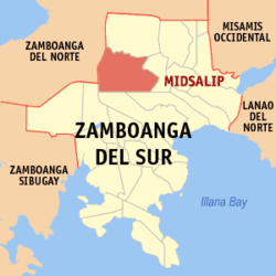 Map of Zamboanga del Sur with Midsalip highlighted | |
.svg.png) Midsalip Location within the Philippines | |
| Coordinates: 8°00′N 123°16′E / 8°N 123.27°ECoordinates: 8°00′N 123°16′E / 8°N 123.27°E | |
| Country |
|
| Region | Zamboanga Peninsula (Region IX) |
| Province | Zamboanga del Sur |
| District | 1st District |
| Founded | September 9, 1964 |
| Barangays | 33 (see Barangays) |
| Government [1] | |
| • Type | Sangguniang Bayan |
| • Mayor | Liwaya A. Angcap-Paras |
| • Electorate | 16,994 voters (2016) |
| Area [2] | |
| • Total | 161.56 km2 (62.38 sq mi) |
| Population (2015 census)[3] | |
| • Total | 32,075 |
| • Density | 200/km2 (510/sq mi) |
| Time zone | UTC+8 (PST) |
| ZIP code | 7021 |
| PSGC | 097318000 |
| IDD : area code | +63 (0)62 |
| Climate type | Tropical climate |
| Income class | 4th municipal income class |
| Revenue (₱) | 93,548,534.52 (2016) |
| Native languages |
Subanon language Cebuano Chavacano Tagalog |
| Website |
www |
Midsalip, officially the Municipality of Midsalip, is a 4th class municipality in the province of Zamboanga del Sur, Philippines. According to the 2015 census, it has a population of 32,075 people.[3]
History
The town's name is from a Subanen word,"Migsalip" which means "to collect" or "accumulate".
Midsalip was formed as a municipality out of 21 barrios of the Municipality of Ramon Magsaysay and 6 barrios of the Municipality of Dumingag on September 9, 1964, by virtue of Executive Order Number 94 signed by President Diosdado Macapagal.[4] This didn’t last long, however, as it was dissolved on February 26, 1966, due to a Supreme Court decision regarding the legality of the funds disbursed by the municipal treasurer. As a result, Midsalip was reverted to barrio status. It wasn’t until May 8, 1967, when the Republic Act No. 4871 was passed when Midsalip became a regular municipality again.[5]
Barangays
Midsalip is politically subdivided into 33 barangays.
- Bacahan
- Balonai
- Bibilop
- Buloron
- Cabaloran
- Canipay Norte
- Canipay Sur
- Cumarom
- Dakayakan
- Duelic
- Dumalinao
- Ecuan
- Golictop
- Guinabot
- Guitalos
- Guma
- Kahayagan
- Licuro-an
- Lumpunid
- Matalang
- New Katipunan
- New Unidos
- Palili
- Pawan
- Pili
- Pisompongan
- Piwan
- Poblacion A
- Poblacion B
- Sigapod
- Timbaboy
- Tulbong
- Tuluan
Demographics
| Population census of Midsalip | ||
|---|---|---|
| Year | Pop. | ±% p.a. |
| 1970 | 17,397 | — |
| 1975 | 20,927 | +3.77% |
| 1980 | 24,624 | +3.31% |
| 1990 | 22,891 | −0.73% |
| 1995 | 25,258 | +1.86% |
| 2000 | 28,909 | +2.94% |
| 2007 | 30,772 | +0.87% |
| 2010 | 31,467 | +0.82% |
| 2015 | 32,075 | +0.37% |
| Source: Philippine Statistics Authority[3][6][7][8] | ||
References
- ↑ "Municipality". Quezon City, Philippines: Department of the Interior and Local Government. Retrieved 31 May 2013.
- ↑ "Province: Zamboanga del Sur". PSGC Interactive. Quezon City, Philippines: Philippine Statistics Authority. Retrieved 12 November 2016.
- 1 2 3 Census of Population (2015). "Region IX (Zamboanga Peninsula)". Total Population by Province, City, Municipality and Barangay. PSA. Retrieved 20 June 2016.
- ↑ "Executive Order No. 94: Creating the Municipality of Midsalip in the Province of Zamboanga del Sur". Official Gazette of the Republic of the Philippines. Manila, Philippines: Presidential Communications Development and Strategic Planning Office. September 4, 1964. Retrieved 24 July 2014.
- ↑ "Republic Act No. 4871 - An Act Creating the Municipality of Midsalip in the Province of Zamboanga del Sur". Philippine Laws, Statutes & Codes. Chan Robles Virtual Law Library. May 8, 1967. Retrieved 24 July 2014.
- ↑ Census of Population and Housing (2010). "Region IX (Zamboanga Peninsula)". Total Population by Province, City, Municipality and Barangay. NSO. Retrieved 29 June 2016.
- ↑ Censuses of Population (1903–2007). "Region IX (Zamboanga Peninsula)". Table 1. Population Enumerated in Various Censuses by Province/Highly Urbanized City: 1903 to 2007. NSO.
- ↑ "Province of Zamboanga del Sur". Municipality Population Data. Local Water Utilities Administration Research Division. Retrieved 17 December 2016.
External links
Places adjacent to Midsalip, Zamboanga del Sur | |
|---|---|
Pagadian (capital) | |
| Municipalities | |
| Component city | |
| Highly urbanized city |
|