Dinas, Zamboanga del Sur
| Dinas | |
|---|---|
| Municipality | |
| Municipality of Dinas | |
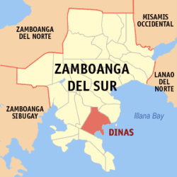 Map of Zamboanga del Sur with Dinas highlighted | |
.svg.png) Dinas Location within the Philippines | |
| Coordinates: 7°38′00″N 123°18′00″E / 7.6333333°N 123.3°ECoordinates: 7°38′00″N 123°18′00″E / 7.6333333°N 123.3°E | |
| Country |
|
| Region | Zamboanga Peninsula (Region IX) |
| Province | Zamboanga del Sur |
| District | 2nd District |
| Founded | June 17, 1950 |
| Barangays | 30 (see Barangays) |
| Government [1] | |
| • Type | Sangguniang Bayan |
| • Mayor | Basilio A. Vidad |
| • Electorate | 18,924 voters (2016) |
| Area [2] | |
| • Total | 121.10 km2 (46.76 sq mi) |
| Population (2015 census)[3] | |
| • Total | 35,504 |
| • Density | 290/km2 (760/sq mi) |
| Time zone | UTC+8 (PST) |
| ZIP code | 7015 |
| PSGC | 097306000 |
| IDD : area code | +63 (0)62 |
| Climate type | Tropical climate |
| Income class | 4th municipal income class |
| Revenue (₱) | 91,884,865.88 (2016) |
| Native languages |
Subanon language Cebuano Chavacano Tagalog |
| Website |
www |
Dinas, officially the Municipality of Dinas, is a 4th class municipality in the province of Zamboanga del Sur, Philippines. According to the 2015 census, it has a population of 35,504 people.[3]
History
Several theories have been woven and advanced to explain the origin of the now famous municipality of Dinas, which had been the cradle of Islamic Culture and civilization and the bulwark of anti-Hispanic colonization of the entire Baganian Peninsula in Zamboanga del Sur.
According to ancient history which has been accepted and educated by the scions of the great grand Sultan Kudarat, a descendants of the renowned Shariff Kabungsuan of Maguindanao was that the name Dinas was taken from a Maguindanao tern Di Nas where "Di" means "Not" and "Nas" means "Bad Luck or Unlucky".
Hence, the early settlers who migrated from the province of Cotabato found their new haven as not unlucky or "Di Nas" because the mouths of all rivers emptying into the coastlines are facing East which according to their belief is a sign of good luck.
The most popular legend handed down to this generation is that Dinas got its name by coincidence as a result of communication gap between a native and foreigner.
When the Spaniards came to our shores, there was already a little settlement in Dinas organized by the followers of Shariff Kabungsuan. Within the community, there was only one sari-sari store wherein household necessities being supplied by the Chinese traders, who frequently visited the place from Zamboanga City.
One day, a group of Spaniards happened to visit the place as part of their Christianization campaign. They roamed around until they reached the only store within the settlement. They asked what the name of the place was. The store owner did not understand a single word from the Spaniards. He thought that the Spaniards were asking what he was selling because they were pointing at the piles of sardines inside the shelves. Immediately, the store owner replied, "Sardinas", the native word of sardines. The foreigner nodded convincingly, "Ah, Dinas" and the Spaniards thought that the name of the place is Dinas. This is how Dinas got its name.[4]
Barangays
Dinas is politically subdivided into 30 barangays.
- Bacawan
- Benuatan
- Beray
- Don Jose
- Dongos
- East Migpulao
- Guinicolalay
- Ignacio Garrata (New Mirapao)
- Kinakap
- Legarda 1
- Legarda 2
- Legarda 3
- Lower Dimaya
- Locuban
- Ludiong
- Nangka
- Nian
- Old Mirapao
- Pisa-an
- Poblacion
- Proper Dimaya
- Sagacad
- Sambulawan
- San Isidro
- Sungayan
- Sumpotan
- Tarakan
- Upper Dimaya
- Upper Sibul
- West Migpulao
Demographics
| Population census of Dinas | ||
|---|---|---|
| Year | Pop. | ±% p.a. |
| 1960 | 29,500 | — |
| 1970 | 23,704 | −2.16% |
| 1975 | 23,081 | −0.53% |
| 1980 | 24,784 | +1.43% |
| 1990 | 28,141 | +1.28% |
| 1995 | 28,364 | +0.15% |
| 2000 | 31,570 | +2.32% |
| 2007 | 33,738 | +0.92% |
| 2010 | 34,768 | +1.10% |
| 2015 | 35,504 | +0.40% |
| Source: Philippine Statistics Authority[3] [5] [6] [7] | ||
References
- ↑ "Municipality". Quezon City, Philippines: Department of the Interior and Local Government. Retrieved 31 May 2013.
- ↑ "Province: Zamboanga del Sur". PSGC Interactive. Quezon City, Philippines: Philippine Statistics Authority. Retrieved 12 November 2016.
- 1 2 3 Census of Population (2015). "Region IX (Zamboanga Peninsula)". Total Population by Province, City, Municipality and Barangay. PSA. Retrieved 20 June 2016.
- ↑ http://www.zamboangadelsur.gov.ph/city-municipalities/dinas
- ↑ Census of Population and Housing (2010). "Region IX (Zamboanga Peninsula)". Total Population by Province, City, Municipality and Barangay. NSO. Retrieved 29 June 2016.
- ↑ Censuses of Population (1903–2007). "Region IX (Zamboanga Peninsula)". Table 1. Population Enumerated in Various Censuses by Province/Highly Urbanized City: 1903 to 2007. NSO.
- ↑ "Province of Zamboanga del Sur". Municipality Population Data. Local Water Utilities Administration Research Division. Retrieved 17 December 2016.
External links
Places adjacent to Dinas, Zamboanga del Sur | |
|---|---|
Pagadian (capital) | |
| Municipalities | |
| Component city | |
| Highly urbanized city |
|