Mahayag, Zamboanga del Sur
| Mahayag | |
|---|---|
| Municipality | |
| Municipality of Mahayag | |
 Municipal Hall | |
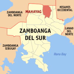 Map of Zamboanga del Sur with Mahayag highlighted | |
.svg.png) Mahayag Location within the Philippines | |
| Coordinates: 8°08′N 123°23′E / 8.13°N 123.38°ECoordinates: 8°08′N 123°23′E / 8.13°N 123.38°E | |
| Country |
|
| Region | Zamboanga Peninsula (Region IX) |
| Province | Zamboanga del Sur |
| District | 1st District |
| Founded | March 9, 1960 |
| Barangays | 29 (see Barangays) |
| Government [1] | |
| • Type | Sangguniang Bayan |
| • Mayor | Lorna Saycon Espina |
| • Electorate | 26,137 voters (2016) |
| Area [2] | |
| • Total | 194.90 km2 (75.25 sq mi) |
| Population (2015 census)[3] | |
| • Total | 46,516 |
| • Density | 240/km2 (620/sq mi) |
| Time zone | UTC+8 (PST) |
| ZIP code | 7026 |
| PSGC | 097315000 |
| IDD : area code | +63 (0)62 |
| Climate type | Tropical climate |
| Income class | 3rd municipal income class |
| Revenue (₱) | 137,448,101.27 (2016) |
| Native languages |
Subanon language Cebuano Chavacano Tagalog |
| Website |
www |
Mahayag, officially the Municipality of Mahayag, is a 3rd class municipality in the province of Zamboanga del Sur, Philippines. According to the 2015 census, it has a population of 46,516 people.[3]
History
The town's name is derived from the Cebuano term "mahayag" (ma = to become + hayag = bright) which means to become bright or sunny. When the Visayan migrants first trickled into the area after World War II, the place was heavily forested, which, to some looks dark and forbidding. Local historical sources had it that when a large "Dao" tree which stands in the townsite was felt, the place becomes bright, hence the expression "mahayag".
Mahayag used to be the sitio of the barangay Molave in the municipality of Aurora. Early settlers of the area had endeavored for the creation of another municipality to fast-track development which is possible only by having a distinct political subdivision from the municipality of Molave. The town site for the new municipality was donated by Zacarias dela Torre and Pedro Alquizar.
The municipality of Mahayag was officially created on March 9, 1960, pursuant to Executive Order No. 393 by President Carlos P. Garcia, with Saturnino Mendoza as its first appointed and subsequently elected Municipal Mayor. It was formed by the separation of 20 barrios from the municipality of Molave and 3 barrios from the municipality of Dumingag.[4]
Barangays
Mahayag is politically subdivided into 29 barangays.
- Bag-ong Balamban
- Boniao
- Delusom
- Diwan
- Guripan
- Kaangayan
- Kabuhi
- Lourmah (Lower Mahayag)
- Lower Salug Daku
- Lower Santo Niño
- Malubo
- Manguiles
- Marabanan (Balanan)
- Panagaan
- Paraiso
- Pedagan
- Poblacion (Upper Mahayag)
- San Isidro
- San Jose
- San Vicente
- Santa Cruz
- Sicpao
- Tuboran
- Tulan
- Tumapic
- Upper Salug Daku
- Upper Santo Niño
Demographics
| Population census of Mahayag | ||
|---|---|---|
| Year | Pop. | ±% p.a. |
| 1970 | 22,493 | — |
| 1975 | 25,305 | +2.39% |
| 1980 | 29,692 | +3.25% |
| 1990 | 37,690 | +2.41% |
| 1995 | 40,806 | +1.50% |
| 2000 | 42,462 | +0.86% |
| 2007 | 44,087 | +0.52% |
| 2010 | 45,015 | +0.76% |
| 2015 | 46,516 | +0.63% |
| Source: Philippine Statistics Authority[3][5][6][7] | ||
Local government
2013-2016 Municipal officials:
- Mayor Lorna Saycon Espina
- Vice Mayor: Camila T. Diaz
- Councilors:
- Jaime Edullantes
- Teomila A. Nobleza
- John Ranile
- Ping Caylan
- Boning Nobleza
- Helen Maglasang
- Raquel Frasco
- Abel Sebandal
Lorna Saycon Espina, the incumbent Municipal mayor, is the 9th Municipal Mayor of the Municipality of Mahayag. Past mayors include Paulino P. Fanilag, Carlito A. Lumacang as OIC-Mayor following the EDSA I Revolution, and Perpetuo C. Apale, the appointed Officer-in-Charge in the Office of the Municipal Mayor during the first election after the ratification of the 1987 Constitution.
Tourist destinations

The town of Mahayag has a high eco-tourism potential, particularly, the cold springs in Barangay Tuburan, the cave system in Barangay Kaangayan, and the Salug River that traverses the Municipality.
Although the municipality has good eco-tourism potential, to date, only the cold springs in Barangay Tuburan have been developed as evidenced by the three private resorts in the area. This is the only tourist destination in Mahayag as of this time.
Government investment to promote and to develop eco-tourism remains to be desired. The cave system in Barangay Kaangayan, for example, due to its proximity to the national highway, can be developed to promote spelunking activities. On the one hand, studies can be undertaken on the feasibility of promoting whitewater rafting in the rapids of Salug River.
Education
In addition to the daycare centers in each barangay, at least one (1) public elementary school exists in each of the 29 barangays in the municipality.
There are six (6) public high schools and one private high school run by the Catholic Church in the municipality.
Although permitted to operate and offer Collegiate courses since the later part of the 1990s, no tertiary courses had been offered by the Santa Maria Goretti Diocesan School except during the time when it served as an extension campus of the Saint Columban College, Pagadian City.
College students who cannot afford to obtain their education from far places like Ozamiz or Pagadian, may still enroll post secondary classes or TESDA accredited short-term courses at the Pagadian Institute of Technology (PIT) campus in Mahayag, and college degrees like Bachelor in Secondary Education (BSED), Bachelor in Elementary Education (BEED) and Associate in Information Technology (AIT) at Josefina H. Cerilles State College- Mahayag External Studies Unit.
References
- ↑ "Municipality". Quezon City, Philippines: Department of the Interior and Local Government. Retrieved 31 May 2013.
- ↑ "Province: Zamboanga del Sur". PSGC Interactive. Quezon City, Philippines: Philippine Statistics Authority. Retrieved 12 November 2016.
- 1 2 3 Census of Population (2015). "Region IX (Zamboanga Peninsula)". Total Population by Province, City, Municipality and Barangay. PSA. Retrieved 20 June 2016.
- ↑ "Executive Order No. 393: Creating the Municipality of Mahayag in the Province of Zamboanga del Sur". Official Gazette. Manila, Philippines: Presidential Communications Development and Strategic Planning Office. May 10, 1960. Retrieved 22 July 2014.
- ↑ Census of Population and Housing (2010). "Region IX (Zamboanga Peninsula)". Total Population by Province, City, Municipality and Barangay. NSO. Retrieved 29 June 2016.
- ↑ Censuses of Population (1903–2007). "Region IX (Zamboanga Peninsula)". Table 1. Population Enumerated in Various Censuses by Province/Highly Urbanized City: 1903 to 2007. NSO.
- ↑ "Province of Zamboanga del Sur". Municipality Population Data. Local Water Utilities Administration Research Division. Retrieved 17 December 2016.
External links
| Wikimedia Commons has media related to Mahayag, Zamboanga del Sur. |
Places adjacent to Mahayag, Zamboanga del Sur | |
|---|---|
Pagadian (capital) | |
| Municipalities | |
| Component city | |
| Highly urbanized city |
|