Ponta Mina
| Ponta Mina | |
|---|---|
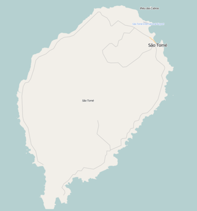 Ponta Mina Location on São Tomé Island | |
| Coordinates: 0°20′07″N 6°44′04″E / 0.3354°N 6.7345°E | |
| Country |
|
| Province | São Tomé |
| District | Água Grande |
| Population (2008) | |
| • Total | 661 |
| Time zone | UTC+0 (UTC) |
Ponta Mina or Ponta da Mina is a small cape, a headland and a subdivision in the east of the city São Tomé in the nation of São Tomé and Príncipe. Its population is 661 (2008 est.).[1] One of nearby the center of São Tomé. The subdivision covers the southeast east of the headland, the rest is covered by the subdivision of Nautico. Main streets include Avenida Marginal 12 de Julho encircling a portion by the Atlantic, Avenidas Amílcar Cabral, da Independėncia and das Nações Unidas, the latter being Secondary Route 2.
The area has an eco-housing area. That portion has a curvilinear street plan, the first in São Tomé and Príncipe, the southwest part has streets mainly not in order.
Notable landmarks include Estádio Nacional 12 de Julho located in the southwest end. Northeast is the UN Building for the nation. Other landmarks include Parque Polular and the National Lyceum. South is the Pestana Miramar Hotel.
The areas is also home to the Nigerian and Portuguese embassies in the nation.
Population history
| Historical population | ||
|---|---|---|
| Year | Pop. | ±% |
| 2001 (census) | 2,293 | — |
| 2008 (estimate) | 2,614 | +14.0% |
References
| Communities | 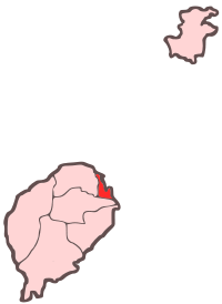 | |
|---|---|---|
| Geographical features |
| |
| Universities and educational institutions | ||
| Landmarks and tourism | ||
| Sports facilities and complexes |
| |
| Transportation |
| |
| Culture | ||
| Topics | ||
| Media |
| |