Pohénégamook
| Pohénégamook | |
|---|---|
| City | |
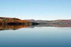 Pohenegamook Lake | |
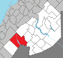 Location within Témiscouata RCM | |
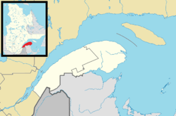 Pohénégamook Location in eastern Quebec | |
| Coordinates: 47°28′N 69°13′W / 47.467°N 69.217°WCoordinates: 47°28′N 69°13′W / 47.467°N 69.217°W[1] | |
| Country |
|
| Province |
|
| Region | Bas-Saint-Laurent |
| RCM | Témiscouata |
| Constituted | November 3, 1973 |
| Government[2] | |
| • Mayor | Louise Labonté |
| • Federal riding |
Rimouski-Neigette— Témiscouata—Les Basques |
| • Prov. riding | Rivière-du-Loup-Témiscouata |
| Area[2][3] | |
| • Total | 349.40 km2 (134.90 sq mi) |
| • Land | 340.33 km2 (131.40 sq mi) |
| Population (2011)[3] | |
| • Total | 2,770 |
| • Density | 8.1/km2 (21/sq mi) |
| • Pop 2006-2011 |
|
| • Dwellings | 1,383 |
| Time zone | UTC−5 (EST) |
| • Summer (DST) | UTC−4 (EDT) |
| Postal code(s) | G0L 1J0 |
| Area code(s) | 418 and 581 |
| Highways |
|
| Website |
www |
Pohénégamook, Quebec (pop. 2940) is a Canadian town on the Canada–United States border in Quebec's Témiscouata Regional County Municipality.
The town shares the border with Estcourt Station, Maine, the northernmost point in New England.
As of 2006, Pohénégamook had 2940 people, down -5.1% from the last census in 2001. The town is named after Lake Pohenegamook and is situated on the lake's southern and western shores.
Pohénégamook was amalgamated with the formerly independent communities of Saint-Pierre d'Estcourt, Saint-Éleuthère, Village-Blier and Saint-David-de-Sully on October 23, 1973.
See also
- Lake Pohenegamook, a waterbody
- Boucanée River, a stream
- List of cities in Quebec
References
External links

- http://www.pohenegamook.net (Pohenegamook official website)
Places adjacent to Pohénégamook | |
|---|---|
| Cities & Towns | |
|---|---|
| Municipalities | |
| Parishes | |
| |
This article is issued from
Wikipedia.
The text is licensed under Creative Commons - Attribution - Sharealike.
Additional terms may apply for the media files.