Machias River (Aroostook River tributary)
| Machias River | |
|---|---|
| Country | United States |
| Physical characteristics | |
| Main source | Maine |
| River mouth |
Aroostook River 530 feet (160 m) 46°37′19″N 68°25′17″W / 46.6219°N 68.4215°WCoordinates: 46°37′19″N 68°25′17″W / 46.6219°N 68.4215°W |
| Length | 33 miles (53 km) |
| Basin features | |
| Progression | Aroostook — St. John — Bay of Fundy |
The Machias River is a major tributary of the Aroostook River, flowing 33.4 miles (53.8 km)[1] through Aroostook County in the northern part of the state of Maine, USA. From the outflow of Big Machias Lake (46°40′45″N 68°45′54″W / 46.6793°N 68.7650°W) in Maine Township 12, Range 8, WELS, the river runs southeast and east to its confluence with the Aroostook in Ashland.
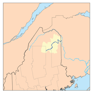
The Aroostook River watershed
See also
References
- ↑ U.S. Geological Survey. National Hydrography Dataset high-resolution flowline data. The National Map Archived 2012-04-05 at WebCite, accessed June 22, 2011
External links
- "Machias River". Geographic Names Information System. United States Geological Survey. 30 September 1980. Retrieved 2010-03-09.
This article is issued from
Wikipedia.
The text is licensed under Creative Commons - Attribution - Sharealike.
Additional terms may apply for the media files.