Plumstead, Cape Town
| Plumstead | |
|---|---|
 Plumstead | |
|
Location within Cape Town  Plumstead  Plumstead Plumstead (South Africa)  Plumstead Plumstead (Africa) | |
| Coordinates: 34°1′20″S 18°28′20″E / 34.02222°S 18.47222°ECoordinates: 34°1′20″S 18°28′20″E / 34.02222°S 18.47222°E | |
| Country | South Africa |
| Province | Western Cape |
| Municipality | City of Cape Town |
| Main Place | Cape Town |
| Area[1] | |
| • Total | 4.58 km2 (1.77 sq mi) |
| Population (2011)[1] | |
| • Total | 20,178 |
| • Density | 4,400/km2 (11,000/sq mi) |
| Racial makeup (2011)[1] | |
| • Black African | 10.4% |
| • Coloured | 28.8% |
| • Indian/Asian | 2.5% |
| • White | 54.5% |
| • Other | 3.8% |
| First languages (2011)[1] | |
| • English | 83.2% |
| • Afrikaans | 10.4% |
| • Xhosa | 1.3% |
| • Other | 5.1% |
| Time zone | UTC+2 (SAST) |
| Postal code (street) | 7800 |
| PO box | 7801 |
| Area code | 021 |
Plumstead is a residential suburb situated in the Southern Suburbs of Cape Town in the Western Cape Province of South Africa.
History
Plumstead was first mentioned when, in 1762, a large portion of the land beyond Wynberg and the Constantia Valley was granted to the free burghers Hendrick Jergens and Johan Barrens, who were Dutch settlers. They called the land 'Rust' (Rest) and 'Werk' (Work). Twenty years later the land was granted to Hendrick Bouman Brigeraad. After the decline of the Dutch East India Company, the British occupied the Cape. An Englishman, Henry Batt, arrived in 1807 and bought 'Rust and Werk' and renamed it Plumstead, after a district of London. Henry Batt farmed the area for twenty six years, and died in 1833. The farm Plumstead was sub-divided and bought by Messrs. Higgs, Loubscher and Southey. Today, Plumstead consists of a mix of houses built in the 1940s and 1950s and more modern residences.
Geography
The suburb is bordered to the East by the M5 expressway and to the West by the suburb of Constantia.
Education
The suburb contains a number of educational institutions.
Schools:
- John Graham Primary School
- Timour Hall Primary School
- Plumstead Preparatory School
- Plumstead High School
- South Peninsula High School
- Norman Henshilwood High School
Tertiary institutions:
- Cape Town College of Fashion Design
Shopping
Plumstead has multiple small shopping centers within its boundaries;
- Pick n Pay Centre
- Gabriel Place
- The Village Square
- Checkers Centre
- Richmond Centre
- Prospur Centre
Sports
Plumstead incorporates the Cape Town Cricket Club and Plumstead Tennis Club, both located on Victoria Road.
Governance
Plumstead is divided between wards 62, 63 and 73 of the City of Cape Town metropolitan municipality. The ward councillors are Elizabeth Brunette, Monty Oliver and Carol Bew, respectively, all members of the Democratic Alliance.[2]The Plumstead Municipal Offices are located on Victoria Road.
Gallery
 Plumstead railway station.
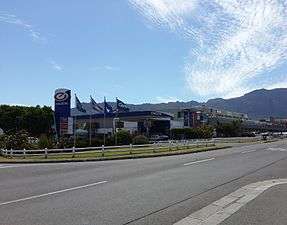 Pick n Pay Centre.
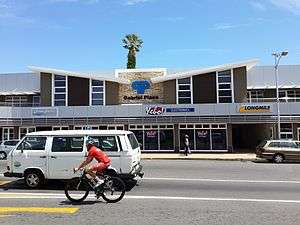 Gabriel Place shopping center.
 View of the upper portion of Plumstead, with Table Mountain in the background.
References
- 1 2 3 4 "Sub Place Plumstead". Census 2011.
- ↑ "Plumstead Councillors". Councillors Online. City of Cape Town. Retrieved 15 June 2013.
- Constantiaberg Bulletin, 25 August 2005; Pg 5.
.svg.png)