Dunoon, Cape Town
| Dunoon | |
|---|---|
 Dunoon | |
|
Location within Cape Town  Dunoon  Dunoon Dunoon (South Africa)  Dunoon Dunoon (Africa) | |
| Coordinates: 33°49′08″S 18°32′24″E / 33.819°S 18.540°ECoordinates: 33°49′08″S 18°32′24″E / 33.819°S 18.540°E | |
| Country | South Africa |
| Province | Western Cape |
| Municipality | City of Cape Town |
| Area[1] | |
| • Total | 0.99 km2 (0.38 sq mi) |
| Population (2011)[1] | |
| • Total | 29,268 |
| • Density | 30,000/km2 (77,000/sq mi) |
| Racial makeup (2011)[1] | |
| • Black African | 89.3% |
| • Coloured | 5.6% |
| • Indian/Asian | 0.1% |
| • White | 0.2% |
| • Other | 4.9% |
| First languages (2011)[1] | |
| • Xhosa | 64.7% |
| • Afrikaans | 7.1% |
| • English | 6.7% |
| • Sotho | 2.9% |
| • Other | 18.6% |
| Time zone | UTC+2 (SAST) |
| Postal code (street) | 7441 |
| PO box | 7438 |
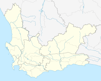
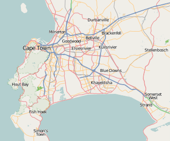
Dunoon is a small township situated in Milnerton, Cape Town, South Africa. The first erf for Dunoon was surveyed in 1996. As the formal housing was built, shacks mushroomed in the area.[2]
It is near the Killarney Motor Racing Complex. Its neighbouring counterpart is Joe Slovo Park. It is a very shanty township with no police station; the nearest one is in Milnerton. In 2011 the population of Dunoon was 31 133. The number of households in Dunoon in 2011 was 11 496.[3]
The main form of transport for Dunoon residents is minibus taxis. The MyCity bus service has recently opened a bus station to serve Dunoon.[4]
On the opposite side of Potsdam Road from Dunoon is an informal settlement called Site 5. Site 5 consists of a group of shacks and dwellers use mobile toilets.
Dunoon has also been known for its participation in Xenophobia demonstrations.[5]
Schooling and Education
It has ten schools: Dunoon Primary School, Sophakama Primary,silverleaf primary and Inkwenkwezi High school It has one high school and Three primary school.
Health services
The City of Cape Town opened a day hospital that has been operating since 2016. The City has officially opened a temporary clinic in Dunoon,[6] in conjunction with the Western Cape Provincial Government, in order to provide better primary healthcare services to residents in the area.
The clinic offers services such as reproductive health advice, HIV counselling and testing, TB treatment and screening, and anti-retroviral treatment amongst others.
Developmental plan for Services, Upliftment and Amenities
For matters concerning Dunoon and its upliftment, City of Cape Town is the planning authority.
This Department has been working to resolve the pedestrian problem on the N7 in the DuNoon Environs. The toilets and water standpipes have been removed from the road reserve and the fence is repaired on regular basis to discourage people entering the N7 road reserve. Safety matters and the dangers of crossing the N7 have been discussed with the DuNoon community.
No foot bridges have been planned as the people tend to select the shortest route regardless of danger.
The proposal to offer a safe crossing alternative involves the lifting the N7 by approximately 2.0 metres over a section of the N7 to the north of Richwood, between the future Blaauwberg Road and Potsdam Interchanges, so that 2 number street links can be constructed at ground level to link the properties abutting the N7, (i.e. the N7 will bridge over the new street links, which are located at ground level). The design process is under way but it will take approximately 12 months before construction can commence.
The current interim safety measure involves the upgrading of the existing Agricultural Underpass, as an alternative N7 crossing for the DuNoon community. This has been a long process, as it requires the relocation of houses as well as the removal of people living in the Agricultural Underpass before the implementation can commence. This upgrade will be implemented in February 2018 and will be completed in 6 weeks. It is hoped that the Agricultural Underpass will be used by the DuNoon community in preference to running across the N7 in the interim.
Despite this, it is acknowledged that it is extremely difficult to prevent people, who are aware on the dangers yet choose to, from running across the N7.
References
- 1 2 3 4 "Sub Place Dunoon". Census 2011.
- ↑
- ↑ "Archived copy" (PDF). Archived from the original (PDF) on 2016-09-10. Retrieved 2014-06-16.
- ↑ Dunoon stop launched 1 March 2014 | News | MyCiTi
- ↑ "SA violence spreads to Cape Town". 23 May 2008 – via news.bbc.co.uk.
- ↑ "Archived copy". Archived from the original on 2014-07-14. Retrieved 2014-06-14.
.svg.png)