Bothasig
| Bothasig | |
|---|---|
 Bothasig | |
|
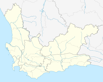
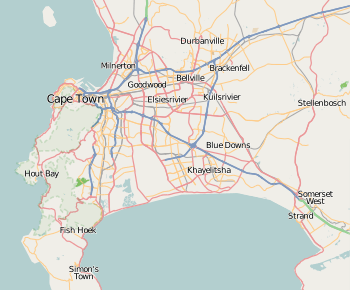
Location within Cape Town  Bothasig  Bothasig Bothasig (South Africa)  Bothasig Bothasig (Africa) | |
| Coordinates: 33°51′34″S 18°32′23″E / 33.85944°S 18.53972°ECoordinates: 33°51′34″S 18°32′23″E / 33.85944°S 18.53972°E | |
| Country | South Africa |
| Province | Western Cape |
| Municipality | City of Cape Town |
| Main Place | Milnerton |
| Area[1] | |
| • Total | 4.07 km2 (1.57 sq mi) |
| Population (2011)[1] | |
| • Total | 11,790 |
| • Density | 2,900/km2 (7,500/sq mi) |
| Racial makeup (2011)[1] | |
| • Black African | 6.2% |
| • Coloured | 14.1% |
| • Indian/Asian | 1.3% |
| • White | 76.7% |
| • Other | 1.6% |
| First languages (2011)[1] | |
| • English | 70.4% |
| • Afrikaans | 25.2% |
| • Xhosa | 2.0% |
| • Other | 2.3% |
| Time zone | UTC+2 (SAST) |
| Postal code (street) | 7441 |
| PO box | 7406 |
Bothasig also known as 'The Sig' is a suburban area of the City of Cape Town in Western Cape, South Africa. It is located north of Edgemead and east of Milnerton. It is located approximately 15 km north-east of the Cape Town city centre.
Township 2,5 km from Milnerton, laid out on the farm Bosmansdam and named after it, but renamed in 1966 after P W Botha, then Minister of Community Development and subsequently Prime Minister and State President of the Republic of South Africa.[2]
Bothasig is an area located toward the west of the province Western Cape in South Africa. The area is very community focused and hosts a soccer club (Abe Sher Stadium) alongside the Bothasig Baseball Club.
References
- 1 2 3 4 "Sub Place Bothasig". Census 2011.
- ↑ "Dictionary of Southern African Place Names (Public Domain)". Human Science Research Council. p. 91.
This article is issued from
Wikipedia.
The text is licensed under Creative Commons - Attribution - Sharealike.
Additional terms may apply for the media files.
.svg.png)