Le Plessis-Bouchard
| Le Plessis-Bouchard | ||
|---|---|---|
| Commune | ||
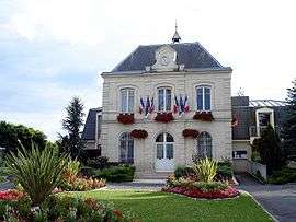 Town hall | ||
| ||
 Le Plessis-Bouchard Location within Île-de-France region  Le Plessis-Bouchard | ||
| Coordinates: 49°00′12″N 2°14′15″E / 49.0033°N 2.2375°ECoordinates: 49°00′12″N 2°14′15″E / 49.0033°N 2.2375°E | ||
| Country | France | |
| Region | Île-de-France | |
| Department | Val-d'Oise | |
| Arrondissement | Argenteuil | |
| Canton | Domont | |
| Intercommunality | CA Val Parisis | |
| Government | ||
| • Mayor (1997–2020) | Gérard Lambert-Motte | |
| Area1 | 2.69 km2 (1.04 sq mi) | |
| Population (2013)2 | 8,040 | |
| • Density | 3,000/km2 (7,700/sq mi) | |
| Time zone | UTC+1 (CET) | |
| • Summer (DST) | UTC+2 (CEST) | |
| INSEE/Postal code | 95491 /95130 | |
| Elevation | 57–81 m (187–266 ft) | |
|
1 French Land Register data, which excludes lakes, ponds, glaciers > 1 km2 (0.386 sq mi or 247 acres) and river estuaries. 2 Population without double counting: residents of multiple communes (e.g., students and military personnel) only counted once. | ||
.svg.png)
Le Plessis-Bouchard is a commune in the Val-d'Oise department in Île-de-France in northern France.
Twin towns
See also
References
- INSEE
- Association of Mayors of the Val d’Oise (in French)
External links
- Official website (in French)
- Land use (IAURIF) (in English)
| Wikimedia Commons has media related to Le Plessis-Bouchard. |
This article is issued from
Wikipedia.
The text is licensed under Creative Commons - Attribution - Sharealike.
Additional terms may apply for the media files.