Villers-en-Arthies
| Villers-en-Arthies | |
|---|---|
| Commune | |
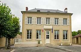 The town hall and school, in Villers-en-Arthies | |
 Villers-en-Arthies Location within Île-de-France region  Villers-en-Arthies | |
| Coordinates: 49°05′24″N 1°43′36″E / 49.0900°N 1.7267°ECoordinates: 49°05′24″N 1°43′36″E / 49.0900°N 1.7267°E | |
| Country | France |
| Region | Île-de-France |
| Department | Val-d'Oise |
| Arrondissement | Pontoise |
| Canton | Vauréal |
| Intercommunality | Vexin Val de Seine |
| Government | |
| • Mayor (2009–2014) | Jean-François Renard |
| Area1 | 8.25 km2 (3.19 sq mi) |
| Population (2006)2 | 473 |
| • Density | 57/km2 (150/sq mi) |
| Time zone | UTC+1 (CET) |
| • Summer (DST) | UTC+2 (CEST) |
| INSEE/Postal code | 95676 /95510 |
| Elevation | 89–205 m (292–673 ft) |
|
1 French Land Register data, which excludes lakes, ponds, glaciers > 1 km2 (0.386 sq mi or 247 acres) and river estuaries. 2 Population without double counting: residents of multiple communes (e.g., students and military personnel) only counted once. | |
Villers-en-Arthies is a commune in the Val-d'Oise department in Île-de-France in northern France.
See also
References
- INSEE
- Association of Mayors of the Val d’Oise (in French)
External links
| Wikimedia Commons has media related to Villers-en-Arthies. |
- Official website (in French)
- Mérimée database - Cultural heritage (in French)
- Land use (IAURIF) (in English)
This article is issued from
Wikipedia.
The text is licensed under Creative Commons - Attribution - Sharealike.
Additional terms may apply for the media files.