Arrondissement of Argenteuil
| Argenteuil | |
|---|---|
| Arrondissement | |
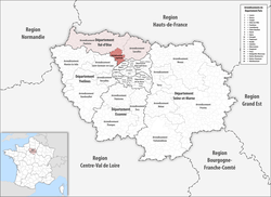 Location of Argenteuil in Île-de-France | |
| Country | France |
| Region | Île-de-France |
| Department | Val-d'Oise |
| Communes | 17 |
| Subprefecture | Argenteuil |
| Area¹ | |
| • Total | 108.5 km2 (41.9 sq mi) |
| Population (2015) | |
| • Total | 408,510 |
| • Density | 3,800/km2 (9,800/sq mi) |
| ¹ French Land Register data, which exclude lakes, ponds, and glaciers larger than 1 km² as well as the estuaries of rivers. | |
The arrondissement of Argenteuil is an arrondissement of France in the Val-d'Oise department in the Île-de-France region. Since the January 2017 reorganization of the arrondissements of Val-d'Oise, it has 17 communes.[1]
Composition
Cantons
The cantons of the arrondissement of Argenteuil are:
- Argenteuil-1 (partly)
- Argenteuil-2
- Argenteuil-3
- Domont (partly)
- Ermont
- Franconville
- Herblay
- Saint-Ouen-l'Aumône (partly)
- Taverny
Communes
The communes of the arrondissement of Argenteuil, and their INSEE codes, are:
- Argenteuil (95018)
- Beauchamp (95051)
- Bessancourt (95060)
- Bezons (95063)
- Cormeilles-en-Parisis (95176)
- Eaubonne (95203)
- Ermont (95219)
- Franconville (95252)
- Frépillon (95256)
- La Frette-sur-Seine (95257)
- Herblay (95306)
- Montigny-lès-Cormeilles (95424)
- Pierrelaye (95488)
- Le Plessis-Bouchard (95491)
- Saint-Leu-la-Forêt (95563)
- Sannois (95582)
- Taverny (95607)
References
- ↑ "Arrêté préfectoral, 30 December 2016, p 42" (PDF). Retrieved 2017-08-02.
External links
This article is issued from
Wikipedia.
The text is licensed under Creative Commons - Attribution - Sharealike.
Additional terms may apply for the media files.