Louvres
| Louvres | ||
|---|---|---|
| Commune | ||
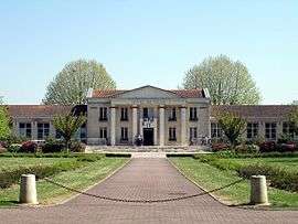 The town hall of Louvres | ||
| ||
 Louvres Location within Île-de-France region  Louvres | ||
| Coordinates: 49°02′41″N 2°30′20″E / 49.0447°N 2.5056°ECoordinates: 49°02′41″N 2°30′20″E / 49.0447°N 2.5056°E | ||
| Country | France | |
| Region | Île-de-France | |
| Department | Val-d'Oise | |
| Arrondissement | Sarcelles | |
| Canton | Goussainville | |
| Intercommunality | CA Roissy Pays de France | |
| Government | ||
| • Mayor (2014–2020) | Jean-Marie Fossier | |
| Area1 | 11.33 km2 (4.37 sq mi) | |
| Population (2013)2 | 9,949 | |
| • Density | 880/km2 (2,300/sq mi) | |
| Time zone | UTC+1 (CET) | |
| • Summer (DST) | UTC+2 (CEST) | |
| INSEE/Postal code | 95351 /95380 | |
|
1 French Land Register data, which excludes lakes, ponds, glaciers > 1 km2 (0.386 sq mi or 247 acres) and river estuaries. 2 Population without double counting: residents of multiple communes (e.g., students and military personnel) only counted once. | ||

Louvres is a commune in the Val-d'Oise department in Île-de-France in northern France.
Education
Schools in Louvres include:
- Four preschools (écoles maternelles): Georges Seurat, du Moulin, du Bouteillier, and Delacroix[1]
- Three elementary schools: du Moulin, du Boutellier, and de la Fontaine Sainte-Geneviève[1]
- Two junior high schools: Collège André Malraux and Collège François Mauriac[2]
Nearby senior high schools:[2]
- Lycée René Cassin in Gonesse
- Lycée Léonard de Vinci in Saint-Witz
- Lycée Charles Baudelaire in Fosses
Town partnerships
Louvres fosters partnerships with the following places:[3]
See also
References
- 1 2 "Les établissements scolaires." Ville de Louvres. Retrieved on September 3, 2016.
- 1 2 "Les collèges et lycées." Ville de Louvres. Retrieved on September 3, 2016.
- ↑ Partnership with Bad Sobernheim
- INSEE
- Association of Mayors of the Val d’Oise (in French)
External links
- Official website (in French)
- Mérimée database - Cultural heritage (in French)
- Land use (IAURIF) (in English)
| Wikimedia Commons has media related to Louvres. |
| Authority control |
|---|
This article is issued from
Wikipedia.
The text is licensed under Creative Commons - Attribution - Sharealike.
Additional terms may apply for the media files.