Épinay-Champlâtreux
| Épinay-Champlâtreux | |
|---|---|
| Commune | |
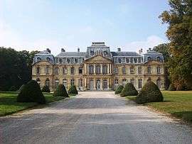 Castle of Champlâtreux | |
 Épinay-Champlâtreux Location within Île-de-France region  Épinay-Champlâtreux | |
| Coordinates: 49°05′09″N 2°24′47″E / 49.0858°N 2.4131°ECoordinates: 49°05′09″N 2°24′47″E / 49.0858°N 2.4131°E | |
| Country | France |
| Region | Île-de-France |
| Department | Val-d'Oise |
| Arrondissement | Sarcelles |
| Canton | Fosses |
| Intercommunality | Pays de France |
| Government | |
| • Mayor (2001–2008) | Edith Bossuto |
| Area1 | 3.56 km2 (1.37 sq mi) |
| Population (2006)2 | 67 |
| • Density | 19/km2 (49/sq mi) |
| Time zone | UTC+1 (CET) |
| • Summer (DST) | UTC+2 (CEST) |
| INSEE/Postal code | 95214 /95270 |
|
1 French Land Register data, which excludes lakes, ponds, glaciers > 1 km2 (0.386 sq mi or 247 acres) and river estuaries. 2 Population without double counting: residents of multiple communes (e.g., students and military personnel) only counted once. | |
Épinay-Champlâtreux is a commune in the Val-d'Oise department in Île-de-France in northern France.
See also
References
- INSEE
- Association of Mayors of the Val d’Oise (in French)
External links
| Wikimedia Commons has media related to Épinay-Champlâtreux. |
- Mérimée database - Cultural heritage (in French)
- Land use (IAURIF) (in English)
This article is issued from
Wikipedia.
The text is licensed under Creative Commons - Attribution - Sharealike.
Additional terms may apply for the media files.