Haravilliers
| Haravilliers | |
|---|---|
| Commune | |
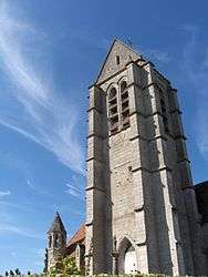 The bell tower of the church of the Assumption, in Haravilliers | |
 Haravilliers Location within Île-de-France region  Haravilliers | |
| Coordinates: 49°10′27″N 2°03′20″E / 49.1742°N 2.0556°ECoordinates: 49°10′27″N 2°03′20″E / 49.1742°N 2.0556°E | |
| Country | France |
| Region | Île-de-France |
| Department | Val-d'Oise |
| Arrondissement | Pontoise |
| Canton | Pontoise |
| Intercommunality | Val de Viosne |
| Government | |
| • Mayor (2001–2008) | Jean-Pierre Fohrer |
| Area1 | 10.90 km2 (4.21 sq mi) |
| Population (2006)2 | 519 |
| • Density | 48/km2 (120/sq mi) |
| Time zone | UTC+1 (CET) |
| • Summer (DST) | UTC+2 (CEST) |
| INSEE/Postal code | 95298 /95640 |
| Elevation | 99–217 m (325–712 ft) |
|
1 French Land Register data, which excludes lakes, ponds, glaciers > 1 km2 (0.386 sq mi or 247 acres) and river estuaries. 2 Population without double counting: residents of multiple communes (e.g., students and military personnel) only counted once. | |
Haravilliers is a commune in the Val-d'Oise department in Île-de-France in northern France.
See also
References
- INSEE
- Association of Mayors of the Val d’Oise (in French)
External links
- Official website (in French)
- Mérimée database - Cultural heritage (in French)
- Land use (IAURIF) (in English)
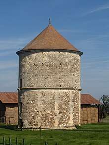
The dovecote, 17th century
| Wikimedia Commons has media related to Haravilliers. |
This article is issued from
Wikipedia.
The text is licensed under Creative Commons - Attribution - Sharealike.
Additional terms may apply for the media files.