Pallini
| Pallini Παλλήνη | |
|---|---|
 Pallini city | |
 Pallini Location within the region 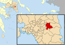 | |
| Coordinates: 38°0′N 23°53′E / 38.000°N 23.883°ECoordinates: 38°0′N 23°53′E / 38.000°N 23.883°E | |
| Country | Greece |
| Administrative region | Attica |
| Regional unit | East Attica |
| Area | |
| • Municipality | 29.43 km2 (11.36 sq mi) |
| • Municipal unit | 18.93 km2 (7.31 sq mi) |
| Elevation | 150 m (490 ft) |
| Population (2011)[1] | |
| • Municipality | 54,415 |
| • Municipality density | 1,800/km2 (4,800/sq mi) |
| • Municipal unit | 22,344 |
| • Municipal unit density | 1,200/km2 (3,100/sq mi) |
| Time zone | UTC+2 (EET) |
| • Summer (DST) | UTC+3 (EEST) |
| Postal code | 153 xx |
| Area code(s) | 210 |
| Website | www.palini.gr |
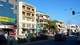
Pallini (Greek: Παλλήνη) is a suburban town in Greater Athens Area and a municipality in East Attica, Greece. The seat of the municipality is the town Gerakas.[2] It is the seat of administration of the East Attica regional unit.
Geography
Pallini is situated in the eastern part of the Athens conurbation, at about 150 m elevation. It lies in a plain between the mountains Penteliko and Hymettus. It is 2 km east of Gerakas and 14 km east of Athens city centre. Its built-up area is continuous with those of the neighbouring suburbs Gerakas and Anthousa. Pallini station, west of the town centre, is served by commuter trains and Athens metro. Greek National Road 54 (Athens - Rafina) passes through Pallini. The municipal unit Pallini includes the subdivision of Leontari.
Municipality

The municipality Pallini was formed at the 2011 local government reform by the merger of the following 3 former municipalities, that became municipal units:[2]
The municipality has an area of 29.430 km2, the municipal unit 18.932 km2.[3]
Historical population
| Year | Town | Municipal unit | Municipality |
|---|---|---|---|
| 1981 | 5,475 | - | - |
| 1991 | 8,021 | 10,908 | - |
| 2001 | 12,552 | 16,679 | - |
| 2011 | 16,415 | 22,344 | 54,415 |
Notable people
- Dimitri Nanopoulos (1948-), physicist
Gallery
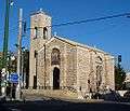 Dormition of Theotokos church
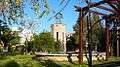 Eleftherias Square
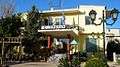 The City Hall
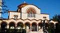 St Tryfonas church
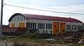 Kantza sports center
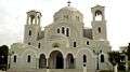 Church in Kantza (Leontari) suburb
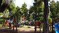 Park
Park Anthousa Square
See also
References
- ↑ "Απογραφή Πληθυσμού - Κατοικιών 2011. ΜΟΝΙΜΟΣ Πληθυσμός" (in Greek). Hellenic Statistical Authority.
- 1 2 Kallikratis law Greece Ministry of Interior (in Greek)
- ↑ "Population & housing census 2001 (incl. area and average elevation)" (PDF) (in Greek). National Statistical Service of Greece.
External links
- Official website (in Greek)
- https://web.archive.org/web/20050309025919/http://www.de.sch.gr/~anpapad/pallini.htm
Administrative division of the Attica Region | ||
|---|---|---|
| Regional unit of Central Athens | 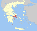 | |
| Regional unit of North Athens | ||
| Regional unit of West Athens | ||
| Regional unit of South Athens | ||
| Regional unit of Piraeus | ||
| Regional unit of East Attica | ||
| Regional unit of West Attica | ||
| Regional unit of Islands | ||
| ||