Perama
| Perama Πέραμα | |
|---|---|
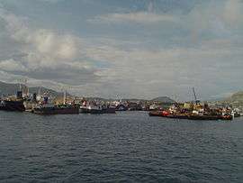 Ships at Perama | |
 Perama Location within the region 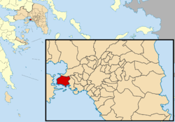 | |
| Coordinates: 37°58′N 23°34′E / 37.967°N 23.567°ECoordinates: 37°58′N 23°34′E / 37.967°N 23.567°E | |
| Country | Greece |
| Administrative region | Attica |
| Regional unit | Piraeus |
| Government | |
| • Mayor | Pantelis Zoumboulis (Ind.) |
| Area | |
| • Municipality | 14.729 km2 (5.687 sq mi) |
| Elevation | 5 m (16 ft) |
| Population (2011)[1] | |
| • Municipality | 25,389 |
| • Municipality density | 1,700/km2 (4,500/sq mi) |
| Time zone | UTC+2 (EET) |
| • Summer (DST) | UTC+3 (EEST) |
| Postal code | 188 63 |
| Area code(s) | 210 |
| Vehicle registration | Z |
| Website | www.perama.gr |
Perama (Greek: Πέραμα) is a port city and a suburb of Piraeus and Athens (Greece). It lies on the southwest edge of the Aegaleo mountains, on the Saronic Gulf coast. It is 8 km northwest of Piraeus, and 15 km west of Athens city centre. The municipality has an area of 14.729 km2.[2] It forms the western terminus of the Port of Piraeus (Athens' port) and there is also a passenger port that provides ferry services to Salamis Island.
The name Perama comes from the Greek word "perasma" which means "passage". Perama has a secondary soccer team named Peramaikos F.C.
Historical population
| Year | Municipality |
|---|---|
| 1981 | 23,012 |
| 1991 | 24,119 |
| 2001 | 25,720 |
| 2011 | 25,389 |
See also
References
- ↑ "Απογραφή Πληθυσμού - Κατοικιών 2011. ΜΟΝΙΜΟΣ Πληθυσμός" (in Greek). Hellenic Statistical Authority.
- ↑ "Population & housing census 2001 (incl. area and average elevation)" (PDF) (in Greek). National Statistical Service of Greece.
External links
- Official website (in Greek)
Places adjacent to Perama | ||||||||||
|---|---|---|---|---|---|---|---|---|---|---|
| ||||||||||
Administrative division of the Attica Region | ||
|---|---|---|
| Regional unit of Central Athens | 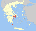 | |
| Regional unit of North Athens | ||
| Regional unit of West Athens | ||
| Regional unit of South Athens | ||
| Regional unit of Piraeus | ||
| Regional unit of East Attica | ||
| Regional unit of West Attica | ||
| Regional unit of Islands | ||
| ||
This article is issued from
Wikipedia.
The text is licensed under Creative Commons - Attribution - Sharealike.
Additional terms may apply for the media files.