Columbio, Sultan Kudarat
| Columbio | |
|---|---|
| Municipality | |
| Municipality of Columbio | |
Nickname(s):
| |
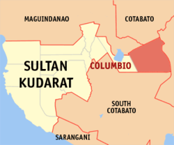 Map of Sultan Kudarat with Columbio highlighted | |
.svg.png) Columbio Location within the Philippines | |
| Coordinates: 6°42′N 124°56′E / 6.7°N 124.93°ECoordinates: 6°42′N 124°56′E / 6.7°N 124.93°E | |
| Country |
|
| Region | Soccsksargen (Region XII) |
| Province | Sultan Kudarat |
| District | 1st District |
| Barangays | 16 (see Barangays) |
| Government [1] | |
| • Type | Sangguniang Bayan |
| • Mayor | Amirh Musali |
| • Electorate | 17,438 voters (2016) |
| Area [2] | |
| • Total | 926.15 km2 (357.59 sq mi) |
| Population (2015 census)[3] | |
| • Total | 33,258 |
| • Density | 36/km2 (93/sq mi) |
| Time zone | UTC+8 (PST) |
| ZIP code | 9801 |
| PSGC | 126502000 |
| IDD : area code | +63 (0)64 |
| Climate type | Tropical climate |
| Income class | 1st municipal income class |
| Revenue (₱) | 180,940,400.68 (2016) |
| Native languages |
Hiligaynon Maguindanao language Kalagan language Tagalog |
| Website |
www |
Columbio, officially the Municipality of Columbio, is a 1st class municipality in the province of Sultan Kudarat, Philippines. According to the 2015 census, it has a population of 33,258 people.[3]
History
The municipality of Columbio was transferred from Cotabato Province to Province of Sultan Kudarat on November 22, 1973 by presidential decree 341 by President Ferdinand E. Marcos.[4]
Barangays
Columbio is politically subdivided into 16 barangays.
- Bantangan (Lasak)
- Datablao
- Eday
- Elbebe
- Lasak
- Libertad
- Lomoyon
- Makat (Sumali Pas)
- Maligaya
- Mayo
- Natividad
- Poblacion
- Polomolok
- Sinapulan
- Sucob
- Telafas
Demographics
| Population census of Columbio | ||
|---|---|---|
| Year | Pop. | ±% p.a. |
| 1970 | 20,748 | — |
| 1975 | 6,467 | −20.85% |
| 1980 | 7,927 | +4.15% |
| 1990 | 17,567 | +8.28% |
| 1995 | 21,511 | +3.87% |
| 2000 | 21,698 | +0.19% |
| 2007 | 23,675 | +1.21% |
| 2010 | 27,440 | +5.52% |
| 2015 | 33,258 | +3.73% |
| Source: Philippine Statistics Authority[3] [5] [6] [7] | ||
Columbio is inhabited by ethnic groups such as the Ilocanos, Ilonggos, Blaan and Maguindanaon. Ilocanos and Ilonggos are the only inhabitants of the town not native to Mindanao.
References
- ↑ "Municipality". Quezon City, Philippines: Department of the Interior and Local Government. Retrieved 31 May 2013.
- ↑ "Province: Sultan Kudarat". PSGC Interactive. Quezon City, Philippines: Philippine Statistics Authority. Retrieved 12 November 2016.
- 1 2 3 Census of Population (2015). "Region XII (Soccsksargen)". Total Population by Province, City, Municipality and Barangay. PSA. Retrieved 20 June 2016.
- ↑ "Presidential Decree No. 341, s. 1973 | GOVPH". Official Gazette of the Republic of the Philippines. Retrieved 9 September 2017.
- ↑ Census of Population and Housing (2010). "Region XII (Soccsksargen)". Total Population by Province, City, Municipality and Barangay. NSO. Retrieved 29 June 2016.
- ↑ Censuses of Population (1903–2007). "Region XII (Soccsksargen)". Table 1. Population Enumerated in Various Censuses by Province/Highly Urbanized City: 1903 to 2007. NSO.
- ↑ "Province of Sultan Kudarat". Municipality Population Data. Local Water Utilities Administration Research Division. Retrieved 17 December 2016.
External links
- Philippine Standard Geographic Code
- Philippine Census Information
- Local Governance Performance Management System
Places adjacent to Columbio, Sultan Kudarat | |
|---|---|
Isulan (capital) | |
| Municipalities | |
| Component city | |
This article is issued from
Wikipedia.
The text is licensed under Creative Commons - Attribution - Sharealike.
Additional terms may apply for the media files.