Lambayong, Sultan Kudarat
| Lambayong | ||
|---|---|---|
| Municipality | ||
| Municipality of Lambayong | ||
| ||
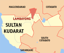 Map of Sultan Kudarat with Lambayong highlighted | ||
.svg.png) Lambayong Location within the Philippines | ||
| Coordinates: 6°48′N 124°38′E / 6.8°N 124.63°ECoordinates: 6°48′N 124°38′E / 6.8°N 124.63°E | ||
| Country |
| |
| Region | Soccsksargen (Region XII) | |
| Province | Sultan Kudarat | |
| District | 1st District | |
| Barangays | 26 (see Barangays) | |
| Government [1] | ||
| • Type | Sangguniang Bayan | |
| • Mayor | Florante Agduma | |
| • Electorate | 37,343 voters (2016) | |
| Area [2] | ||
| • Total | 226.88 km2 (87.60 sq mi) | |
| Population (2015 census)[3] | ||
| • Total | 77,013 | |
| • Density | 340/km2 (880/sq mi) | |
| Time zone | UTC+8 (PST) | |
| ZIP code | 9802 | |
| PSGC | 126508000 | |
| IDD : area code | +63 (0)64 | |
| Climate type | Tropical climate | |
| Income class | 2nd municipal income class | |
| Revenue (₱) | 150,288,304.74 (2016) | |
| Native languages |
Hiligaynon Maguindanao language Tagalog | |
| Website |
lambayong | |

Lambayong, officially the Municipality of Lambayong, is a 2nd class municipality in the province of Sultan Kudarat, Philippines. According to the 2015 census, it has a population of 77,013 people.[3]
History
The municipality of Lambayong was transferred from Cotabato Province to Province of Sultan Kudarat on November 22, 1973 by presidential decree 341 of President Ferdinand E. Marcos.[4] It was named as Mariano Marcos in honor of his father.
On October 12, 1988, President Corazon Aquino signed Republic Act No. 6676, renaming the municipality to its current name.
Barangays
Lambayong is politically subdivided into 26 barangays.
- Caridad (Cuyapon)
- Didtaras
- Gansing (Bilumen)
- Kabulakan
- Kapingkong
- Katitisan
- Lagao
- Lilit
- Madanding
- Maligaya
- Mamali
- Matiompong
- Midtapok
- New Cebu
- Palumbi
- Pidtiguian
- Pimbalayan
- Pinguiaman
- Poblacion (Lambayong)
- Sadsalan
- Seneben
- Sigayan
- Tambak
- Tinumigues
- Tumiao (Tinaga)
- Udtong
Demographics
| Population census of Lambayong | ||
|---|---|---|
| Year | Pop. | ±% p.a. |
| 1975 | 26,301 | — |
| 1980 | 29,694 | +2.46% |
| 1990 | 39,182 | +2.81% |
| 1995 | 46,636 | +3.32% |
| 2000 | 51,192 | +2.02% |
| 2007 | 60,372 | +2.30% |
| 2010 | 65,557 | +3.04% |
| 2015 | 77,013 | +3.11% |
| Source: Philippine Statistics Authority[3][5][6][7] | ||
References
- ↑ "Municipality". Quezon City, Philippines: Department of the Interior and Local Government. Retrieved 31 May 2013.
- ↑ "Province: Sultan Kudarat". PSGC Interactive. Quezon City, Philippines: Philippine Statistics Authority. Retrieved 12 November 2016.
- 1 2 3 Census of Population (2015). "Region XII (Soccsksargen)". Total Population by Province, City, Municipality and Barangay. PSA. Retrieved 20 June 2016.
- ↑ "Presidential Decree No. 341, s. 1973 | GOVPH". Official Gazette of the Republic of the Philippines. Retrieved 9 September 2017.
- ↑ Census of Population and Housing (2010). "Region XII (Soccsksargen)". Total Population by Province, City, Municipality and Barangay. NSO. Retrieved 29 June 2016.
- ↑ Censuses of Population (1903–2007). "Region XII (Soccsksargen)". Table 1. Population Enumerated in Various Censuses by Province/Highly Urbanized City: 1903 to 2007. NSO.
- ↑ "Province of Sultan Kudarat". Municipality Population Data. Local Water Utilities Administration Research Division. Retrieved 17 December 2016.
External links
- Philippine Standard Geographic Code
- Philippine Census Information
- Local Governance Performance Management System
Places adjacent to Lambayong, Sultan Kudarat | |
|---|---|
Isulan (capital) | |
| Municipalities | |
| Component city | |
This article is issued from
Wikipedia.
The text is licensed under Creative Commons - Attribution - Sharealike.
Additional terms may apply for the media files.