Ouro Guiré
| Ouro Guiré | |
|---|---|
| Commune | |
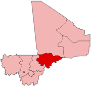
 Ouro Guiré Location in Mali | |
| Coordinates: 14°23′37″N 4°52′2″W / 14.39361°N 4.86722°WCoordinates: 14°23′37″N 4°52′2″W / 14.39361°N 4.86722°W | |
| Country |
|
| Region | Mopti Region |
| Cercle | Ténenkou Cercle |
| Population (2009 census)[1] | |
| • Total | 9,289 |
| Time zone | UTC+0 (GMT) |
Ouro Guiré is a commune of the Cercle of Ténenkou in the Mopti Region of Mali. The commune lies to the southeast of the small town of Ténenkou in the Inner Niger Delta. It is crossed by the Diaka, a branch of the Niger River that flows only when the river is in flood. The principal village is Koubi. The commune contains 15 small villages and in 2009 had a population of 9,289. Most of the population are Fulani (French: Peul or Peulh; Fula: Fulɓe) with some Bozo. Traditionally, the Fulani raise livestock while the Bozo are fishermen.
References
- ↑ Resultats Provisoires RGPH 2009 (Région de Mopti) (PDF) (in French), République de Mali: Institut National de la Statistique .
External links
- Plan de Sécurité Alimentaire Commune Rurale de Ouro-Guiré 2006-2010 (PDF) (in French), Commissariat à la Sécurité Alimentaire, République du Mali, USAID-Mali, 2006 .
This article is issued from
Wikipedia.
The text is licensed under Creative Commons - Attribution - Sharealike.
Additional terms may apply for the media files.