Old Town station (Staten Island Railway)
Old Town | |||||||||||||||||||||||||||||||||||||||||||||||||||||||||||||||||||||||||||||||||||||||||||||||||||||||||||||||||||||||||||
|---|---|---|---|---|---|---|---|---|---|---|---|---|---|---|---|---|---|---|---|---|---|---|---|---|---|---|---|---|---|---|---|---|---|---|---|---|---|---|---|---|---|---|---|---|---|---|---|---|---|---|---|---|---|---|---|---|---|---|---|---|---|---|---|---|---|---|---|---|---|---|---|---|---|---|---|---|---|---|---|---|---|---|---|---|---|---|---|---|---|---|---|---|---|---|---|---|---|---|---|---|---|---|---|---|---|---|---|---|---|---|---|---|---|---|---|---|---|---|---|---|---|---|---|
|
| |||||||||||||||||||||||||||||||||||||||||||||||||||||||||||||||||||||||||||||||||||||||||||||||||||||||||||||||||||||||||||
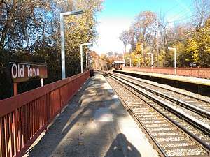 Northbound platform | |||||||||||||||||||||||||||||||||||||||||||||||||||||||||||||||||||||||||||||||||||||||||||||||||||||||||||||||||||||||||||
| Station statistics | |||||||||||||||||||||||||||||||||||||||||||||||||||||||||||||||||||||||||||||||||||||||||||||||||||||||||||||||||||||||||||
| Address |
Old Town Road & North Railroad Avenue Staten Island, NY 10304 | ||||||||||||||||||||||||||||||||||||||||||||||||||||||||||||||||||||||||||||||||||||||||||||||||||||||||||||||||||||||||||
| Borough | Staten Island | ||||||||||||||||||||||||||||||||||||||||||||||||||||||||||||||||||||||||||||||||||||||||||||||||||||||||||||||||||||||||||
| Locale | Old Town | ||||||||||||||||||||||||||||||||||||||||||||||||||||||||||||||||||||||||||||||||||||||||||||||||||||||||||||||||||||||||||
| Coordinates | 40°35′47″N 74°05′15″W / 40.5964°N 74.0875°WCoordinates: 40°35′47″N 74°05′15″W / 40.5964°N 74.0875°W | ||||||||||||||||||||||||||||||||||||||||||||||||||||||||||||||||||||||||||||||||||||||||||||||||||||||||||||||||||||||||||
| Services |
Local | ||||||||||||||||||||||||||||||||||||||||||||||||||||||||||||||||||||||||||||||||||||||||||||||||||||||||||||||||||||||||||
| Structure | Embankment | ||||||||||||||||||||||||||||||||||||||||||||||||||||||||||||||||||||||||||||||||||||||||||||||||||||||||||||||||||||||||||
| Platforms | 2 side platforms | ||||||||||||||||||||||||||||||||||||||||||||||||||||||||||||||||||||||||||||||||||||||||||||||||||||||||||||||||||||||||||
| Tracks | 2 | ||||||||||||||||||||||||||||||||||||||||||||||||||||||||||||||||||||||||||||||||||||||||||||||||||||||||||||||||||||||||||
| Other information | |||||||||||||||||||||||||||||||||||||||||||||||||||||||||||||||||||||||||||||||||||||||||||||||||||||||||||||||||||||||||||
| Opened | 1937[lower-alpha 1] | ||||||||||||||||||||||||||||||||||||||||||||||||||||||||||||||||||||||||||||||||||||||||||||||||||||||||||||||||||||||||||
| Station code | 506[5] | ||||||||||||||||||||||||||||||||||||||||||||||||||||||||||||||||||||||||||||||||||||||||||||||||||||||||||||||||||||||||||
| Former/other names | Old Town Road | ||||||||||||||||||||||||||||||||||||||||||||||||||||||||||||||||||||||||||||||||||||||||||||||||||||||||||||||||||||||||||
| Station succession | |||||||||||||||||||||||||||||||||||||||||||||||||||||||||||||||||||||||||||||||||||||||||||||||||||||||||||||||||||||||||||
| Next north | Grasmere | ||||||||||||||||||||||||||||||||||||||||||||||||||||||||||||||||||||||||||||||||||||||||||||||||||||||||||||||||||||||||||
| Next south | Dongan Hills | ||||||||||||||||||||||||||||||||||||||||||||||||||||||||||||||||||||||||||||||||||||||||||||||||||||||||||||||||||||||||||
| |||||||||||||||||||||||||||||||||||||||||||||||||||||||||||||||||||||||||||||||||||||||||||||||||||||||||||||||||||||||||||
| |||||||||||||||||||||||||||||||||||||||||||||||||||||||||||||||||||||||||||||||||||||||||||||||||||||||||||||||||||||||||||
| |||||||||||||||||||||||||||||||||||||||||||||||||||||||||||||||||||||||||||||||||||||||||||||||||||||||||||||||||||||||||||


Old Town is a Staten Island Railway station in the neighborhood of Old Town, Staten Island, New York.
History
The station opened toward the beginning of 1937[1][2][4], likely during a grade crossing elimination project. The original name of the station was "Old Town Road;" the "Road" was dropped soon after the Metropolitan Transportation Authority assumed control of the Staten Island Railway from the Baltimore and Ohio Railroad in 1971 (the MTA concurrently shortened the name of the Huguenot Park station to simply "Huguenot").
Station layout
| P Platforms |
Side platform, doors will open on the right | |
| Southbound | ← Tottenville toward Tottenville (Dongan Hills) | |
| Northbound | → St. George toward St. George (Grasmere) → | |
| Side platform, doors will open on the right | ||
| G | Street level | Exit/Entrance |

The station is located on an embankment at Railroad Avenue on the main line. It has two side platforms, and metal orange canopies and walls. Just north of this station, a spur that had multiple purposes and served the press building of the Staten Island Advance newspaper is nowadays used as a storage spur for ballast cars.
Exits
The exit at the south end leads to Old Town Road. An additional staircase at the north end of the northbound platform leads to a roadway to Dawson Place and Oregon Road.[6]
References
- ↑ The opening date for this station can be approximated using contemporaneous maps and tikets. This ticket from 1935[1] shows that the Old Town station has not yet opened. A map of the Staten Island Rapid Transit Railway Company dated to January 11, 1937 shown here: [2] does not show the Old Town, Jefferson Avenue or Lake Avenue stations. However,[3] another map with the same date shows these stations with a few additional modifications. It seems that the second map was a revised version of the first one. Presumably it was printed to correct the old information, which did not show these stations. Finally, this ticket from 1938: [4] does show the station.
- 1 2 "Staten Island Rapid Transit Ticket from July 31, 1935 No. A 9508". Flickr. Staten Island Rapid Transit Railway Company. Retrieved December 24, 2017.
- 1 2 "Staten Island Rapid Transit Railway Map 1937". Flickr. Staten Island Rapid Transit Railway Company. Retrieved December 24, 2017.
- ↑ "Staten Island Rapid Transit Railway Map 1937". Staten Island Rapid Transit Railway Company. Missing or empty
|url=(help) - 1 2 "Staten Island Rapid Transit Ticket 1939 No. B 260510". Flickr. Staten Island Rapid Transit Railway Company. Retrieved December 24, 2017.
- ↑ "Station Developers' Information". Metropolitan Transportation Authority. Retrieved June 13, 2017.
- ↑ "Map of NYC Subway Entrances". NYC Open Data. City of New York. Retrieved July 10, 2018.
External links
![]()