Nishi-ku, Niigata
| Nishi-ku 西区 | |
|---|---|
| Ward | |
| Nishi Ward | |
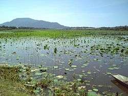 Sakata Lagoon | |
 Location of Nishi-ku in Niigata City | |
 Nishi-ku | |
| Coordinates: 37°52′26.7″N 138°58′17.8″E / 37.874083°N 138.971611°E | |
| Country | Japan |
| Region | Kōshin'etsu, Hokuriku (Chūbu) |
| Prefecture | Niigata |
| City | Niigata |
| Area | |
| • Total | 94.09 km2 (36.33 sq mi) |
| Population (June 1, 2016) | |
| • Total | 162,664 |
| • Density | 1,730/km2 (4,500/sq mi) |
| Time zone | UTC+9 (Japan Standard Time) |
| Address | 3-14-41 Terao-Higashi, Nishi-ku, Niigata-shi, Niigata 950-2097 |
| Phone number | 025-268-1000 |
| Website |
www |

Nishi-ku (西区 Nishi-ku) is one of the eight wards of Niigata City, Niigata Prefecture, in the Hokuriku region of Japan. As of 1 June 2016, the ward had an estimated population of 162,664 and a population density of 1730 persons per km². Its total area was 94.09 square kilometres (36.33 sq mi).
Geography
Nishi-ku is located in a central Niigata city, bordered by the Sea of Japan to the north. The Shinano River flow through the ward.
Surrounding municipalities
History
The area of present-day Nishi-ku was part of ancient Echigo Province. The village of Kurosaki (黒埼) was founded on November 1, 1901 by the merger of five villages, and was raised to town status on February 1, 1973. It was annexed by Niigata city on January 1, 2001. The villages of Uchino (内野), Akatsuka (赤塚) and Nakanokoya (中野小屋) were also established on November 1, 1901. Uchino was raised to town status on October 1, 1928 and was annexed by Niigata city on January 11, 1960. Niigata annexed Akatsuka and Nakanokoya on June 1, 1961. Niigata became a government-designated city on April 1, 2007 and was divided into wards, with the new Nishi Ward consisting of the former towns of Kurosaki and Uchino, and villages of Akatsuka and Nakanokoya.
Education
Universities and colleges
Secondary schools
Nishi-ku has eight public middle schools. There are three public high schools operated by the Niigata Prefectural Board of Education, one private high school and one private combined middle/high school.
Transportation
Railway
Transit bus
- Transit bus operated by Niigata Kotsu[1]
Water Shuttle
- Shinanogawa Water Shuttle: (Minatopia) - - - (Niigata Prefectural office) - Furusato Village
Highway
Points of interest
Places
Events
- Sea of Japan Sunset Concert
- Kurosaki Festival
References
- ↑ 運行便別時刻表 [Bus Lines and Timetables (2016.3- )] (in Japanese). Niigata Kotsu. Retrieved 9 October 2016.
- ↑ 路線図(中心部) [Bus Map for Central Niigata (2016.3- )] (PDF) (in Japanese). Niigata Kotsu. Retrieved 9 October 2016.
- ↑ 路線図(西方面) [Bus Map for West Niigata (2016.3- )] (PDF) (in Japanese). Niigata Kotsu. Retrieved 9 October 2016.
External links
![]()
- Niigata official website (in Japanese)
- Niigata Nishi-ku website (in Japanese)
- Niigata City Official Tourist Information (multilingual)
- Niigata Pref. Official Travel Guide (multilingual)
| Wards of Niigata | ||
|---|---|---|
| Special cities | ||
| Cities | ||
| Districts | ||
Coordinates: 37°52′26″N 138°58′18″E / 37.87389°N 138.97167°E