Newhall, Cheshire
| Newhall | |
|---|---|
 Aston House Farm, Aston | |
 Newhall Newhall shown within Cheshire | |
| Population | 776 (2011) |
| OS grid reference | SJ609454 |
| Civil parish |
|
| Unitary authority | |
| Ceremonial county | |
| Region | |
| Country | England |
| Sovereign state | United Kingdom |
| Post town | NANTWICH |
| Postcode district | CW5 |
| Dialling code | 01260 |
| Police | Cheshire |
| Fire | Cheshire |
| Ambulance | North West |
| EU Parliament | North West England |
| UK Parliament | |
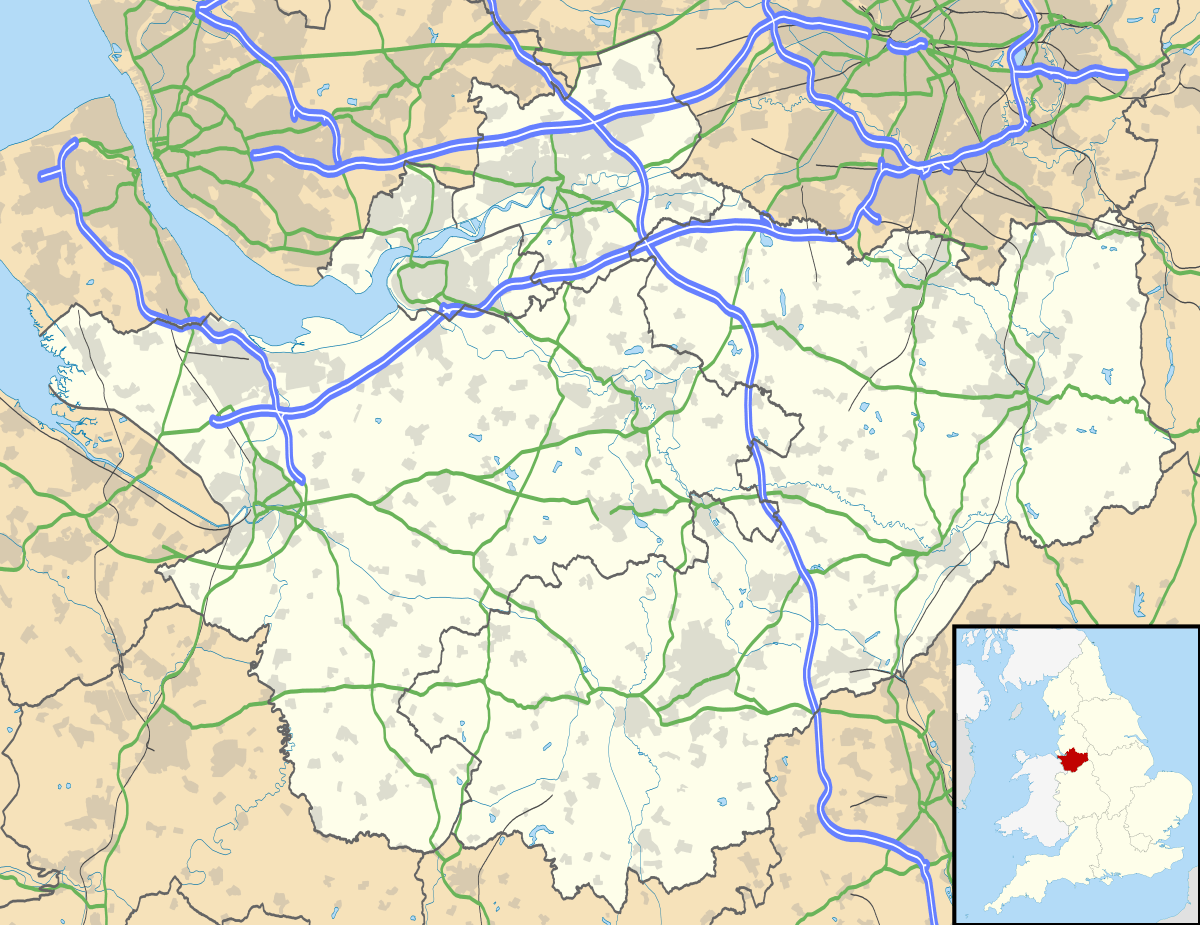
Newhall is a village (at SJ609454) and civil parish in the unitary authority of Cheshire East and the ceremonial county of Cheshire, England. The village lies 3½ miles to the west of Audlem and 5 miles to the south west of Nantwich. The parish also includes the village of Aston (at SJ610468), and the small settlements of Aston Heath, Barnett Brook, Brown's Bank, Dodd's Green, Grandford, Grindley Green, Hollingreen, Kingswood Green, Maiden Estate, Salesbrook, Sheppenhall and part of Sandford.[1] Nearby villages include Audlem and Wrenbury.
According to the 2001 census, the parish had a population of 669,[2] increasing to 776 at the 2011 Census.[3]
Governance
Newhall is administered by Newhall Parish Council.[4] From 1974 the civil parish was served by Crewe and Nantwich Borough Council, which was succeeded on 1 April 2009 by the unitary authority of Cheshire East.[5] Newhall falls in the parliamentary constituency of Eddisbury,[6] which has been represented by Antoinette Sandbach since 2015, after being represented by Stephen O'Brien (1999–2015).
Geography and transport

The A530 and A525 roads run north–south and east–west, respectively, through the parish.
Landmarks
The industrial enterprises of Aston Mill and New Primebake are located in the parish. St Andrew's Methodist Chapel is located in the village of Aston and has a small cemetery; there is a former Methodist church in Dodd's Green.[1] The Bhurtpore Inn, an award-winning public house listed in The Good Pub Guide, is found in Aston.[7]
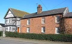
Aston House Farm is a black-and-white timber-framed farmhouse in Aston which dates from 1662; it is listed at grade II.[8]
See also
References
- 1 2 Genuki: Newhall (accessed 14 August 2007)
- ↑ Neighbourhood Statistics: Newhall CP (accessed 12 August 2007)
- ↑ "Civil Parish population 2011". Neighbourhood Statistics. Office for National Statistics. Retrieved 13 March 2016.
- ↑ Cheshire County Council: Parish Council Details: Newhall Parish Council (accessed 28 January 2009)
- ↑ Cheshire (Structural Changes) Order 2008 Archived 2009-05-17 at the Wayback Machine.
- ↑ Cheshire County Council: Interactive Mapping: Eddisbury (accessed 28 January 2009)
- ↑ The Good Pub Guide: Bhurtpore, Aston (accessed 16 August 2007)
- ↑ Images of England: Aston House Farmhouse (accessed 28 January 2009)
External links
![]()
Cheshire Portal | |
| Unitary authorities | |
| Major settlements | |
| Rivers | |
| Topics | |