Macclesfield Forest and Wildboarclough
| Macclesfield Forest and Wildboarclough | |
|---|---|
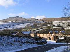 Clough House in Wildboarclough | |
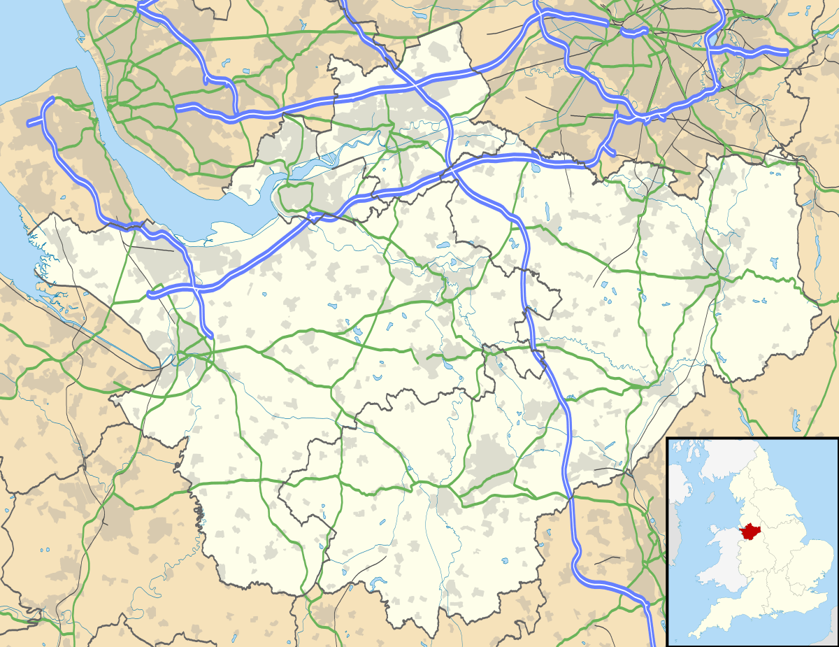 Macclesfield Forest and Wildboarclough Macclesfield Forest and Wildboarclough shown within Cheshire | |
| Population | 189 (2011) |
| OS grid reference | SJ977707 |
| Civil parish |
|
| Unitary authority | |
| Ceremonial county | |
| Region | |
| Country | England |
| Sovereign state | United Kingdom |
| Post town | MACCLESFIELD |
| Postcode district | SK11 |
| Dialling code | 01260 |
| Police | Cheshire |
| Fire | Cheshire |
| Ambulance | North West |
| EU Parliament | North West England |
| UK Parliament | |
Macclesfield Forest and Wildboarclough is a civil parish in the unitary authority of Cheshire East and the ceremonial county of Cheshire, England.[1] It lies on the western fringe of the Peak District National park. The population of the civil parish taken at the 2011 Census was 189.[2]
The parish is small, so there is no parish council; instead, the residents hold a periodic Parish meeting.[1] The area consists mainly of reservoirs, woodland, farmland, and moorland. There are no centres of population, only a few villages and hamlets, most notably Wildboarclough and Langley.
See also
Notes and references
| Wikimedia Commons has media related to Macclesfield Forest and Wildboarclough. |
- 1 2 Macclesfield Borough Council. "Parish Clerks". Macclesfield Borough Council. Archived from the original on 2008-04-11. Retrieved 2007-01-29.
- ↑ "Civil Parish population 2011". Neighbourhood Statistics. Office for National Statistics. Retrieved 13 March 2016.
Cheshire Portal | |
| Unitary authorities | |
| Major settlements | |
| Rivers | |
| Topics | |
This article is issued from
Wikipedia.
The text is licensed under Creative Commons - Attribution - Sharealike.
Additional terms may apply for the media files.