Olney-Oak Lane, Philadelphia
| Olney-Oak Lane | |
|---|---|
| Neighborhood of Philadelphia | |
 | |
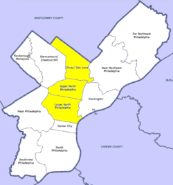 Map of Philadelphia, with Olney-Oak Lane at top of highlighted area (click for larger image) | |
| Country |
|
| State |
|
| County |
|
| City |
|
| Population (2010) | |
| • Total | 168,770 |
| ZIP code |
|
Olney-Oak Lane, Philadelphia, is a section of Philadelphia that is immediately north of Upper North Philadelphia and south of Cheltenham. It is an area that consists of the now defunct township that was called "Bristol Township, Philadelphia County, Pennsylvania". The section is often included as part of North Philadelphia by city government agencies,[1] though locally it is often referred to as "Uptown," along with the Germantown section.
The section includes the neighborhoods of East Oak Lane and West Oak Lane, Feltonville, Fern Rock, Koreatown, Logan, Ogontz, and Olney.
Demographics
As of 2010, the Olney-Oak Lane section of Philadelphia had a population of 168,770, with 76,576 males, 92,195 females, and a median age of 33.[2]
- Non-Hispanic Black: 94,679 (56.1%)
- Hispanic or Latino of any race: 40,336 (23.9%)
- Non-Hispanic White: 15,526 (9.2%)
- Asian: 12,320 (7.3%)
- Mixed or Other: 5,906 (3.5%)
See also
References
- ↑ http://www.opendataphilly.org/opendata/resource/29/planning-analysis-sections/
- ↑ "Olney - Oak Lane, Philadelphia, PA".
- ↑ Factfinder at census.gov
- ↑ "2010 Census". Medgar Evers College. Archived from the original on 2010-06-11. Retrieved 2010-04-13.
Coordinates: 40°02′51″N 75°06′02″W / 40.04759°N 75.10065°W