National Register of Historic Places listings in Milwaukee
This list comprises buildings, sites, structures, districts, and objects in the City of Milwaukee, Wisconsin, which are listed on the National Register of Historic Places. There are 258 NRHP sites listed in Milwaukee County, including 71 outside the City of Milwaukee included in the National Register of Historic Places listings in Milwaukee County, Wisconsin and 187 in the city, listed below. One previously listed site in the city has been removed.
- This National Park Service list is complete through NPS recent listings posted October 11, 2018.[1]
Current listings
| [2] | Name on the Register | Image | Date listed[3] | Location | Description |
|---|---|---|---|---|---|
| 1 | 27th and Wells Streets Commercial Historic District | November 8, 2016 (#16000767) |
757, 760, 800-810, 801-813, 817-831, 820-826 N.27th St., 2632, 2711 W. Wells St. 43°02′25″N 87°56′52″W / 43.040290°N 87.947651°W |
Intact neighborhood commercial district on the 27th Street streetcar line,[4] including the 1916 Baebenroth's Pharmacy,[5] the Elizabethan Revival-styled West Point Apartments,[6] the 1925 Mediterranean Revival Cecelia Apartments,[7] the 1926 Mediterranean Revival Tower Theater,[8] and the 1928 Liberty Building, which was converted to Doctors' Hospital in 1949.[9] | |
| 2 | Abbot Row | 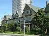 |
March 3, 1983 (#83003402) |
1019-1043 E. Ogden Ave. 43°02′52″N 87°53′53″W / 43.047778°N 87.898056°W |
Picturesque Queen Anne-style rowhouse of ten 3-story apartments, each with a private garden and patio. Designed by Howland Russel and built in 1889 for Edwin H. Abbot of the Wisconsin Central RR.[10][11] |
| 3 | Charles Abresch House | 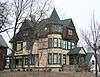 |
January 16, 1986 (#86000095) |
2126 W. Juneau Ave. 43°02′46″N 87°56′25″W / 43.046111°N 87.940278°W |
2.5 story Queen Anne home with 3-story tower, designed by Frederick Velguth and built in 1890. Abresch was a German immigrant who initially specialized in building beer wagons. Later his Charles Abresch Company transitioned to build car and truck bodies.[12][13] |
| 4 | Emanuel D. Adler House | 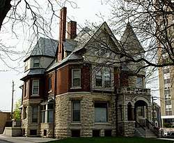 |
September 13, 1991 (#91001397) |
1681 N. Prospect Ave. 43°03′09″N 87°53′30″W / 43.052378°N 87.891669°W |
3-story brick and stone Queen Anne home with Romanesque Revival elements, designed by Alfred Clas and built in 1888. Adler and his family ran a business that made ready-to-wear clothing.[14][15] |
| 5 | All Saints' Episcopal Cathedral Complex | 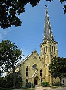 |
December 27, 1974 (#74000099) |
804-828 E. Juneau Ave. 43°02′46″N 87°54′06″W / 43.046111°N 87.901667°W |
1868 Gothic Revival design by E. Townsend Mix, originally as Olivet Congregational Church |
| 6 | Charles Allis House |  |
January 17, 1975 (#75000072) |
1630 E. Royall Pl. 43°03′13″N 87°53′25″W / 43.053611°N 87.890278°W |
1911 Tudor-style mansion, home to Charles Allis, designed by Alexander Eschweiler |
| 7 | American System Built Homes-Burnham Street District |  |
September 12, 1985 (#85002166) |
W. Burnham St. 43°00′38″N 87°56′55″W / 43.010556°N 87.948611°W |
Frank Lloyd Wright-designed affordable housing, built 1915 |
| 8 | Astor on the Lake |  |
September 6, 1984 (#84003715) |
924 E. Juneau Ave. 43°02′46″N 87°54′01″W / 43.046111°N 87.900278°W |
1920 Classical Revival Hotel |
| 9 | Baasen House-German YMCA |  |
August 2, 1984 (#84003718) |
1702 N. 4th St. 43°03′10″N 87°54′51″W / 43.052778°N 87.914167°W |
Designed by Charles Gombert (1874); part of the Brewers' Hill MRA |
| 10 | Baumbach Building | 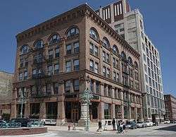 |
March 3, 1983 (#83003403) |
302 N. Broadway St. 43°02′03″N 87°54′25″W / 43.034167°N 87.906944°W |
Built in 1900 for a men's clothing firm. |
| 11 | Bay View Historic District | 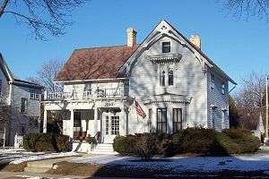 |
August 23, 1982 (#82000686) |
Roughly bounded by Lake Michigan, Meredith, Superior, Nock, Wentworth, Pryor, Clair, RR tracks and Conway St. 42°59′41″N 87°54′20″W / 42.994722°N 87.905556°W |
1867 residential neighborhood |
| 12 | Blatz Brewery Complex | 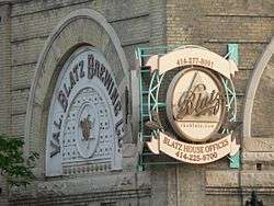 |
April 15, 1986 (#86000793) |
1101-1147 N. Broadway 43°02′42″N 87°54′32″W / 43.045°N 87.908889°W |
1891 Brewery |
| 13 | Valentin Blatz Brewing Company Office Building | 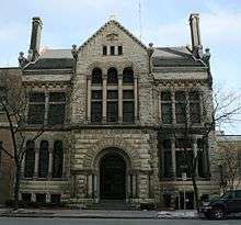 |
March 31, 1983 (#83003404) |
1120 N. Broadway 43°02′44″N 87°54′29″W / 43.045556°N 87.908056°W |
1890 Brewery offices |
| 14 | Blommer Ice Cream Company | August 31, 2017 (#100001574) |
1502 W. North Ave. 43°03′38″N 87°55′54″W / 43.06066°N 87.931769°W |
||
| 15 | Frederick C. Bogk House | 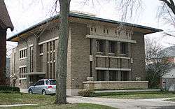 |
October 18, 1972 (#72000058) |
2420 N. Terrace Ave. 43°03′42″N 87°52′36″W / 43.061731°N 87.87665°W |
1917 Frank Lloyd Wright-designed residence |
| 16 | Brewers Hill Historic District |  |
August 2, 1984 (#84003745) |
Vine, Reservoir, Palmer, 1st, 2nd, and Brown Sts. •Boundary increase (listed April 27, 1995, refnum 95000449): Roughly, Brown and Lloyd Sts. and Garfield and North Aves. from 2nd St. to Hubbard St. 43°03′17″N 87°54′48″W / 43.054722°N 87.913333°W |
part of the Brewers' Hill MRA |
| 17 | Herman W. Buemming House |  |
January 18, 1990 (#89002315) |
1012 E. Pleasant St. 43°03′02″N 87°53′56″W / 43.050556°N 87.898889°W |
1901 Greek Revival house |
| 18 | J. L. Burnham Block | 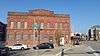 |
February 11, 1988 (#88000086) |
907-911 W. National Ave. 43°01′24″N 87°55′22″W / 43.023333°N 87.922778°W |
Early Italianate commercial architecture, by cream city brickmaker J.L. Burnham |
| 19 | Elias A. Calkins Doublehouse | 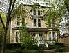 |
January 18, 1990 (#89002313) |
1612-1614 E. Kane Pl. 43°03′21″N 87°53′25″W / 43.055833°N 87.890278°W |
|
| 20 | Calvary Presbyterian Church | 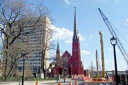 |
March 10, 1986 (#86000098) |
935 W. Wisconsin Ave. 43°02′18″N 87°55′27″W / 43.038333°N 87.924167°W |
Gothic Revival church designed by Koch & Hess and built in 1870, with a colossal corner tower. |
| 21 | Michael Carpenter House | 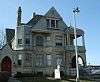 |
January 16, 1986 (#86000096) |
1115 Thirty-fifth St. 43°02′43″N 87°57′28″W / 43.045278°N 87.957778°W |
part of the West Side Area MRA |
| 22 | Cass-Juneau Street Historic District | November 3, 1988 (#88002389) |
Roughly bounded by E. Knapp and Marshall Sts., Juneau Ave., and Van Buren St. 43°02′47″N 87°54′08″W / 43.046389°N 87.902222°W |
||
| 23 | Cass-Wells Street Historic District | June 13, 1986 (#86001325) |
712, 718, and 724 E. Wells St. and 801, 809, 815, 819, and 823 N. Cass St. 43°02′31″N 87°54′08″W / 43.041944°N 87.902222°W |
||
| 24 | Central Library | 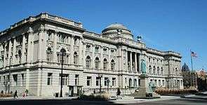 |
December 30, 1974 (#74000101) |
814 W. Wisconsin Ave. 43°02′22″N 87°55′21″W / 43.039444°N 87.9225°W |
Ferry and Clas-designed 1895 Renaissance-style library |
| 25 | Century Building | August 28, 2017 (#100001520) |
808 N. Old World Third St., 230 W. Wells St. 43°02′25″N 87°48′51″W / 43.040399°N 87.814201°W |
||
| 26 | Chief Lippert Fire Station |  |
October 28, 1988 (#88002007) |
642 W. North Ave. 43°03′38″N 87°55′10″W / 43.060556°N 87.919444°W |
1876 Firehouse |
| 27 | Christ Evangelical Lutheran Church | 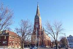 |
September 25, 1987 (#87001735) |
2235 W. Greenfield Ave. 43°01′00″N 87°56′31″W / 43.016667°N 87.941944°W |
1901 Gothic Revival church designed by Frederick Velguth |
| 28 | Commerce Street Power Plant |  |
June 25, 1999 (#99000761) |
1338 N. Commerce St. 43°02′49″N 87°54′48″W / 43.046944°N 87.913333°W |
|
| 29 | Concordia Historic District | July 30, 1985 (#85001688) |
Roughly bounded by West State, N. 27th, W. Killbourn Ave. and N. 35th St. 43°02′32″N 87°57′09″W / 43.042222°N 87.9525°W |
part of the West Side Area MRA | |
| 30 | Congregation Beth Israel Synagogue | 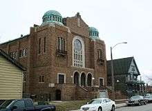 |
March 5, 1992 (#92000107) |
2432 N. Teutonia Ave. 43°03′47″N 87°55′43″W / 43.063056°N 87.928611°W |
1925 synagogue. Sold in 1960 and converted into the Greater Galilee Missionary Baptist Church. |
| 31 | Thomas Cook House | 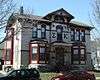 |
January 16, 1986 (#86000104) |
853 N. Seventeenth St. 43°02′29″N 87°56′03″W / 43.041389°N 87.934167°W |
part of the West Side Area MRA |
| 32 | Edward J. Dahinden House |  |
February 25, 1986 (#86000313) |
3316 W. Wisconsin Ave. 43°02′21″N 87°57′20″W / 43.039167°N 87.955556°W |
part of the West Side Area MRA |
| 33 | Desmond-Farnham-Hustis House | 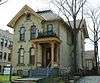 |
January 18, 1990 (#89002314) |
1535 N. Marshall St. 43°03′00″N 87°54′03″W / 43.05°N 87.900833°W |
|
| 34 | Dover Street School and Social Center | 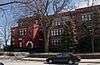 |
May 10, 2016 (#16000239) |
619 E. Dover St. 42°59′50″N 87°54′05″W / 42.997158°N 87.901385°W |
|
| 35 | Eagles Club |  |
July 29, 1986 (#86002096) |
2401 W. Wisconsin Ave. 43°02′18″N 87°56′35″W / 43.038333°N 87.943056°W |
1920s ballroom, belonging to the Fraternal Order of Eagles, architect Russell Barr Williamson; part of the West Side Area MRA |
| 36 | East Brady Street Historic District | 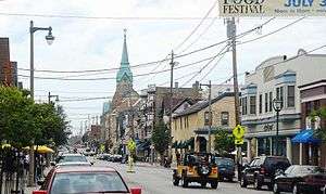 |
March 9, 1990 (#90000363) |
E. Brady St. from N. Farwell Ave. to N. Van Buren St. 43°03′11″N 87°53′52″W / 43.053056°N 87.897778°W |
Commercial center of Polish neighborhood, from 1865 |
| 37 | East Oregon and South Barclay Industrial Historic District |  |
December 29, 2014 (#14001112) |
300 S. Barclay, 139, 221 E. Oregon & 214 E. Florida Sts. 43°01′39″N 87°54′34″W / 43.0275°N 87.9095°W |
|
| 38 | East Side Commercial Historic District | 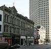 |
September 23, 1986 (#86002325) |
Roughly bounded by E. Wells St., N. Jefferson St. and N. Broadway, Michigan and E. Clybourn, and N. Water Sts. 43°02′18″N 87°54′26″W / 43.038333°N 87.907222°W |
|
| 39 | East Village Historic District |  |
January 21, 2004 (#03001486) |
Generally bounded by North Humboldt, East Brady, North Warren and Milwaukee R 43°03′19″N 87°53′45″W / 43.055278°N 87.895833°W |
Working class residential neighborhood |
| 40 | Abraham H. Esbenshade House | 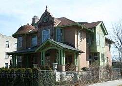 |
January 16, 1986 (#86000106) |
3119 W. Wells St. 43°02′25″N 87°57′13″W / 43.040278°N 87.953611°W |
part of the West Side Area MRA |
| 41 | Exton Apartments Building | 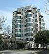 |
January 9, 1997 (#96001576) |
1260 N. Prospect Ave. 43°02′49″N 87°53′45″W / 43.046944°N 87.895833°W |
1938 Nine-story Art Deco apartment building, architect Herbert Tullgren |
| 42 | Federal Building | 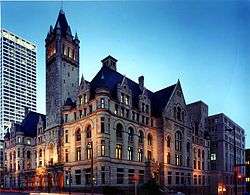 |
March 14, 1973 (#73000082) |
515-519 E. Wisconsin Ave. 43°02′17″N 87°54′16″W / 43.038056°N 87.904444°W |
Richardsonian Romanesque federal building and courthouse, 1890's |
| 43 | Otto F. Fiebing House |  |
September 12, 1985 (#85002022) |
1302 N. Hawley Rd. 43°02′51″N 87°59′01″W / 43.0475°N 87.983611°W |
part of the Ernest Flagg Stone Masonry Houses of Milwaukee County Thematic Resource (TR) |
| 44 | Fifth Street School | March 5, 2018 (#100002175) |
2770 N 5th St. 43°04′08″N 87°55′01″W / 43.068759°N 87.916960°W |
||
| 45 | First Church of Christ, Scientist | 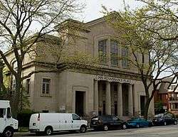 |
March 8, 1989 (#89000070) |
1443-1451 N. Prospect Ave. 43°02′57″N 87°53′41″W / 43.049167°N 87.894722°W |
|
| 46 | First Unitarian Church | 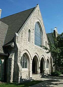 |
December 30, 1974 (#74000102) |
1009 E. Ogden Ave. 43°02′53″N 87°53′57″W / 43.048056°N 87.899167°W |
1891-2 Gothic Revival church designed by Milwaukee architects Ferry and Clas. |
| 47 | First Ward Triangle Historic District | March 19, 1987 (#87000489) |
Roughly Franklin Pl., N. Prospect and E. Juneau Aves., and E. Knapp St. 43°02′47″N 87°53′50″W / 43.046389°N 87.897222°W |
||
| 48 | Florida and Third Industrial Historic District | 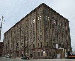 |
July 10, 2008 (#08000656) |
234-500 (N side) W. Florida St., 222 W. Pittsburgh Ave., 212, 222, 305, 331 S. Third St., 400 S. Fifth St. 43°01′39″N 87°54′46″W / 43.0275°N 87.912778°W |
Industrial properties, 1891–1928 |
| 49 | Forest Home Cemetery and Chapel | 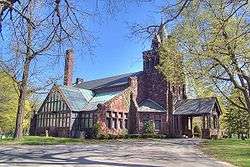 |
November 3, 1980 (#80000166) |
2405 Forest Home Ave. 42°59′53″N 87°56′35″W / 42.998056°N 87.943056°W |
Resting place for many Milwaukee luminaries, founded 1850 |
| 50 | Christian Foth House | March 22, 1988 (#88000218) |
1209-1211 S. Seventh St. 43°01′08″N 87°55′11″W / 43.018889°N 87.919722°W |
||
| 51 | Fourth Street School | 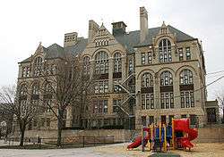 |
August 2, 1984 (#84003720) |
333 W. Galena St. 43°03′03″N 87°54′55″W / 43.050833°N 87.915278°W |
School that Prime Minister Golda Meir attended, 1906–1912; part of the Brewers' Hill MRA |
| 52 | Friedmann Row | 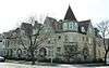 |
April 12, 1996 (#96000420) |
1537, 1539, 1541, 1543 N. Cass St. and 731 E. Pleasant St. 43°03′02″N 87°54′08″W / 43.050556°N 87.902222°W |
|
| 53 | Gallun Tannery Historic District | 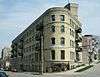 |
August 2, 1984 (#84003721) |
Holton and Water Sts. 43°03′20″N 87°54′05″W / 43.055556°N 87.901389°W |
part of the Brewers' Hill MRA |
| 54 | Garden Homes Historic District | May 4, 1990 (#90000669) |
Roughly bounded by W. Ruby and N. Teutonia Aves., N. 24th Pl., W. Atkinson Ave. and N. 27th St. 43°05′51″N 87°56′41″W / 43.0975°N 87.944722°W |
||
| 55 | German-English Academy | 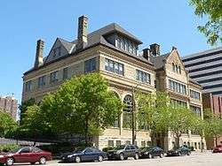 |
April 11, 1977 (#77000037) |
1020 N. Broadway 43°02′39″N 87°54′29″W / 43.044167°N 87.908056°W |
Romanesque Revival school built 1891-92 to house a private Academy started in 1851 by German immigrants to promote German language and culture. Designed by Crane and Barkhausen. |
| 56 | Germania Building |  |
July 7, 1983 (#83003405) |
135 W. Wells St. 43°02′23″N 87°54′45″W / 43.039722°N 87.9125°W |
1896 home to Germania Publishing Company. Largest office building in the city at the time. |
| 57 | Gesu Church | 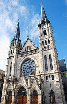 |
January 16, 1986 (#86000108) |
1145 W. Wisconsin Ave. 43°02′18″N 87°55′38″W / 43.038333°N 87.927222°W |
Twin-spired Gothic-style church; part of the West Side Area MRA |
| 58 | Gimbels Parking Pavilion | March 29, 2001 (#01000310) |
555 N. Plankinton Ave. 43°02′13″N 87°54′43″W / 43.036944°N 87.911944°W |
Art moderne monument to postwar suburban mobility | |
| 59 | Goodwill Industries Building | 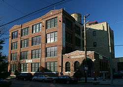 |
July 14, 2004 (#04000714) |
2102 W. Pierce St. 43°01′29″N 87°56′22″W / 43.024722°N 87.939444°W |
Training center for the disabled |
| 60 | Graham Row | 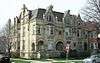 |
July 27, 1979 (#79000095) |
1501, 1503, and 1507 N. Marshall St. 43°02′58″N 87°54′04″W / 43.049444°N 87.901111°W |
|
| 61 | Grand Avenue Congregational Church |  |
January 16, 1986 (#86000110) |
2133 W. Wisconsin Ave. 43°02′18″N 87°56′25″W / 43.038333°N 87.940278°W |
part of the West Side Area MRA |
| 61 | Grand Avenue Elementary School | March 23, 2018 (#100002236) |
2708 W. Wisconsin Ave. 43°02′19″N 87°56′54″W / 43.038745°N 87.948264°W |
||
| 62 | Thomas A. Greene Memorial Museum |  |
November 4, 1993 (#93001615) |
3367 N. Downer Ave. 43°04′44″N 87°52′41″W / 43.078889°N 87.878056°W |
Built in 1913 to house the collection of amateur geologist, Greene |
| 63 | Harley-Davidson Motorcycle Factory Building | November 9, 1994 (#86003850) |
3700 W. Juneau Ave. (1147 N. Thirty-eighth St.) 43°02′45″N 87°57′40″W / 43.045833°N 87.961111°W |
part of the West Side Area MRA | |
| 64 | Highland Avenue Methodist Church | 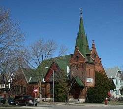 |
January 16, 1986 (#86000114) |
2024 W. Highland Ave. 43°02′41″N 87°56′19″W / 43.044722°N 87.938611°W |
part of the West Side Area MRA |
| 65 | Highland Boulevard Historic District | July 30, 1985 (#85001686) |
W. Highland Blvd. roughly bounded by N. 33rd and N. 29th Sts. 43°02′41″N 87°57′09″W / 43.044722°N 87.9525°W |
part of the West Side Area MRA | |
| 66 | Historic Third Ward District |  |
March 8, 1984 (#84003724) |
Bounded by the Milwaukee River, C&NW RR, and E. St. Paul and N. Jackson Sts. 43°01′56″N 87°54′26″W / 43.032222°N 87.907222°W |
Neighborhood of Irish settlers, and later Italian businesses |
| 67 | Alfred M. Hoelz House |  |
September 12, 1985 (#85002029) |
3449-3451 Frederick Ave. 43°04′49″N 87°53′02″W / 43.080278°N 87.883889°W |
part of the Ernest Flagg Stone Masonry Houses of Milwaukee County TR |
| 68 | Holy Trinity Roman Catholic Church | 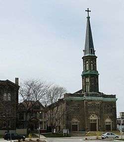 |
November 7, 1972 (#72000062) |
605 S. 4th St. 43°01′30″N 87°54′57″W / 43.025°N 87.915833°W |
|
| 69 | Home Office, Northwestern Mutual Life Insurance Company |  |
March 20, 1973 (#73000083) |
605-623 N. Broadway 43°02′16″N 87°54′28″W / 43.037778°N 87.907778°W |
|
| 70 | David W. Howie House | 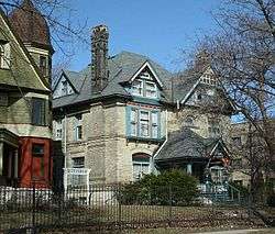 |
January 16, 1986 (#86000116) |
3026 W. Wells St. 43°02′26″N 87°57′09″W / 43.040556°N 87.9525°W |
part of the West Side Area MRA |
| 71 | Immanuel Presbyterian Church | 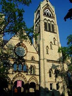 |
December 27, 1974 (#74000104) |
1100 N. Astor St. 43°02′41″N 87°53′58″W / 43.044722°N 87.899444°W |
1873 Gothic Revival design by E. Townsend Mix, buff-colored Wauwatosa limestone with red and gray interjections, original interior destroyed by 1887 fire |
| 72 | Iron Block |  |
December 27, 1974 (#74000105) |
205 E. Wisconsin Ave. 43°02′18″N 87°54′32″W / 43.038333°N 87.908889°W |
Cast Iron façade, shipped from New York, built 1861 |
| 73 | Johnston Hall | 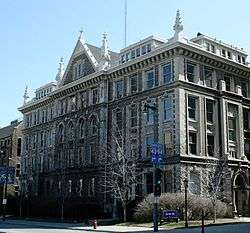 |
January 16, 1986 (#86000118) |
1121 W. Wisconsin Ave. 43°02′18″N 87°55′37″W / 43.038333°N 87.926944°W |
part of the West Side Area MRA |
| 74 | Joseph B. Kalvelage House |  |
May 23, 1978 (#78000118) |
2432 W. Kilbourn Ave. 43°02′30″N 87°56′38″W / 43.041667°N 87.943889°W |
1897 German baroque house. |
| 75 | Sanford R. Kane House |  |
September 13, 1991 (#91001398) |
1841 N. Prospect Ave. 43°03′15″N 87°53′22″W / 43.054167°N 87.889444°W |
1883 Queen Anne style mansion |
| 76 | Kenwood Park-Prospect Hill Historic District |  |
March 7, 2002 (#02000185) |
Roughly bounded by N. Hackett Ave., E. Edgewood Ave., N. Lake Dr. and E. Newberry Ave. 43°04′33″N 87°52′30″W / 43.075833°N 87.875°W |
|
| 77 | Frederick Ketter Warehouse |  |
August 2, 1984 (#84003725) |
325 W. Vine St. 43°03′13″N 87°54′54″W / 43.053611°N 87.915°W |
part of the Brewers' Hill MRA |
| 78 | Kilbourn Avenue Row House Historic District |  |
February 25, 1986 (#86000311) |
Roughly bounded by N. 14th St., W. Kilbourn Ave., and N. 15th St. 43°02′29″N 87°55′53″W / 43.041389°N 87.931389°W |
part of the West Side Area MRA |
| 79 | Kilbourn Masonic Temple | 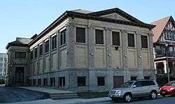 |
January 16, 1986 (#86000121) |
827 N. Eleventh St. 43°02′26″N 87°55′35″W / 43.040556°N 87.926389°W |
part of the West Side Area MRA |
| 80 | Kinnickinnic River Parkway |  |
July 14, 2011 (#11000462) |
Between S. 72nd & S. 16th Sts. 42°59′51″N 87°57′49″W / 42.9975°N 87.963611°W |
part of the Milwaukee County Parkway System Multiple Property Submission (MPS) |
| 81 | Knapp-Astor House |  |
March 27, 1980 (#80000167) |
930 E. Knapp St. and 1301 N. Astor St. 43°02′49″N 87°53′59″W / 43.046944°N 87.899722°W |
|
| 82 | Knickerbocker Hotel |  |
June 2, 1988 (#88000680) |
1028 E. Juneau Ave. 43°02′45″N 87°53′56″W / 43.045833°N 87.898889°W |
8-story late Neoclassical residential apartment hotel built in 1929, designed by Rossman & Wierdsma. |
| 83 | Koelsch Funeral Home | October 12, 2010 (#10000822) |
7622 W, Greenfield Ave. 43°01′00″N 88°00′30″W / 43.016667°N 88.008333°W |
||
| 84 | Lake Park | April 22, 1993 (#93000339) |
2900 N. Lake Dr. and 2800 E. Kenwood Blvd. 43°04′13″N 87°52′07″W / 43.070278°N 87.868611°W |
Designed by Frederick Law Olmsted, and begun in the 1890s | |
| 85 | LIGHT VESSEL NO. 57 (Shipwreck) | December 23, 1991 (#91001823) |
Lake Michigan near South Shore Park 43°00′06″N 87°53′08″W / 43.001533°N 87.8855°W |
||
| 86 | Lindsay-Bostrom Building |  |
April 26, 2002 (#02000417) |
133 W. Oregon St. 43°01′41″N 87°54′43″W / 43.028056°N 87.911944°W |
|
| 87 | Lohman Funeral Home and Livery Stable | 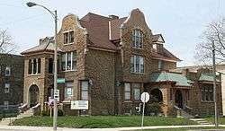 |
March 17, 1988 (#88000220) |
804 W. Greenfield and 1325 S. Eighth 43°01′02″N 87°55′16″W / 43.017222°N 87.921111°W |
livery stable being razed as of October 2012[16] |
| 88 | Robert Machek House | 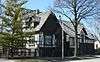 |
October 28, 1977 (#77000038) |
1305 N. 19th St. 43°02′50″N 87°56′12″W / 43.047222°N 87.936667°W |
|
| 89 | Mackie Building | 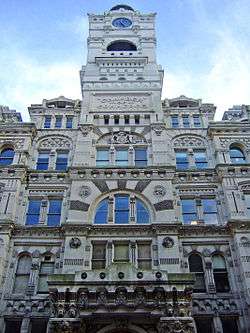 |
April 3, 1973 (#73000084) |
225 E. Michigan St. 43°02′14″N 87°54′29″W / 43.037158°N 87.90805°W |
1879 Victorian landmark designed by E. Townsend Mix, once the world’s largest grain exchange |
| 90 | George C. Mansfield Company Building | 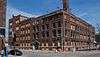 |
July 26, 2016 (#16000476) |
1300 N. 4th St. 43°02′50″N 87°54′57″W / 43.047338°N 87.915814°W |
|
| 91 | Mayer Boot and Shoe Company Building |  |
August 2, 1984 (#84003728) |
116 E. Walnut St. 43°03′10″N 87°54′37″W / 43.052778°N 87.910278°W |
part of the Brewers' Hill MRA |
| 92 | McIntosh-Goodrich Mansion | August 31, 2000 (#00001045) |
1584 N. Prospect Ave. 43°03′02″N 87°53′33″W / 43.050556°N 87.8925°W |
1932 Classical revival mansion, designed by architect H.R. Wilson | |
| 93 | McKinley Boulevard Historic District | July 30, 1985 (#85001687) |
W. McKinley Blvd. between N. 34th & N. 27th Sts. 43°02′50″N 87°57′08″W / 43.047222°N 87.952222°W |
part of the West Side Area MRA | |
| 94 | Milwaukee Breakwater Light | 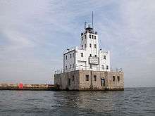 |
September 16, 2011 (#11000678) |
South end of the north breakwater, 0.7 miles (1.1 km) east of the mouth of the Milwaukee River 43°01′37″N 87°52′55″W / 43.026944°N 87.881944°W |
part of the Light Stations of the United States MPS |
| 95 | Milwaukee City Hall | 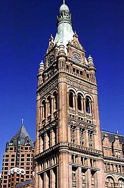 |
March 14, 1973 (#73000085) |
200 E. Wells St. 43°02′31″N 87°54′35″W / 43.041944°N 87.909722°W |
Henry C. Koch-designed 1894 Flemish Revival building, tallest building in US outside of New York City, 1895–1901 |
| 96 | Milwaukee County Courthouse |  |
March 9, 1982 (#82000687) |
901 N. 9th St. 43°02′29″N 87°55′26″W / 43.041389°N 87.923889°W |
Massive 1931 Classical Revival courthouse; part of the County Courthouses of Wisconsin TR |
| 97 | Milwaukee County Dispensary and Emergency Hospital |  |
March 21, 1985 (#85000639) |
2430 W. Wisconsin Ave. 43°02′22″N 87°56′38″W / 43.039444°N 87.943889°W |
|
| 98 | Milwaukee County Historical Center | 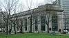 |
March 14, 1973 (#73000086) |
910 N. 3rd St. 43°02′30″N 87°54′52″W / 43.041667°N 87.914444°W |
1913 Neo-Classical bank building, currently home to the Milwaukee County Historical Center |
| 99 | Milwaukee Fire Department High Pressure Pumping Station | 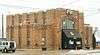 |
July 7, 1981 (#81000049) |
2011 S. 1st St. 43°00′21″N 87°54′41″W / 43.005833°N 87.911389°W |
|
| 100 | Milwaukee Hospital | 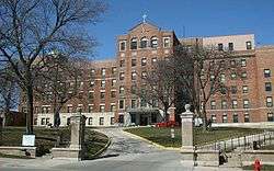 |
September 6, 2006 (#06000800) |
2200 W. Kilbourn Ave. 43°02′33″N 87°56′26″W / 43.0425°N 87.940556°W |
First Protestant hospital west of Pittsburgh, founded 1863 |
| 101 | Milwaukee News Building and Milwaukee Abstract Association Building | 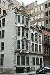 |
March 1, 1982 (#82000688) |
222 E. Mason St. 43°02′24″N 87°54′32″W / 43.04°N 87.908889°W |
|
| 102 | Milwaukee Normal School-Milwaukee Girls' Trade and Technical High School | 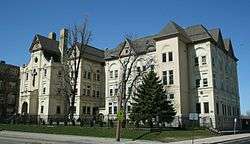 |
January 16, 1986 (#86000123) |
1820 W. Wells St. 43°02′27″N 87°56′09″W / 43.040833°N 87.935833°W |
part of the West Side Area MRA |
| 103 | Milwaukee Paper Box Company | December 18, 2013 (#13000956) |
1560 W. Pierce St. 43°01′29″N 87°55′57″W / 43.024691°N 87.932479°W |
||
| 104 | Milwaukee Pierhead Light | 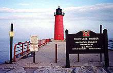 |
November 21, 2012 (#12000971) |
Milwaukee Harbor entry N. pier, SE. corner of H.W. Maier Festival Park 43°01′34″N 87°53′43″W / 43.0260°N 87.8953°W |
|
| 105 | Milwaukee River Parkway |  |
November 6, 2012 (#12000914) |
Between Good Hope Rd. & W. Capitol Dr. 43°07′07″N 87°55′24″W / 43.118716°N 87.923241°W |
Part of the Milwaukee County Parkway System MPS |
| 106 | Milwaukee-Western Fuel Company Building |  |
March 5, 1992 (#92000108) |
2150 N. Prospect Ave. 43°03′29″N 87°53′07″W / 43.058056°N 87.885278°W |
1934 Art Deco office building designed by Herbert Tullgren |
| 107 | Milwaukee-Downer "Quad" |  |
January 17, 1974 (#74000106) |
NW corner of Hartford and Downer Aves. 43°04′42″N 87°52′43″W / 43.078333°N 87.878611°W |
|
| 108 | Mitchell Building |  |
April 3, 1973 (#73000087) |
207 E. Michigan St. 43°02′14″N 87°54′31″W / 43.037222°N 87.908611°W |
E. Townsend Mix-designed French Second Empire-style 1876 office building |
| 109 | Alexander Mitchell House |  |
August 28, 2012 (#86003852) |
900 W. Wisconsin Ave. 43°02′23″N 87°55′25″W / 43.039714°N 87.923745°W |
|
| 110 | New Coeln House |  |
February 11, 1988 (#88000083) |
5905 S. Howell Ave. 42°56′14″N 87°54′36″W / 42.937222°N 87.91°W |
|
| 111 | Newberry Boulevard Historic District |  |
March 7, 1994 (#94000137) |
1802-3000 E. Newberry Blvd. 43°04′10″N 87°52′50″W / 43.069444°N 87.880556°W |
|
| 112 | North 47th Street Bungalow Historic District | February 28, 2017 (#100000699) |
2500 block of N. 47th St. between Wright and Clarke Sts. 43°03′55″N 87°58′21″W / 43.065280°N 87.972436°W |
||
| 113 | North First Street Historic District |  |
August 2, 1984 (#84003731) |
Roughly 1st and 2nd Sts. between North and Center Sts. 43°03′47″N 87°54′42″W / 43.063056°N 87.911667°W |
part of the Brewers' Hill MRA |
| 114 | North Grant Boulevard Historic District | March 23, 1995 (#95000290) |
2370-2879 N. Grant Blvd. 43°04′02″N 87°57′57″W / 43.067222°N 87.965833°W |
Upscale subdivision, 1913–1931 | |
| 115 | North Point Lighthouse | 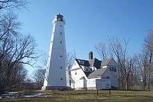 |
July 19, 1984 (#84003732) |
Wahl St. at Terrace 43°03′57″N 87°52′13″W / 43.065833°N 87.870278°W |
Lighthouse established in 1855, current structure 1888 and 1913; part of the U.S. Coast Guard Lighthouses and Light Stations on the Great Lakes TR |
| 116 | North Point North Historic District |  |
March 24, 2000 (#00000255) |
Roughly bounded by N. Downer Ave., E. Park Pl., and N. Wahl Ave. 43°03′55″N 87°52′35″W / 43.065278°N 87.876389°W |
|
| 117 | North Point South Historic District |  |
September 4, 1979 (#79000322) |
Roughly bounded by North Ave., Summit, Terrace, and Lafayette Sts. 43°03′26″N 87°52′55″W / 43.057222°N 87.881944°W |
|
| 118 | North Point Water Tower | 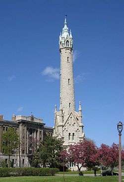 |
February 23, 1973 (#73000088) |
E. North Ave. between N. Lake Dr. and N. Terrace Ave. 43°03′37″N 87°52′47″W / 43.060278°N 87.879722°W |
175-foot Victorian Gothic tower, used to regulate water pressure, designed by Charles Gombert and built in 1873 |
| 119 | North Sherman Boulevard Historic District | April 6, 2004 (#04000271) |
N. Sherman Blvd. Roughly bounded by W. Keefe Ave. and W. Lisbon Ave. 43°04′13″N 87°58′02″W / 43.070278°N 87.967222°W |
||
| 120 | North Third Street Historic District |  |
August 2, 1984 (#84003733) |
Roughly N. 3rd St. between N. 3rd Ave. and Vine St. 43°03′35″N 87°54′52″W / 43.059722°N 87.914444°W |
part of the Brewers' Hill MRA |
| 121 | Northwestern Branch, National Home for Disabled Volunteer Soldiers Historic District |  |
June 3, 2005 (#05000530) |
5000 W. National Ave. 43°01′44″N 87°58′33″W / 43.028889°N 87.975833°W |
Cream city brick building in Gothic Revival style designed by E. Townsend Mix in 1867, surrounded by grounds that were one of the first city parks; designated a National Historic Landmark June 17, 2011 |
| 122 | Nunn-Bush Shoe Company Factory | September 11, 2017 (#100001599) |
2821 N. 4th St. 43°04′13″N 87°54′56″W / 43.070302°N 87.915465°W |
||
| 123 | Old St. Mary's Church |  |
March 7, 1973 (#73000253) |
844 N. Broadway 43°02′29″N 87°54′28″W / 43.041389°N 87.907778°W |
Milwaukee's first German Catholic church, Zopfstil style, 1847 |
| 124 | Old World Third Street Historic District |  |
March 19, 1987 (#87000494) |
N. Old World Third St., W. Highland Ave., and W. State St. 43°02′37″N 87°54′53″W / 43.043611°N 87.914722°W |
|
| 125 | Joseph B. Oliver House |  |
January 18, 1990 (#89002312) |
1516 E. Brady St. 43°03′10″N 87°53′29″W / 43.052778°N 87.891389°W |
|
| 126 | Oneida Street Station |  |
December 6, 1984 (#84000701) |
108 E. Wells and 816 N. Edison Sts. 43°02′28″N 87°54′41″W / 43.041111°N 87.911389°W |
First use of pulverized coal in boilers, 1919 |
| 127 | Pabst Brewery Saloon |  |
January 16, 1986 (#86000125) |
1338-1340 W. Juneau Ave. 43°02′46″N 87°55′48″W / 43.046111°N 87.93°W |
part of the West Side Area MRA |
| 128 | Pabst Brewing Company Complex |  |
November 14, 2003 (#03001165) |
Roughly bounded by Highland Ave., 11th, Winnebago and 9th Sts. 43°02′45″N 87°55′28″W / 43.045833°N 87.924444°W |
Brewing company founded in 1844. One-time largest brewer in the world |
| 129 | Pabst Theater | 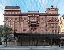 |
April 11, 1972 (#72000063) |
144 E. Wells St. 43°02′28″N 87°54′52″W / 43.041111°N 87.914444°W |
Technologically innovative theater, built 1895 |
| 130 | Frederick Pabst House | 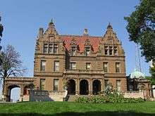 |
April 21, 1975 (#75000073) |
2000 W. Wisconsin Ave. 43°02′21″N 87°56′17″W / 43.039167°N 87.938056°W |
1892 Flemish Renaissance Revival mansion of beer baron, Captain Frederick Pabst. Architect George Bowman Ferry. |
| 131 | George W. Peck Row House | June 14, 2016 (#16000378) |
1620-1630 N. Farwell Ave. 43°03′07″N 87°53′36″W / 43.051834°N 87.893360°W |
||
| 132 | Peckham Junior High School | May 30, 2012 (#12000319) |
3245 N. 37th St. 43°04′42″N 87°57′37″W / 43.078238°N 87.9603°W |
||
| 133 | Pittsburgh Plate Glass Enamel Plant |  |
October 21, 2009 (#09000851) |
201 E. Pittsburgh Ave. 43°01′44″N 87°54′30″W / 43.028797°N 87.908389°W |
Art deco factory and office building |
| 134 | Plankinton-Wells-Water Street Historic District |  |
June 13, 1986 (#86001328) |
Roughly bounded by Wells, Bridge, N. Water, E. Mason, W. Wells, and N. Second Sts. 43°02′26″N 87°54′40″W / 43.040556°N 87.911111°W |
|
| 135 | John Pritzlaff Hardware Company |  |
January 14, 2013 (#12001187) |
305-333 N. Plankinton & 143, 155, W. St. Paul Aves. 43°02′04″N 87°54′43″W / 43.034337°N 87.911977°W |
1875 home of Milwaukee's largest hardware company |
| 136 | Prospect Avenue Apartment Buildings Historic District |  |
April 19, 1990 (#90000640) |
N. Prospect Ave. area roughly between E. Kane Pl. and E. Windsor St. 43°03′20″N 87°53′17″W / 43.055556°N 87.888056°W |
|
| 137 | Prospect Avenue Mansions Historic District | 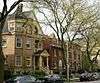 |
April 7, 1990 (#90000478) |
1363-1551 N. Prospect Ave. 43°02′56″N 87°53′40″W / 43.048889°N 87.894444°W |
|
| 138 | Prospect Hill Historic District | March 1, 2005 (#05000104) |
2700 block of N. Hackett Ave., N. Shepard Ave., N. Summit Ave. and 2804-06 E. Park Place 43°04′05″N 87°52′33″W / 43.068056°N 87.875833°W |
||
| 139 | Public School No. 27 |  |
August 2, 1984 (#84003735) |
2215 N. 4th St. 43°03′34″N 87°54′58″W / 43.059444°N 87.916111°W |
part of the Brewers' Hill MRA |
| 140 | Public Service Building | 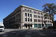 |
May 20, 1998 (#98000576) |
231 W. Michigan St. 43°02′14″N 87°54′52″W / 43.037222°N 87.914444°W |
1902 home of the first unified electric power utility in the nation, the Milwaukee Electric Railway and Light Company (now Wisconsin Energy Corporation), founded 1896 |
| 141 | Pythian Castle Lodge | February 25, 1988 (#88000089) |
1925 W. National Ave. 43°01′21″N 87°56′15″W / 43.0225°N 87.9375°W |
1927 Spanish Colonial Revival-style lodge of Knights of Pythias. | |
| 142 | Charles Quarles House |  |
July 27, 1979 (#79000096) |
2531 N. Farwell Ave. 43°03′52″N 87°52′55″W / 43.064444°N 87.881944°W |
|
| 143 | Saint Anthony Hospital | October 6, 2017 (#100001724) |
1004 N. 10th St. 43°02′37″N 87°55′28″W / 43.043579°N 87.924380°W |
||
| 144 | Saint George Melkite Catholic Church |  |
January 16, 1986 (#86000128) |
1617 W. State St. 43°02′35″N 87°56′00″W / 43.043056°N 87.933333°W |
Best example of Byzantine Revival inspired architecture in the city,exemplifies the association between ethnicity and architectural design; part of the West Side Area MRA |
| 145 | Saint James Court Apartments | 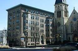 |
July 2, 2008 (#08000606) |
831 West Wisconsin Ave. 43°02′18″N 87°55′22″W / 43.038342°N 87.922714°W |
|
| 146 | St. James Episcopal Church | 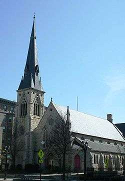 |
June 27, 1979 (#79000098) |
833 W. Wisconsin Ave. 43°02′17″N 87°55′22″W / 43.038056°N 87.922778°W |
|
| 147 | St. John's Evangelical Lutheran Church Complex | 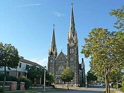 |
May 18, 1992 (#92000459) |
804-816 W. Vliet St. 43°02′55″N 87°55′19″W / 43.048611°N 87.921944°W |
1889 Gothic Revival church designed by Hermann Schnetzky |
| 148 | St. John's Roman Catholic Cathedral | 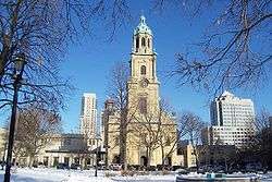 |
December 31, 1974 (#74000108) |
812 N. Jackson St. 43°02′30″N 87°54′14″W / 43.041667°N 87.903889°W |
Zopfstil-style cathedral, built 1847-1852 |
| 149 | St. Josaphat Basilica | 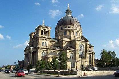 |
March 7, 1973 (#73000089) |
601 W. Lincoln Ave. 43°00′09″N 87°55′09″W / 43.0025°N 87.919167°W |
Grand 1901 church, named the third basilica in the US in 1929. |
| 150 | St. Martini Evangelical Lutheran Church | September 25, 1987 (#87001741) |
1557 W. Orchard St. 43°00′57″N 87°55′57″W / 43.015833°N 87.9325°W |
||
| 151 | St. Patrick's Roman Catholic Church | 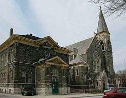 |
December 16, 1974 (#74000109) |
1105 S. 7th St. 43°01′12″N 87°55′13″W / 43.02°N 87.920278°W |
|
| 152 | St. Paul's Episcopal Church |  |
December 27, 1974 (#74000110) |
904 E. Knapp St. 43°02′50″N 87°54′02″W / 43.047222°N 87.900556°W |
Romanesque Revival style church noted for its Tiffany windows, built 1882-90 by local architect E. Townsend Mix adopting an original design published earlier by Henry Hobson Richardson |
| 153 | Saint Peter's Evangelical Lutheran Church |  |
September 25, 1987 (#87001736) |
1204, 1213, 1214, and 1215 S. Eighth St. 43°01′08″N 87°55′16″W / 43.018889°N 87.921111°W |
Designed by Andrew Elleson in Italianate Gothic Revival style and completed in 1885 |
| 154 | Saint Vincent's Infant Asylum | 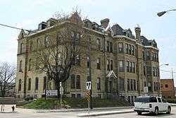 |
September 25, 1987 (#87001742) |
809 W. Greenfield Ave. 43°01′01″N 87°55′16″W / 43.016944°N 87.921111°W |
|
| 155 | Saints Peter and Paul Roman Catholic Church Complex |  |
September 13, 1991 (#91001392) |
2474 and 2490 N. Cramer St. and 2479 and 2491 N. Murray Ave. 43°03′48″N 87°53′10″W / 43.063333°N 87.886111°W |
Later parish of German immigrants, with Romanesque Revival church built in 1890-92, Neoclassical school built in 1890, and Romanesque convent built in 1889. |
| 156 | Salem Evangelical Church | 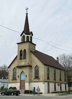 |
October 1, 1987 (#87001760) |
1025 & 1037 S. Eleventh St. 43°01′13″N 87°55′32″W / 43.020278°N 87.925556°W |
|
| 157 | Joseph Schlitz Brewing Company Saloon | 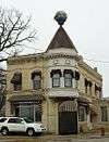 |
April 11, 1977 (#77000040) |
2414 S. St. Clair St. 43°00′01″N 87°53′35″W / 43.000278°N 87.893056°W |
|
| 158 | Joseph Schlitz Company Brewery Complex | 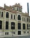 |
December 30, 1999 (#99001632) |
219 W. Galena St. 43°03′03″N 87°54′46″W / 43.050833°N 87.912778°W |
|
| 159 | Victor Schlitz House | 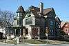 |
January 16, 1986 (#86000145) |
2004 W. Highland Ave. 43°02′41″N 87°56′16″W / 43.044722°N 87.937778°W |
Designed by Charles Gombert 1890; part of the West Side Area MRA |
| 160 | Schoonmaker Reef |  |
September 25, 1997 (#97001266) |
North of West St., between N. 66th St. and N. 64th St. extended 43°02′50″N 87°59′37″W / 43.047222°N 87.993611°W |
1862 discovery of fossilized reef, among the first in the world identified as such |
| 161 | George Schuster House and Carriage Shed | 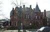 |
January 16, 1986 (#86000137) |
3209 W. Wells St. 43°02′25″N 87°57′16″W / 43.040278°N 87.954444°W |
1891 bright red eclectic-style home and carriage barn; part of the West Side Area MRA |
| 162 | Second Church of Christ Scientist | 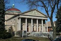 |
January 16, 1986 (#86000139) |
2722 W. Highland Blvd. 43°02′43″N 87°56′54″W / 43.045278°N 87.948333°W |
Christian Science church inspired by the Pantheon in Rome, designed by Carl Barkhausen and built in 1913. |
| 163 | Shorecrest Hotel | 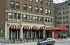 |
September 7, 1984 (#84003737) |
1962 N. Prospect Ave. 43°03′20″N 87°53′15″W / 43.05545°N 87.887444°W |
|
| 164 | Fred Sivyer House |  |
January 16, 1986 (#86000141) |
761 N. 25th St. 43°02′24″N 87°56′42″W / 43.04°N 87.945°W |
part of the West Side Area MRA |
| 165 | Sixth Church of Christ, Scientist |  |
March 27, 1980 (#80000168) |
1036 N. Van Buren St. 43°02′42″N 87°54′17″W / 43.045°N 87.904722°W |
|
| 166 | Lloyd R. Smith House |  |
December 30, 1974 (#74000107) |
2220 N. Terrace Ave. 43°03′28″N 87°52′51″W / 43.057778°N 87.880833°W |
1924 Italian villa-style home overlooking Lake Michigan |
| 167 | Soldiers' Home Reef |  |
November 4, 1993 (#93001617) |
Northeast of the junction of Wood Ave. and General Mitchell Blvd., Clement J. Zablocki Veterans Affairs Medical Center grounds 43°01′40″N 87°58′29″W / 43.027778°N 87.974722°W |
1862 discovery of fossilized reef, among the first in the world identified as such |
| 168 | South Branch Library | February 11, 1988 (#88000084) |
931 W. Madison St. 43°01′04″N 87°55′25″W / 43.017778°N 87.923611°W |
||
| 169 | South First and Second Street Historic District |  |
November 30, 1987 (#87002092) |
Roughly bounded by Menomonee River, Chicago & N. Western RR, Seeboth, S. First, Oregon, & S. Second Sts. 43°01′49″N 87°54′43″W / 43.030278°N 87.911944°W |
|
| 170 | South Layton Boulevard Historic District | April 24, 1996 (#96000412) |
921-2264 S. Layton Blvd. 43°00′48″N 87°56′54″W / 43.013333°N 87.948333°W |
||
| 171 | Spencerian Business College |  |
March 14, 2008 (#07001331) |
2800 W Wright St. 43°03′52″N 87°56′56″W / 43.064444°N 87.948889°W |
Distinguished business training institution, founded 1863 |
| 172 | Spring Grove Site | September 10, 1979 (#79000097) |
Address Restricted |
||
| 173 | Square D Company-Industrial Controller Division | October 22, 2014 (#14000878) |
710 S. 3rd St. 43°01′26″N 87°54′50″W / 43.0239°N 87.9139°W |
||
| 174 | State Bank of Wisconsin | 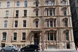 |
March 8, 1984 (#84003742) |
210 E. Michigan St. 43°02′15″N 87°54′30″W / 43.0375°N 87.908333°W |
|
| 175 | William Steinmeyer House | 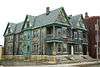 |
October 11, 1984 (#84000102) |
1716-1722 N. 5th St. 43°03′11″N 87°55′01″W / 43.053056°N 87.916944°W |
part of the Brewers' Hill MRA |
| 176 | Trinity Evangelical Lutheran Church | 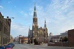 |
May 8, 1979 (#79000099) |
1046 N. 9th St. 43°02′39″N 87°55′21″W / 43.044167°N 87.9225°W |
1878 German Romanesque/Gothic Revival-style church designed by Frederick Velguth |
| 177 | Tripoli Temple | 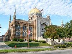 |
January 16, 1986 (#86000142) |
3000 W. Wisconsin Ave. 43°02′21″N 87°57′05″W / 43.039167°N 87.951389°W |
Moorish Revival Shrine Center, loosely based on the Taj Mahal, Ferry and Clas, 1928; part of the West Side Area MRA |
| 178 | Turner Hall |  |
November 7, 1977 (#77000041) |
1034 N. 4th St. 43°02′37″N 87°54′56″W / 43.043611°N 87.915556°W |
Henry C. Koch-designed 1882 meeting place of German-American social, political and gymnastic organization, The Turners |
| 179 | Harry B. Walker House | 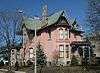 |
January 16, 1986 (#86000144) |
3130 W. Wells St. 43°02′26″N 87°57′14″W / 43.040556°N 87.953889°W |
part of the West Side Area MRA |
| 180 | Walker's Point Historic District | 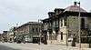 |
December 19, 1978 (#78000120) |
Roughly bounded by the Freeway, Scott, 2nd, and W. Virginia Street 43°01′27″N 87°55′00″W / 43.024167°N 87.916667°W |
|
| 181 | Ward Memorial Hall | 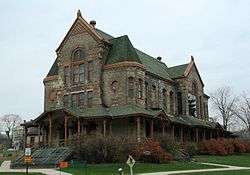 |
September 6, 1984 (#84003748) |
5000 W. National Ave. 43°01′32″N 87°58′35″W / 43.025556°N 87.976389°W |
One of the oldest theaters in Wisconsin, opened 1882 |
| 182 | West Side Commercial Historic District |  |
December 22, 2000 (#78003462) |
Roughly, W. Wisconsin Ave., N. Third St., N. Plankinton Ave, and N. 2nd St. 43°02′18″N 87°54′49″W / 43.038333°N 87.913611°W |
|
| 183 | West St. Paul Avenue Industrial Historic District | March 12, 2018 (#100002198) |
Generally bounded by the N & S sides of & 1101-2045 W. St. Paul Ave. including 272 to 405 N 12th & 324-422 N 15th Sts. 43°02′05″N 87°55′52″W / 43.034747°N 87.931241°W |
||
| 184 | West Washington-North Hi-Mount Boulevards Historic District | May 18, 1994 (#94000422) |
4701-5929 W. Washington Blvd.; 1720-2049 N. Hi-Mount Blvd. 43°03′12″N 87°58′49″W / 43.053333°N 87.980278°W |
||
| 185 | Wisconsin Consistory Building |  |
September 26, 1994 (#94001158) |
790 N. Van Buren St. 43°02′29″N 87°54′08″W / 43.041389°N 87.902222°W |
|
| 186 | Wisconsin Leather Company Building | 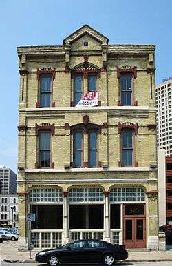 |
March 30, 2005 (#05000250) |
320 E. Clybourn St. 43°02′18″N 87°54′24″W / 43.038333°N 87.906667°W |
1874, E. Townsend Mix |
| 187 | Woman's Club of Wisconsin |  |
October 4, 1982 (#82001847) |
813 E. Kilbourn Ave. 43°02′33″N 87°54′05″W / 43.0425°N 87.901389°W |
The oldest woman's clubhouse in the United States, 1887, designed by architects Ferry & Clas |
Former listing
| [2] | Name on the Register | Image | Date listed | Date removed | Location | City or town | Summary |
|---|---|---|---|---|---|---|---|
| 1 | Old Coast Guard Station |  |
August 7, 1989 (#89001047) | July 1, 2009 | 1600 North Lincoln Memorial Drive 43°03′04″N 87°53′15″W / 43.0511°N 87.8875°W |
Milwaukee |
See also
| Wikimedia Commons has media related to National Register of Historic Places in Milwaukee County, Wisconsin. |
References
- ↑ "National Register of Historic Places: Weekly List Actions". National Park Service, United States Department of the Interior. Retrieved on October 11, 2018.
- 1 2 Numbers represent an ordering by significant words. Various colorings, defined here, differentiate National Historic Landmarks and historic districts from other NRHP buildings, structures, sites or objects.
- ↑ The eight-digit number below each date is the number assigned to each location in the National Register Information System database, which can be viewed by clicking the number.
- ↑ "27th and Wells Commercial Historic District". Wisconsin Historical Society. Retrieved 2017-09-11.
- ↑ "Baebenroth's Pharmacy". Wisconsin Historical Society. Retrieved 2017-09-11.
- ↑ "West Point Apartments". Wisconsin Historical Society. Retrieved 2017-09-11.
- ↑ "Cecelia Apartment Building". Wisconsin Historical Society. Retrieved 2017-09-11.
- ↑ "Tower Theater". Wisconsin Historical Society. Retrieved 2017-09-11.
- ↑ Donna Weiss; Kate Bissen (2016-09-22). "NRHP Inventory/Nomination: 27th and Wells Streets Commercial Historic District" (PDF). National Park Service. Retrieved 2017-09-11.
- ↑ "Abbot Row". Wisconsin Historical Society. Retrieved 2017-09-11.
- ↑ Gary Tipler (1982-10-27). "NRHP Inventory/Nomination: Abbot Row". National Park Service. Retrieved 2017-09-11. With two photos.
- ↑ "Charles Abresch House". Wisconsin Historical Society. Retrieved 2017-12-24.
- ↑ Robin D. Wenger; Carlen Hatala (1983). "Inventory Form for Nominated Properties: Charles Abresch House". State Historical Society of Wisconsin. Retrieved 2017-12-24. With two photos.
- ↑ "Adler, Emanuel D., House". Wisconsin Historical Society. Retrieved 2017-12-24.
- ↑ Lee Vollmert; Carlen Hatala (1990-01-05). "NRHP Inventory/Nomination: Adler, Emanuel D., House". National Park Service. Retrieved 2017-12-24. With nine photos.
- ↑ Pabst, Georgia (October 18, 2012). "Historic Stable Coming Down". Milwaukee Journal Sentinel.
|  | |
| Topics | |
|---|---|
| Lists by states |
|
| Lists by insular areas | |
| Lists by associated states | |
| Other areas | |
| |
This article is issued from
Wikipedia.
The text is licensed under Creative Commons - Attribution - Sharealike.
Additional terms may apply for the media files.