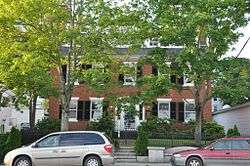
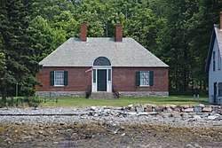
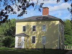
| [3] |
Name on the Register[4] |
Image |
Date listed[5] |
Location |
City or town |
Description |
|---|
| 1 |
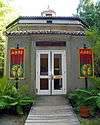
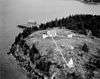
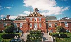
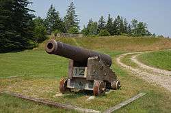
Robert Abbe Museum of Stone Antiquities |
|
January 19, 1983
(#83000451) |
South of Bar Harbor off State Route 3
44°21′40″N 68°12′30″W / 44.361111°N 68.208333°W / 44.361111; -68.208333 (Robert Abbe Museum of Stone Antiquities) |
Bar Harbor |
|
| 2 |
Agassiz Bedrock Outcrop |
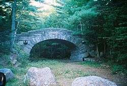
|
February 13, 2003
(#03000014) |
406 State St.
44°33′40″N 68°26′19″W / 44.561111°N 68.438611°W / 44.561111; -68.438611 (Agassiz Bedrock Outcrop) |
Ellsworth |
|
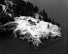
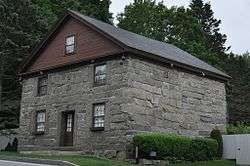
| 3 |
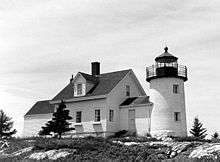
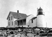
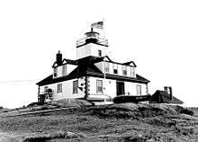
Baker Island Light Station |
|
March 14, 1988
(#88000046) |
Baker Island in Acadia National Park
44°14′28″N 68°11′56″W / 44.241111°N 68.198889°W / 44.241111; -68.198889 (Baker Island Light Station) |
Islesford |
First light station serving Mount Desert Island—established in 1828—with a surviving 1855 light tower and keeper's house.[6] |
| 4 |
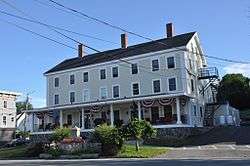
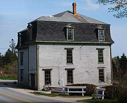
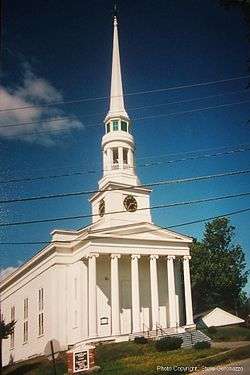
Barncastle |
|
November 10, 1980
(#80000219) |
South St.
44°23′51″N 68°35′18″W / 44.3975°N 68.588333°W / 44.3975; -68.588333 (Barncastle) |
Blue Hill |
|
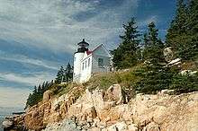
| 5 |
Bass Harbor Head Light Station |
|
January 21, 1988
(#87002273) |
Bass Harbor Head
44°13′19″N 68°20′16″W / 44.221944°N 68.337778°W / 44.221944; -68.337778 (Bass Harbor Head Light Station) |
Bass Harbor |
|
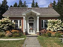
| 6 |
Bass Harbor Memorial Library |
|
August 5, 2009
(#09000593) |
89 Bernard Rd.
44°14′28″N 68°21′20″W / 44.241244°N 68.355606°W / 44.241244; -68.355606 (Bass Harbor Memorial Library) |
Tremont |
|
| 7 |
Bear Island Light Station |
|
March 14, 1988
(#88000043) |
Bear Island, Acadia National Park
44°17′00″N 68°16′14″W / 44.283333°N 68.270556°W / 44.283333; -68.270556 (Bear Island Light Station) |
Northeast Harbor |
Light station established in 1839 to serve Northeast Harbor, with a surviving 1889 light tower and keeper's house and 1905 outbuildings.[7] |
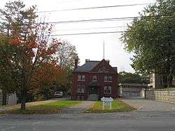
| 8 |
Beth Eden Chapel |
|
August 2, 2001
(#01000818) |
Naskeag Point Rd. at Stubbs Dr.
44°14′05″N 68°31′56″W / 44.234803°N 68.532244°W / 44.234803; -68.532244 (Beth Eden Chapel) |
Brooklin |
|
| 9 |
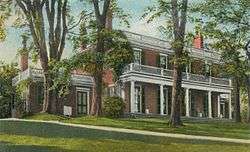
Black Mansion |
|
December 23, 1969
(#69000026) |
W. Main St. (State Route 172)
44°32′12″N 68°26′21″W / 44.536667°N 68.439167°W / 44.536667; -68.439167 (Black Mansion) |
Ellsworth |
|
| 10 |
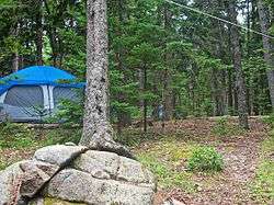
Blackwoods Campground |
|
June 29, 2007
(#07000612) |
State Route 233, Eagle Lake Rd.
44°18′38″N 68°12′15″W / 44.310676°N 68.204094°W / 44.310676; -68.204094 (Blackwoods Campground) |
Bar Harbor |
|
| 11 |
Blue Hill Historic District |
|
December 8, 1980
(#80000220) |
State Routes 15, 172, 176, and 177
44°24′49″N 68°35′22″W / 44.413611°N 68.589444°W / 44.413611; -68.589444 (Blue Hill Historic District) |
Blue Hill |
|
| 12 |
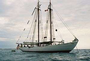
BOWDOIN (schooner) |
|
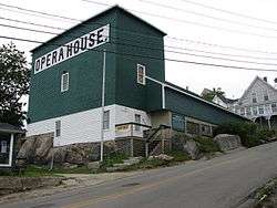
February 12, 1980
(#80000411) |
Maine Maritime Academy
44°23′12″N 68°47′48″W / 44.386667°N 68.796667°W / 44.386667; -68.796667 (BOWDOIN (schooner)) |
Castine |
|
| 13 |
Brick School House |
|
April 23, 1980
(#80000221) |
School House Hill
44°50′51″N 68°19′43″W / 44.8475°N 68.328611°W / 44.8475; -68.328611 (Brick School House) |
Aurora |
|
| 14 |
Brooklin IOOF Hall |
|
January 26, 1990
(#89002341) |
State Route 175
44°15′55″N 68°34′51″W / 44.265278°N 68.580833°W / 44.265278; -68.580833 (Brooklin IOOF Hall) |
Brooklin |
|
| 15 |
Brown-Pilsbury Double House |
|
September 11, 1997
(#97001129) |
188-190 Franklin St.
44°34′26″N 68°47′49″W / 44.573889°N 68.796944°W / 44.573889; -68.796944 (Brown-Pilsbury Double House) |
Bucksport |
|
| 16 |
Buck Memorial Library |
|
December 30, 1987
(#87002193) |
Maine St.
44°34′17″N 68°47′32″W / 44.571389°N 68.792222°W / 44.571389; -68.792222 (Buck Memorial Library) |
Bucksport |
|
| 17 |
Bucksport Railroad Station |
|
April 28, 1975
(#75000091) |
Main St.
44°34′19″N 68°47′50″W / 44.571944°N 68.797222°W / 44.571944; -68.797222 (Bucksport Railroad Station) |
Bucksport |
|
| 18 |
Burnt Coat Harbor Light Station |
|
January 21, 1988
(#87002272) |
Hockamock Head
44°08′03″N 68°26′52″W / 44.134167°N 68.447778°W / 44.134167; -68.447778 (Burnt Coat Harbor Light Station) |
Swans Island |
|
| 19 |
Carriage Paths, Bridges and Gatehouses |
|
November 14, 1979
(#79000131) |
Acadia National Park and vicinity
44°20′32″N 68°15′30″W / 44.342222°N 68.258333°W / 44.342222; -68.258333 (Carriage Paths, Bridges and Gatehouses) |
Acadia National Park |
Network of scenic carriage roads with 13 bridges and two gatehouse complexes, established 1919–1931 by John D. Rockefeller, Jr. for automobile-free recreation by high-society vacationers. Now open to non-motorized use by the public.[8] |
| 20 |
Castine Historic District |
|
February 23, 1973
(#73000240) |
Roughly bounded by the Bagaduce and Penobscot rivers, and by Wadsworth Cove Rd.
44°23′27″N 68°48′19″W / 44.390833°N 68.805278°W / 44.390833; -68.805278 (Castine Historic District) |
Castine |
|
| 21 |
Cate House |
|
January 26, 1970
(#70000040) |
Corner of Court and Pleasant Sts.
44°23′18″N 68°48′01″W / 44.388333°N 68.800278°W / 44.388333; -68.800278 (Cate House) |
Castine |
|
| 22 |
Church of Our Father |
|
July 1, 1999
(#99000770) |
State Route 3, 0.5 miles (0.80 km) north of Crooked Rd.
44°25′15″N 68°15′02″W / 44.420833°N 68.250556°W / 44.420833; -68.250556 (Church of Our Father) |
Hulls Cove |
|
| 23 |
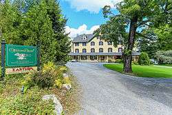
Claremont Hotel |
|
March 29, 1978
(#78000162) |
Claremont Rd.
44°16′44″N 68°18′46″W / 44.278889°N 68.312778°W / 44.278889; -68.312778 (Claremont Hotel) |
Southwest Harbor |
|
| 24 |
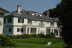
Cleftstone |
|
September 24, 1999
(#99001192) |
92 Eden St.
44°23′36″N 68°13′19″W / 44.393333°N 68.221944°W / 44.393333; -68.221944 (Cleftstone) |
Bar Harbor |
|
| 25 |
Cover Farm |
|
December 14, 1995
(#95001464) |
Off the western side of State Route 3, 0.3 miles (0.48 km) northwest of its junction with Crooked Rd.
44°25′05″N 68°15′18″W / 44.418056°N 68.255°W / 44.418056; -68.255 (Cover Farm) |
Hulls Cove |
|
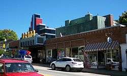
| 26 |
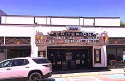
Criterion Theatre |
|
April 23, 1980
(#80000222) |
35 Cottage St.
44°23′24″N 68°12′23″W / 44.39°N 68.206389°W / 44.39; -68.206389 (Criterion Theatre) |
Bar Harbor |
|
| 27 |
Dix Family Stable |
|
April 5, 1990
(#90000578) |
State Route 102A
44°14′33″N 68°20′41″W / 44.2425°N 68.344722°W / 44.2425; -68.344722 (Dix Family Stable) |
Bass Harbor |
|
| 28 |
Duck Cove School |
|
July 15, 1993
(#93000640) |
Eastern side of State Route 46 at its junction with Stubbs Brook Rd.
44°35′36″N 68°44′33″W / 44.593333°N 68.7425°W / 44.593333; -68.7425 (Duck Cove School) |
Bucksport |
|
| 29 |
East Blue Hill Library |
|
April 5, 1990
(#90000577) |
Miliken Rd.
44°25′01″N 68°31′21″W / 44.416944°N 68.5225°W / 44.416944; -68.5225 (East Blue Hill Library) |
East Blue Hill |
|
| 30 |
East Blue Hill Post Office |
|
February 12, 2003
(#03000016) |
13 Curtis Cove Rd.
44°25′01″N 68°31′20″W / 44.416944°N 68.522222°W / 44.416944; -68.522222 (East Blue Hill Post Office) |
East Blue Hill |
|
| 31 |
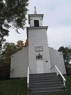
Eastbrook Baptist Church and Eastbrook Town House |
|
December 18, 1978
(#78000163) |
State Route 200
44°40′42″N 68°16′00″W / 44.678333°N 68.266667°W / 44.678333; -68.266667 (Eastbrook Baptist Church and Eastbrook Town House) |
Eastbrook |
|
| 32 |
Edgecliff |
|
October 16, 2013
(#13000835) |
34 Norwood Ln.
44°17′04″N 68°19′02″W / 44.284361°N 68.317178°W / 44.284361; -68.317178 (Edgecliff) |
Southwest Harbor |
|
| 33 |
Eegonos |
|
January 15, 1980
(#80000223) |
145 Eden St.
44°24′15″N 68°13′58″W / 44.404167°N 68.232778°W / 44.404167; -68.232778 (Eegonos) |
Bar Harbor |
|
| 34 |
Egg Rock Light Station |
|
January 21, 1988
(#87002270) |
Egg Rock in Frenchman Bay
44°21′13″N 68°08′20″W / 44.353611°N 68.138889°W / 44.353611; -68.138889 (Egg Rock Light Station) |
Winter Harbor |
|
| 35 |
Ellsworth City Hall |
|
January 10, 1986
(#86000073) |
City Hall Plaza
44°32′33″N 68°25′27″W / 44.5425°N 68.4243°W / 44.5425; -68.4243 (Ellsworth City Hall) |
Ellsworth |
|
| 36 |
Ellsworth Congregational Church |
|
April 23, 1973
(#73000108) |
State St.
44°32′37″N 68°25′52″W / 44.543611°N 68.431111°W / 44.543611; -68.431111 (Ellsworth Congregational Church) |
Ellsworth |
|
| 37 |
Ellsworth Power House and Dam |
|
June 20, 1985
(#85001262) |
Union River
44°32′39″N 68°25′50″W / 44.544167°N 68.430556°W / 44.544167; -68.430556 (Ellsworth Power House and Dam) |
Ellsworth |
|
| 38 |
Elm Street Congregational Church and Parish House |
|
June 14, 1990
(#90000925) |
Junction of Elm and Franklin Sts.
44°34′24″N 68°47′41″W / 44.573333°N 68.794722°W / 44.573333; -68.794722 (Elm Street Congregational Church and Parish House) |
Bucksport |
|
| 39 |
James Emery House |
|
August 13, 1974
(#74000151) |
Main St.
44°34′23″N 68°47′48″W / 44.5731°N 68.7968°W / 44.5731; -68.7968 (James Emery House) |
Bucksport |
|
| 40 |
The Farm House |
|
November 7, 2007
(#07001152) |
15 Highbrook Rd.
44°23′18″N 68°13′09″W / 44.388333°N 68.219167°W / 44.388333; -68.219167 (The Farm House) |
Bar Harbor |
|
| 41 |
Fernald Point Prehistoric Site |
|
July 21, 1978
(#78000164) |
Fernald Point[9]
44°17′53″N 68°18′35″W / 44.2980°N 68.3098°W / 44.2980; -68.3098 (Fernald Point Prehistoric Site) |
Southwest Harbor |
|
| 42 |
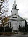
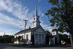
First Baptist Church |
|
August 2, 2001
(#01000817) |
362 Lamoine Beach Rd.
44°28′03″N 68°19′17″W / 44.4675°N 68.321389°W / 44.4675; -68.321389 (First Baptist Church) |
East Lamoine |
|
| 43 |
First Baptist Church |
|
April 24, 1973
(#73000109) |
Off State Route 172
44°18′16″N 68°36′52″W / 44.304444°N 68.614444°W / 44.304444; -68.614444 (First Baptist Church) |
Sedgwick |
|
| 44 |
Flye Point 2 |
|
April 15, 1985
(#85000842) |
Address Restricted
|
Brooklin |
|
| 45 |
Fort George |
|
December 30, 1969
(#69000007) |
Wadsworth St. off Battle Ave.
44°23′27″N 68°48′22″W / 44.390833°N 68.806111°W / 44.390833; -68.806111 (Fort George) |
Castine |
A British fort during the American Revolution and the site of the Penobscot Expedition |
| 46 |
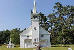
Free Baptist Church of Great Pond |
|
October 31, 2012
(#12000892) |
1231 Great Pond Rd.
44°56′14″N 68°16′50″W / 44.937201°N 68.280443°W / 44.937201; -68.280443 (Free Baptist Church of Great Pond) |
Great Pond |
|
| 47 |
Garland Farm |
|
October 19, 2005
(#05001174) |
1029 State Route 3
44°25′40″N 68°19′30″W / 44.427778°N 68.325°W / 44.427778; -68.325 (Garland Farm) |
Bar Harbor |
|
| 48 |
Gavin Watson Site |
|
March 18, 1987
(#87000415) |
Address Restricted
|
Sullivan |
|
| 49 |
Daniel Coit Gilman Summer Home |
|
October 15, 1966
(#66000093) |
Off Huntington Rd.
44°17′30″N 68°16′56″W / 44.291667°N 68.282222°W / 44.291667; -68.282222 (Daniel Coit Gilman Summer Home) |
Northeast Harbor |
|
| 50 |
Goddard Site |
|
May 7, 1979
(#79000132) |
Address Restricted
|
Brooklin |
|
| 51 |
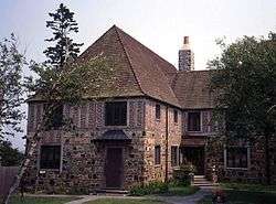
The Grand |
|
August 1, 2012
(#12000452) |
163, 165, 167, 169, & 173 Main St.
44°32′30″N 68°25′22″W / 44.541708°N 68.422832°W / 44.541708; -68.422832 (The Grand) |
Ellsworth |
|
| 52 |
Granite Store |
|
December 16, 1974
(#74000152) |
U.S. Route 1
44°31′12″N 68°11′57″W / 44.52°N 68.199167°W / 44.52; -68.199167 (Granite Store) |
Sullivan |
|
| 53 |
Great Duck Island Light Station |
|
March 14, 1988
(#88000159) |
Southern tip of Great Duck Island
44°08′32″N 68°14′46″W / 44.142222°N 68.246111°W / 44.142222; -68.246111 (Great Duck Island Light Station) |
Frenchboro |
|
| 54 |
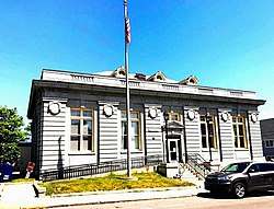
Edward J. Hammond Hall |
|
January 14, 2004
(#03001405) |
Main St.
44°23′28″N 68°05′23″W / 44.391111°N 68.089722°W / 44.391111; -68.089722 (Edward J. Hammond Hall) |
Winter Harbor |
|
| 55 |
Hancock County Jail |
|
January 24, 2008
(#07001445) |
40 State St.
44°32′32″N 68°25′34″W / 44.542222°N 68.426111°W / 44.542222; -68.426111 (Hancock County Jail) |
Ellsworth |
|
| 56 |
Hancock Point School |
|
April 23, 2013
(#13000187) |
644 Point Rd.
44°29′15″N 68°14′55″W / 44.4874°N 68.2487°W / 44.4874; -68.2487 (Hancock Point School) |
Hancock |
|
| 57 |
Harbor Lane-Eden Street Historic District |
|
July 22, 2009
(#09000550) |
Portions of Harbor Ln. and Eden St.
44°23′22″N 68°13′02″W / 44.389419°N 68.2173°W / 44.389419; -68.2173 (Harbor Lane-Eden Street Historic District) |
Bar Harbor |
|
| 58 |
Squire Ignatius Haskell House |
|
February 3, 1978
(#78000165) |
20 Main Street
44°13′26″N 68°40′49″W / 44.223889°N 68.680278°W / 44.223889; -68.680278 (Squire Ignatius Haskell House) |
Deer Isle |
Now Pilgrim's Inn. |
| 59 |
Haystack Mountain School of Crafts |
|
December 23, 2005
(#05001469) |
89 Haystack School Dr.
44°11′19″N 68°35′05″W / 44.188611°N 68.584722°W / 44.188611; -68.584722 (Haystack Mountain School of Crafts) |
Deer Isle |
|
| 60 |
Phineas Heywood House |
|
January 7, 1988
(#87002194) |
343 Maine St.
44°34′19″N 68°47′42″W / 44.571944°N 68.795°W / 44.571944; -68.795 (Phineas Heywood House) |
Bucksport |
|
| 61 |
Higgins Barn |
|
January 28, 2004
(#03001502) |
256 Oak Hill Rd.
44°22′48″N 68°21′48″W / 44.38°N 68.363333°W / 44.38; -68.363333 (Higgins Barn) |
Indian Point |
|
| 62 |
Highseas |
|
November 30, 1978
(#78000326) |
South of Bar Harbor on Schooner Head Rd.
44°21′21″N 68°11′01″W / 44.355833°N 68.183611°W / 44.355833; -68.183611 (Highseas) |
Bar Harbor |
Highseas was built in 1912 as a private summer estate. It is now a residence hall owned by The Jackson Laboratory. |
| 63 |
Ward Hinckley House |
|
December 16, 1974
(#74000153) |
Address Restricted
|
Blue Hill |
|
| 64 |
Hulls Cove High School |
|
March 25, 1999
(#99000374) |
State Route 3, 0.4 miles (0.64 km) north of its junction with Crooked Rd.
44°25′11″N 68°15′03″W / 44.419722°N 68.250833°W / 44.419722; -68.250833 (Hulls Cove High School) |
Hulls Cove |
|
| 65 |
Islesford Historical Museum and Blue Ducks Ships Store |
|
September 30, 1980
(#80000224) |
Little Cranberry Island
44°15′42″N 68°14′25″W / 44.261667°N 68.240278°W / 44.261667; -68.240278 (Islesford Historical Museum and Blue Ducks Ships Store) |
Islesford |
|
| 66 |
Col. Charles and Mary Ann Jarvis Homestead |
|
January 15, 2004
(#03001403) |
10 Surry Rd.
44°32′18″N 68°25′46″W / 44.538333°N 68.429444°W / 44.538333; -68.429444 (Col. Charles and Mary Ann Jarvis Homestead) |
Ellsworth |
|
| 67 |
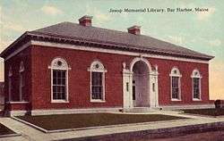
Jesup Memorial Library |
|
April 1, 1991
(#91000323) |
34 Mt. Desert St.
44°23′12″N 68°12′25″W / 44.386667°N 68.206944°W / 44.386667; -68.206944 (Jesup Memorial Library) |
Bar Harbor |
|
| 68 |
Jonathan Fisher Memorial |
|
December 30, 1969
(#69000031) |
Southwest of Blue Hill on State Route 15 (Outer Main St.)
44°24′18″N 68°35′51″W / 44.405°N 68.5975°W / 44.405; -68.5975 (Jonathan Fisher Memorial) |
Blue Hill |
|
| 69 |
Col. Meltiah Jordan House |
|
August 13, 1974
(#74000154) |
20 State St.
44°32′32″N 68°25′32″W / 44.542222°N 68.425556°W / 44.542222; -68.425556 (Col. Meltiah Jordan House) |
Ellsworth |
Houses the Ellsworth Public Library; misspelled "Jordon" in the National Register. |
| 70 |
John Innes Kane Cottage |
|
March 26, 1992
(#92000275) |
Off the southeastern end of Hancock St.
44°23′09″N 68°11′53″W / 44.385833°N 68.198056°W / 44.385833; -68.198056 (John Innes Kane Cottage) |
Bar Harbor |
|
| 71 |
Lucerne Inn |
|
June 16, 1982
(#82000742) |
Bar Harbor Rd., U.S. Route 1A
44°42′10″N 68°35′59″W / 44.702778°N 68.599722°W / 44.702778; -68.599722 (Lucerne Inn) |
Dedham |
|
| 72 |
Moore-Mayo House |
|
September 22, 2004
(#04001050) |
Lighthouse Rd.
44°13′44″N 68°20′22″W / 44.2288°N 68.3394°W / 44.2288; -68.3394 (Moore-Mayo House) |
Bass Harbor |
|
| 73 |
Mount Desert Light Station |
|
March 14, 1988
(#88000155) |
Mount Desert Rock
43°58′07″N 68°07′43″W / 43.968581°N 68.128603°W / 43.968581; -68.128603 (Mount Desert Light Station) |
Frenchboro |
Mount Desert Light Station now operates as a research field station, and is owned by College of the Atlantic. |
| 74 |
Nannau |
|
November 8, 1984
(#84000322) |
Lower Main St.
44°22′31″N 68°11′45″W / 44.375278°N 68.195833°W / 44.375278; -68.195833 (Nannau) |
Bar Harbor |
|
| 75 |
Nazi Spy Landing Site |
|
February 13, 2003
(#03000015) |
Western shore of Crabtree Neck at Sunset Ledge Cove
44°28′25″N 68°14′41″W / 44.473611°N 68.244722°W / 44.473611; -68.244722 (Nazi Spy Landing Site) |
Hancock Point |
Landing site of Erich Gimpel and William Colepaugh in late November 1944 |
| 76 |
Off-the-Neck Historic District |
|
September 25, 1986
(#86002442) |
State Route 166
44°24′16″N 68°47′38″W / 44.404444°N 68.793889°W / 44.404444; -68.793889 (Off-the-Neck Historic District) |
Castine |
|
| 77 |
Old Hancock County Buildings |
|
November 23, 1977
(#77000161) |
Court St.
44°32′20″N 68°25′46″W / 44.5389°N 68.4295°W / 44.5389; -68.4295 (Old Hancock County Buildings) |
Ellsworth |
|
| 78 |
Frederick Law Olmsted Summer Home |
|
November 7, 1976
(#76000089) |
Southwest of Sunset on Deer Isle
44°10′43″N 68°43′05″W / 44.178611°N 68.718056°W / 44.178611; -68.718056 (Frederick Law Olmsted Summer Home) |
Sunset |
|
| 79 |
Parker House |
|
September 22, 2004
(#04001047) |
185 South St.
44°23′49″N 68°35′19″W / 44.396944°N 68.588611°W / 44.396944; -68.588611 (Parker House) |
Blue Hill |
|
| 80 |
Pentagoet Archeological District |
|
April 12, 1993
(#93000603) |
Perkins Street at Pentagoet Lane
44°23′05″N 68°48′12″W / 44.3847°N 68.8034°W / 44.3847; -68.8034 (Pentagoet Archeological District) |
Castine |
|
| 81 |
John Perkins House |
|
December 30, 1969
(#69000019) |
Perkins St.
44°23′02″N 68°48′22″W / 44.383889°N 68.806111°W / 44.383889; -68.806111 (John Perkins House) |
Castine |
|
| 82 |
John Peters House |
|
October 6, 1983
(#83003642) |
Off State Route 176
44°24′41″N 68°34′28″W / 44.411389°N 68.574444°W / 44.411389; -68.574444 (John Peters House) |
Blue Hill |
|
| 83 |
Pond Island Archeological District |
|
January 28, 1979
(#79000133) |
Pond Island[10]
44°17′36″N 68°48′29″W / 44.2933°N 68.808°W / 44.2933; -68.808 (Pond Island Archeological District) |
Deer Isle |
Island now owned as conservation land by Maine Coast Heritage Trust. |
| 84 |
Peter Powers House |
|
April 23, 1980
(#80000225) |
State Route 15 and Sunshine Rd.
44°13′00″N 68°40′27″W / 44.216667°N 68.674167°W / 44.216667; -68.674167 (Peter Powers House) |
Deer Isle |
|
| 85 |
Prospect Harbor Light Station |
|
March 14, 1988
(#88000151) |
Prospect Harbor Pt.
44°24′11″N 68°00′48″W / 44.403056°N 68.013333°W / 44.403056; -68.013333 (Prospect Harbor Light Station) |
Prospect Harbor |
|
| 86 |
Jed Prouty Tavern and Inn |
|
January 10, 1986
(#86000074) |
52-54 Main St.
44°34′17″N 68°47′30″W / 44.571389°N 68.791667°W / 44.571389; -68.791667 (Jed Prouty Tavern and Inn) |
Bucksport |
|
| 87 |
Pumpkin Island Light Station |
|
February 1, 1988
(#87002537) |
Pumpkin Island, Eggemoggin Reach
44°18′33″N 68°44′36″W / 44.309167°N 68.743333°W / 44.309167; -68.743333 (Pumpkin Island Light Station) |
Sargentville |
|
| 88 |
Raventhorp |
|
January 7, 1988
(#87002195) |
Greening Island
44°16′58″N 68°18′12″W / 44.282778°N 68.303333°W / 44.282778; -68.303333 (Raventhorp) |
Southwest Harbor |
|
| 89 |
Redwood |
|
April 3, 1978
(#78000166) |
Barberry Lane
44°22′58″N 68°11′48″W / 44.382778°N 68.196667°W / 44.382778; -68.196667 (Redwood) |
Bar Harbor |
|
| 90 |
Reverie Cove |
|
February 19, 1982
(#82000743) |
Harbor Lane
44°23′25″N 68°12′56″W / 44.390278°N 68.215556°W / 44.390278; -68.215556 (Reverie Cove) |
Bar Harbor |
|
| 91 |
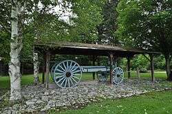
Robertson Quarry Galamander |
|
October 2, 1992
(#92001292) |
Eastern side of State Route 182, northeast of its junction with Grist Mill Rd.
44°34′45″N 68°15′51″W / 44.579167°N 68.264167°W / 44.579167; -68.264167 (Robertson Quarry Galamander) |
West Franklin |
A galamander is a specialized wagon for hauling stone; this is one of only two known to survive in Maine. |
| 92 |
Rural Hall |
|
September 22, 2004
(#04001049) |
Surry Rd., 1 mile (1.6 km) east of Contention Cove
44°29′42″N 68°26′46″W / 44.495°N 68.446111°W / 44.495; -68.446111 (Rural Hall) |
Surry |
|
| 93 |
St. Edward's Convent, (Former) |
|
October 8, 1998
(#98001237) |
33 Ledgelawn Ave.
44°23′07″N 68°12′30″W / 44.385278°N 68.208333°W / 44.385278; -68.208333 (St. Edward's Convent, (Former)) |
Bar Harbor |
|
| 94 |
Saint Jude's Episcopal Church |
|
July 24, 1986
(#86001905) |
State Route 3
44°17′38″N 68°14′48″W / 44.293889°N 68.246667°W / 44.293889; -68.246667 (Saint Jude's Episcopal Church) |
Seal Harbor |
|
| 95 |
St. Mary's-By-The-Sea |
|
July 5, 2000
(#00000761) |
20 S. Shore Rd.
44°17′19″N 68°17′09″W / 44.288611°N 68.285833°W / 44.288611; -68.285833 (St. Mary's-By-The-Sea) |
Northeast Harbor |
|
| 96 |
Saint Saviour's Episcopal Church and Rectory |
|
June 20, 1995
(#95000729) |
41 Mt. Desert St.
44°23′14″N 68°12′23″W / 44.387222°N 68.206389°W / 44.387222; -68.206389 (Saint Saviour's Episcopal Church and Rectory) |
Bar Harbor |
|
| 97 |
Schoodic Peninsula Historic District |
|
June 29, 2007
(#07000614) |
1.5 miles (2.4 km) south of State Route 186
44°22′30″N 68°03′50″W / 44.374975°N 68.063829°W / 44.374975; -68.063829 (Schoodic Peninsula Historic District) |
Winter Harbor |
|
| 98 |
Sea Change |
|
August 7, 2009
(#08000991) |
27 Corning Way
44°17′13″N 68°16′51″W / 44.2869°N 68.2808°W / 44.2869; -68.2808 (Sea Change) |
Northeast Harbor |
|
| 99 |
Seal Harbor Congregational Church |
|
February 14, 1985
(#85000272) |
State Route 3
44°17′37″N 68°14′54″W / 44.293611°N 68.248333°W / 44.293611; -68.248333 (Seal Harbor Congregational Church) |
Seal Harbor |
|
| 100 |
Seawall Campground |
|
June 29, 2007
(#07000613) |
State Route 102A, Seawall Rd.
44°14′26″N 68°18′16″W / 44.240495°N 68.304327°W / 44.240495; -68.304327 (Seawall Campground) |
Southwest Harbor |
|
| 101 |
Sedgwick Historic District |
|
January 20, 1995
(#94001550) |
Junction of State Route 172 and Old County Rd.
44°18′58″N 68°36′35″W / 44.316111°N 68.609722°W / 44.316111; -68.609722 (Sedgwick Historic District) |
Sedgwick |
|
| 102 |
Salome Sellers House |
|
January 27, 1983
(#83004189) |
South of Deer Isle on State Route 15A
44°11′56″N 68°42′20″W / 44.1990°N 68.7056°W / 44.1990; -68.7056 (Salome Sellers House) |
Deer Isle |
Museum of the Deer Isle-Stonington Historical Society |
| 103 |
Shore Acres |
|
April 14, 2000
(#00000373) |
791 Lamoine Beach Rd.
44°27′12″N 68°17′07″W / 44.453333°N 68.285278°W / 44.453333; -68.285278 (Shore Acres) |
Lamoine Beach |
|
| 104 |
Eric E. Soderholtz Cottage |
|
June 18, 1992
(#92000793) |
Off the eastern side of State Route 186, 0.5 miles (0.80 km) south of U.S Route 1
44°27′51″N 68°05′39″W / 44.4643°N 68.0941°W / 44.4643; -68.0941 (Eric E. Soderholtz Cottage) |
West Gouldsboro |
|
| 105 |
Somesville Historic District |
|
January 8, 1975
(#75000092) |
Somes Harbor and its environs
44°21′44″N 68°19′53″W / 44.3622°N 68.3314°W / 44.3622; -68.3314 (Somesville Historic District) |
Mount Desert |
|
| 106 |
Sorrento Library |
|
June 20, 1995
(#95000724) |
Southern side of Waukeag Ave. 0.5 miles (0.80 km) west of its junction with State Route 185
44°28′22″N 68°11′18″W / 44.472778°N 68.188333°W / 44.472778; -68.188333 (Sorrento Library) |
Sorrento |
|
| 107 |
Sproul's Cafe |
|
February 4, 1982
(#82000744) |
128 Main St.
44°23′20″N 68°12′14″W / 44.388889°N 68.203889°W / 44.388889; -68.203889 (Sproul's Cafe) |
Bar Harbor |
|
| 108 |
Stanwood Homestead |
|
June 19, 1973
(#73000110) |
295 High St. (State Route 3)
44°31′42″N 68°24′18″W / 44.528333°N 68.405°W / 44.528333; -68.405 (Stanwood Homestead) |
Ellsworth |
Now Birdsacre Sanctuary |
| 109 |
Stone Barn Farm |
|
November 29, 2001
(#01001271) |
Junction of Crooked Rd. and Norway Dr.
44°25′03″N 68°18′06″W / 44.4175°N 68.301667°W / 44.4175; -68.301667 (Stone Barn Farm) |
Salsbury Cove |
|
| 110 |
Stonington Opera House |
|
October 16, 1991
(#91001509) |
Northwestern corner of Main St. and School St.
44°09′21″N 68°40′01″W / 44.155833°N 68.666944°W / 44.155833; -68.666944 (Stonington Opera House) |
Stonington |
|
| 111 |
Surry Town Hall |
|
October 16, 2008
(#08000993) |
1217 Surry Rd.
44°29′50″N 68°29′29″W / 44.49719°N 68.49135°W / 44.49719; -68.49135 (Surry Town Hall) |
Surry |
|
| 112 |
Topside |
|
August 13, 1975
(#75000229) |
Northern bank of Walker Pond off State Route 176
44°20′38″N 68°41′39″W / 44.343889°N 68.694167°W / 44.343889; -68.694167 (Topside) |
Brooksville |
|
| 113 |
The Turrets |
|
December 24, 1974
(#74000155) |
Eden St.
44°23′41″N 68°13′13″W / 44.394722°N 68.220278°W / 44.394722; -68.220278 (The Turrets) |
Bar Harbor |
|
| 114 |
Union Church of Northeast Harbor |
|
June 26, 1998
(#98000722) |
21 Summit Rd.
44°17′40″N 68°17′29″W / 44.294444°N 68.291389°W / 44.294444; -68.291389 (Union Church of Northeast Harbor) |
Northeast Harbor |
|
| 115 |
U.S. Naval Radio Station- Apartment Building and Power House |
|
July 3, 2013
(#13000533) |
Schoodic Peninsula unit, Acadia National Park
44°20′10″N 68°03′33″W / 44.33610°N 68.05914°W / 44.33610; -68.05914 (U.S. Naval Radio Station- Apartment Building and Power House) |
Winter Harbor vicinity |
|
| 116 |
US Post Office-Bar Harbor Main |
|
May 2, 1986
(#86000880) |
55 Cottage St.
44°23′23″N 68°12′26″W / 44.3896°N 68.2072°W / 44.3896; -68.2072 (US Post Office-Bar Harbor Main) |
Bar Harbor |
|
| 117 |
Von Mach Site (ME 151/02) |
|
January 17, 1989
(#88000901) |
Address Restricted
|
Brooksville |
|
| 118 |
West Brooksville Congregational Church |
|
June 20, 1995
(#95000727) |
Eastern side of State Route 176, 1 mile (1.6 km) northwest of its junction with Varnum Rd.
44°23′42″N 68°45′28″W / 44.395°N 68.757778°W / 44.395; -68.757778 (West Brooksville Congregational Church) |
West Brooksville |
|
| 119 |
West Gouldsboro Union Church |
|
June 14, 1990
(#90000926) |
State Route 186 between Jones Cove and Jones Pond
44°27′55″N 68°05′41″W / 44.465278°N 68.094722°W / 44.465278; -68.094722 (West Gouldsboro Union Church) |
West Gouldsboro |
|
| 120 |
West Gouldsboro Village Library |
|
October 23, 1991
(#91001512) |
Eastern side of State Route 186 between Jones Cove and Jones Pond
44°27′56″N 68°05′41″W / 44.465556°N 68.094722°W / 44.465556; -68.094722 (West Gouldsboro Village Library) |
West Gouldsboro |
|
| 121 |
West Street Historic District |
|
May 6, 1980
(#80000226) |
West St. between Billings Ave. and Eden St.
44°23′28″N 68°12′41″W / 44.391111°N 68.211389°W / 44.391111; -68.211389 (West Street Historic District) |
Bar Harbor |
|
| 122 |
E. B. White House |
|
September 22, 1986
(#86002467) |
State Route 175
44°17′39″N 68°33′18″W / 44.2942°N 68.555°W / 44.2942; -68.555 (E. B. White House) |
Brooklin |
|
| 123 |
Samuel Kidder Whiting House |
|
July 14, 1983
(#83000453) |
214 Main St
44°32′34″N 68°25′15″W / 44.5429°N 68.4207°W / 44.5429; -68.4207 (Samuel Kidder Whiting House) |
Ellsworth |
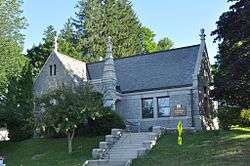
|
| 124 |
Wilson Hall |
|
April 27, 1983
(#83000452) |
Franklin St.
44°34′31″N 68°47′51″W / 44.575278°N 68.7975°W / 44.575278; -68.7975 (Wilson Hall) |
Bucksport |
|
| 125 |
Winter Harbor Light Station |
|
February 1, 1988
(#87002538) |
Mark Island, Winter Harbor
44°21′42″N 68°05′18″W / 44.361667°N 68.088333°W / 44.361667; -68.088333 (Winter Harbor Light Station) |
Winter Harbor |
|
.jpg)
.jpg)
.jpg)
_Lighthouse_(1892_version)_Maine.JPG)