Sargentville, Maine
| Sargentville, Maine | |
|---|---|
| Village | |
 Sargentville | |
| Coordinates: 44°18′05″N 68°40′21″W / 44.30139°N 68.67250°WCoordinates: 44°18′05″N 68°40′21″W / 44.30139°N 68.67250°W | |
| Country | United States |
| State | Maine |
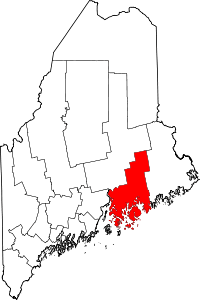
| County | Hancock |
| Town | Sedgwick |
| Elevation | 115 ft (35 m) |
| Time zone | UTC-5 (Eastern (EST)) |
| • Summer (DST) | UTC-4 (EDT) |
| ZIP code | 04673 |
| Area code(s) | 207 |
| GNIS feature ID | 574928[1] |
Sargentville is an unincorporated village in the town of Sedgwick, Hancock County, Maine, United States. The community is located along Maine State Route 175 21 miles (34 km) southwest of Ellsworth. Sargentville had a post office from February 10, 1855, until April 23, 2005; it still has its own ZIP code, 04673.[2][3]
References
- ↑ "Sargentville". Geographic Names Information System. United States Geological Survey.
- ↑ United States Postal Service. "USPS - Look Up a ZIP Code". Retrieved April 23, 2017.
- ↑ "Postmaster Finder - Post Offices by ZIP Code". United States Postal Service. Retrieved April 23, 2017.
This article is issued from
Wikipedia.
The text is licensed under Creative Commons - Attribution - Sharealike.
Additional terms may apply for the media files.