| [3] |
Name on the Register[4] |
Image |
Date listed[5] |
Location |
City or town |
Description |
|---|
| 1 |
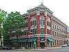
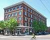
Audubon Acres Site (40 HA 84) |
|
October 7, 1982
(#82001728) |
900 N Sanctuary Rd.
34°59′58″N 85°10′49″W / 34.9993536°N 85.1803115°W / 34.9993536; -85.1803115 (Audubon Acres Site (40 HA 84)) |
Chattanooga |
|
| 2 |
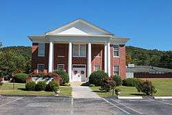
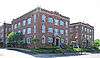
Nathan L. Bachman School |
|
April 17, 2001
(#01000381) |
2815 Anderson Pike
35°09′47″N 85°19′20″W / 35.163056°N 85.322222°W / 35.163056; -85.322222 (Nathan L. Bachman School) |
Walden |
|
| 3 |
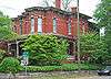
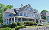
Bonny Oaks |
|
August 11, 1980
(#80003803) |
5114 Bonny Oaks Dr.
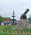
35°04′20″N 85°11′01″W / 35.072222°N 85.183611°W / 35.072222; -85.183611 (Bonny Oaks) |
Chattanooga |
|
| 4 |
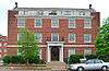
Brabson House |
|
April 11, 1973
(#73001772) |
407 E. 5th St.
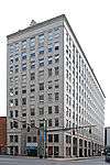
35°03′05″N 85°18′16″W / 35.051389°N 85.304444°W / 35.051389; -85.304444 (Brabson House) |
Chattanooga |
|
| 5 |
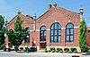
Brainerd Junior High |
|
September 15, 1980
(#80003804) |
4201 Cherryton Dr.
35°01′06″N 85°14′07″W / 35.018333°N 85.235278°W / 35.018333; -85.235278 (Brainerd Junior High) |
Chattanooga |
|
| 6 |
Brainerd Mission Cemetery |
|
December 6, 1979
(#79002435) |
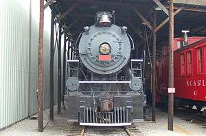
5700 Eastgate Loop
35°00′43″N 85°12′46″W / 35.011944°N 85.212778°W / 35.011944; -85.212778 (Brainerd Mission Cemetery) |
Chattanooga |
|
| 7 |
Brown House |
|
April 11, 1973
(#73001781) |
9521 Ooltewah-Georgetown Rd.
35°11′21″N 85°01′16″W / 35.189167°N 85.021111°W / 35.189167; -85.021111 (Brown House) |
Ooltewah |
|
| 8 |
Brown's Ferry Tavern |
|
March 24, 1971
(#71000822) |
Brown's Ferry Rd.
35°02′41″N 85°21′19″W / 35.044722°N 85.355278°W / 35.044722; -85.355278 (Brown's Ferry Tavern) |
Chattanooga |
|
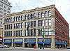
| 9 |
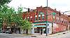
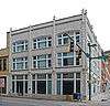
Central Block Building |
|
September 1, 1995
(#95000293) |
630-638 Market St.
35°02′55″N 85°18′35″W / 35.048611°N 85.309722°W / 35.048611; -85.309722 (Central Block Building) |
Chattanooga |
|
| 10 |
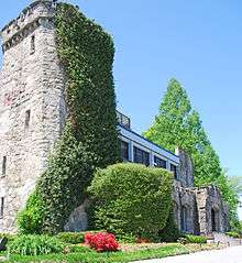
Chattanooga Bank Building |
|
September 15, 1980
(#80003805) |
8th St.
35°02′50″N 85°18′36″W / 35.047222°N 85.31°W / 35.047222; -85.31 (Chattanooga Bank Building) |
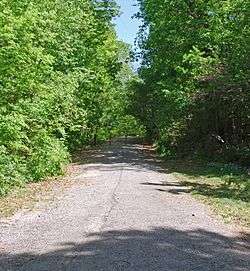
Chattanooga |
|
| 11 |
Chattanooga Car Barns |
|
July 9, 1979
(#79002436) |
301 Market St.
35°03′12″N 85°18′37″W / 35.053333°N 85.310278°W / 35.053333; -85.310278 (Chattanooga Car Barns) |
Chattanooga |
|
| 12 |
Chattanooga Electric Railway |
|
February 29, 1980
(#80003806) |
211-241 Market St.
35°03′13″N 85°18′36″W / 35.053611°N 85.31°W / 35.053611; -85.31 (Chattanooga Electric Railway) |
Chattanooga |
|
| 13 |
Chattanooga National Cemetery |
|
September 16, 1996
(#96001013) |
1200 Bailey Ave.
35°02′06″N 85°17′23″W / 35.035°N 85.289722°W / 35.035; -85.289722 (Chattanooga National Cemetery) |
Chattanooga |
|
| 14 |
Chattanooga Plow Power House |
|
October 7, 1999
(#99001243) |
1633-1635 Chestnut St.
35°02′14″N 85°18′52″W / 35.037222°N 85.314444°W / 35.037222; -85.314444 (Chattanooga Plow Power House) |
Chattanooga |
|
| 15 |
Chattanooga, Harrison, Georgetown & Charleston Railroad Tunnel |
|
August 24, 1978
(#78002595) |
Below N. Crest Rd.
35°03′51″N 85°14′20″W / 35.064167°N 85.238889°W / 35.064167; -85.238889 (Chattanooga, Harrison, Georgetown & Charleston Railroad Tunnel) |
Chattanooga |
|
| 16 |
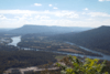
Chickamauga and Chattanooga National Military Park |
|
October 15, 1966
(#66000274) |
South of Chattanooga on U.S. Route 27
34°58′09″N 85°17′07″W / 34.969167°N 85.285278°W / 34.969167; -85.285278 (Chickamauga and Chattanooga National Military Park) |
Chattanooga |
extends into Catoosa County, Georgia, is administered by the National Park Service |
| 17 |
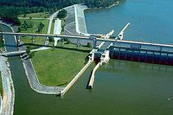
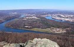
Chickamauga Hydroelectric Project |
|
August 11, 2017
(#100001466) |
5400 Lake Resort Dr.
35°06′14″N 85°13′46″W / 35.103889°N 85.229444°W / 35.103889; -85.229444 (Chickamauga Hydroelectric Project) |
Chattanooga |
|
| 18 |
Civil War Fortification |
|
January 31, 1976
(#76001779) |
Bonny Oaks Dr.
35°04′06″N 85°09′12″W / 35.068333°N 85.153333°W / 35.068333; -85.153333 (Civil War Fortification) |
Chattanooga |
|
| 19 |
Connor Toll House |
|
August 22, 1977
(#77001273) |
4212 Anderson Pike
35°10′45″N 85°20′11″W / 35.179167°N 85.336389°W / 35.179167; -85.336389 (Connor Toll House) |
Signal Mountain |
|
| 20 |
Crane Building |
|
November 10, 1983
(#83004246) |
1317 Chestnut St.
35°02′24″N 85°18′45″W / 35.04°N 85.3125°W / 35.04; -85.3125 (Crane Building) |
Chattanooga |
|
| 21 |
Cravens-Coleman House |
|
October 25, 1990
(#90001655) |
1 Cravens Terrace
35°00′49″N 85°20′26″W / 35.013611°N 85.340556°W / 35.013611; -85.340556 (Cravens-Coleman House) |
Chattanooga |
|
| 22 |
Judge Will Cummings House |
|
July 3, 1980
(#80003807) |
West of Chattanooga at 4025 Cummings Rd.
35°01′03″N 85°23′33″W / 35.0175°N 85.3925°W / 35.0175; -85.3925 (Judge Will Cummings House) |
Chattanooga |
|
| 23 |
Hiram Douglas House |
|
April 24, 1973
(#73001782) |
About 5 miles north of Ooltewah on Snow Hill Rd.
35°08′08″N 85°04′07″W / 35.135556°N 85.068611°W / 35.135556; -85.068611 (Hiram Douglas House) |
Ooltewah |
|
| 24 |
East Tennessee Iron Manufacturing Company Blast Furnace |
|
May 8, 1980
(#80003808) |
Address Restricted
|
Chattanooga |
|
| 25 |
Engel Stadium |
|
November 19, 2009
(#09000954) |
O'Neal St. and E. 3rd St.
35°02′43″N 85°17′12″W / 35.045258°N 85.286739°W / 35.045258; -85.286739 (Engel Stadium) |
Chattanooga |
|
| 26 |
Faxon-Thomas Mansion |
|
November 25, 1980
(#80003809) |
10 Bluff View Ave.
35°03′21″N 85°18′21″W / 35.055833°N 85.305833°W / 35.055833; -85.305833 (Faxon-Thomas Mansion) |
Chattanooga |
|
| 27 |
Ferger Place Historic District |
|
May 1, 1980
(#80003810) |
Evening Side Dr. and Morning Side Dr.
35°01′30″N 85°17′04″W / 35.025°N 85.284444°W / 35.025; -85.284444 (Ferger Place Historic District) |
Chattanooga |
|
| 28 |
First Baptist Church Education Building |
|
February 29, 1980
(#80003811) |
317 Oak St.
35°02′56″N 85°18′21″W / 35.048889°N 85.305833°W / 35.048889; -85.305833 (First Baptist Church Education Building) |
Chattanooga |
|
| 29 |
First Congregational Church |
|
July 22, 2010
(#10000491) |
901 Lindsay St.
35°02′42″N 85°18′26″W / 35.045°N 85.307222°W / 35.045; -85.307222 (First Congregational Church) |
Chattanooga |
|
| 30 |
First Presbyterian Church |
|
November 18, 2009
(#09000955) |
554 McCallie Ave.
35°02′47″N 85°18′10″W / 35.046358°N 85.302744°W / 35.046358; -85.302744 (First Presbyterian Church) |
Chattanooga |
|
| 31 |
Fort Wood Historic District |
|
April 18, 1979
(#79002437) |
Roughly bounded by Palmetto, McCallie, Central, and 5th Sts.
35°02′42″N 85°17′34″W / 35.045°N 85.292778°W / 35.045; -85.292778 (Fort Wood Historic District) |
Chattanooga |
|
| 32 |
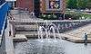
Fountain Square |
|
March 28, 1979
(#79002438) |
600-622 Georgia Ave. and 317 Oak St.
35°02′58″N 85°18′22″W / 35.049444°N 85.306111°W / 35.049444; -85.306111 (Fountain Square) |
Chattanooga |
|
| 33 |
Gaskill House |
|
December 6, 1979
(#79002439) |
427 E. 5th St.
35°03′03″N 85°18′14″W / 35.050833°N 85.303889°W / 35.050833; -85.303889 (Gaskill House) |
Chattanooga |
|
| 34 |
Glenwood Historic District |
|
July 25, 1989
(#89000861) |
Roughly bounded by Parkwood Dr., Glenwood Dr., Oak St., and Derby St.
35°02′16″N 85°15′49″W / 35.037778°N 85.263611°W / 35.037778; -85.263611 (Glenwood Historic District) |
Chattanooga |
|
| 35 |
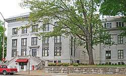
Hamilton County Courthouse |
|
November 21, 1978
(#78002596) |
W. 6th St. and Georgia Ave.
35°02′58″N 85°18′25″W / 35.049444°N 85.306944°W / 35.049444; -85.306944 (Hamilton County Courthouse) |
Chattanooga |
|
| 36 |
Hampton Place Archeological Site (40HA146) |
|
May 22, 1984
(#84003548) |
Address Restricted
|
Chattanooga |
|
| 37 |
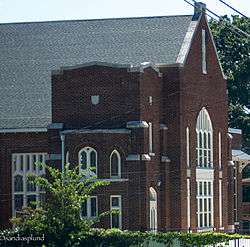
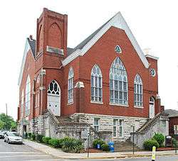
Highland Park Methodist Episcopal Church |
|
February 29, 1980
(#80003813) |
1900 Bailey Ave.
35°02′01″N 85°16′32″W / 35.033611°N 85.275556°W / 35.033611; -85.275556 (Highland Park Methodist Episcopal Church) |
Chattanooga |
|
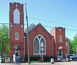
| 38 |
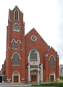
Highland Park Methodist Episcopal Church, South |
|
March 12, 2012
(#12000118) |
1918 Union Ave.
35°01′55″N 85°16′32″W / 35.03192°N 85.275473°W / 35.03192; -85.275473 (Highland Park Methodist Episcopal Church, South) |
Chattanooga |
Renamed in 1938 to St. Andrew's Methodist Church. Closed in 2004.[6] |
| 39 |
Hutcheson House |
|
November 21, 1978
(#78002597) |
360 S. Crest Rd.
35°00′29″N 85°16′09″W / 35.008056°N 85.269167°W / 35.008056; -85.269167 (Hutcheson House) |
Chattanooga |
|
| 40 |
Caleb Isbester House |
|
March 25, 1982
(#82003975) |
551 Oak St.
35°02′53″N 85°18′14″W / 35.048056°N 85.303889°W / 35.048056; -85.303889 (Caleb Isbester House) |
Chattanooga |
|
| 41 |
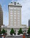
James Building |
|
February 29, 1980
(#80003814) |
735 Broad St.
35°02′50″N 85°18′37″W / 35.047222°N 85.310278°W / 35.047222; -85.310278 (James Building) |
Chattanooga |
|
| 42 |
James County Courthouse |
|
November 7, 1976
(#76001782) |
Mulberry St.
35°04′17″N 85°03′37″W / 35.071389°N 85.060278°W / 35.071389; -85.060278 (James County Courthouse) |
Ooltewah |
County courthouse for James County, which was merged into Hamilton County after its bankruptcy in 1919. |
| 43 |
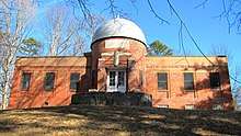
Clarence T. Jones Observatory |
|
November 20, 2009
(#09000949) |
10 N. Tuxedo Ave.
35°01′01″N 85°14′12″W / 35.016925°N 85.236794°W / 35.016925; -85.236794 (Clarence T. Jones Observatory) |
Chattanooga |
Still in use |
| 44 |
Kelley House |
|
May 14, 1980
(#80003815) |
1903 McCallie Ave.
35°02′08″N 85°16′27″W / 35.035556°N 85.274167°W / 35.035556; -85.274167 (Kelley House) |
Chattanooga |
|
| 45 |
M.L. King Boulevard Historic District |
|
March 20, 1984
(#84003551) |
Roughly M. L. King Boulevard between Browns and University Sts.
35°02′38″N 85°18′14″W / 35.043889°N 85.303889°W / 35.043889; -85.303889 (M.L. King Boulevard Historic District) |
Chattanooga |
|
| 46 |
Lookout Mountain Caverns and Cavern Castle |
|
November 26, 1985
(#85002969) |
Scenic Highway
35°01′09″N 85°20′22″W / 35.019167°N 85.339444°W / 35.019167; -85.339444 (Lookout Mountain Caverns and Cavern Castle) |
Chattanooga |
|
| 47 |
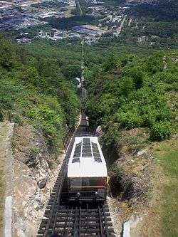
Lookout Mountain Incline Railway |
|
April 26, 1973
(#73001774) |
Off U.S. Route 11
35°00′28″N 85°20′08″W / 35.007778°N 85.335556°W / 35.007778; -85.335556 (Lookout Mountain Incline Railway) |
Chattanooga |
|
| 48 |
Louise Terrace Apartments |
|
October 30, 1998
(#98001306) |
314 and 316 Walnut St.
35°03′10″N 85°18′27″W / 35.052778°N 85.3075°W / 35.052778; -85.3075 (Louise Terrace Apartments) |
Chattanooga |
|
| 49 |
Maclellan Building |
|
April 4, 1985
(#85000708) |
721 Broad St.
35°02′51″N 85°18′36″W / 35.0475°N 85.31°W / 35.0475; -85.31 (Maclellan Building) |
Chattanooga |
|
| 50 |
Mallards Dozen Archeological Site (40HA147) |
|
May 22, 1984
(#84003552) |
Address Restricted
|
Chattanooga |
|
| 51 |
Market and Main Streets Historic District |
|
July 24, 1992
(#92000927) |
Roughly bounded by Cowart, King, Market, and Main Sts.
35°02′18″N 85°18′28″W / 35.038333°N 85.307778°W / 35.038333; -85.307778 (Market and Main Streets Historic District) |
Chattanooga |
|
| 52 |
Market Square-Patten Parkway |
|
May 1, 1980
(#80003816) |
Roughly bounded by E. 8th and E. 9th Sts. and Georgia and Lindsay Aves.
35°02′46″N 85°18′27″W / 35.046111°N 85.3075°W / 35.046111; -85.3075 (Market Square-Patten Parkway) |
Chattanooga |
|
| 53 |
Market Street Bridge |
|
December 20, 2010
(#10001047) |
Market St. over the Tennessee River
35°03′31″N 85°18′33″W / 35.058611°N 85.309167°W / 35.058611; -85.309167 (Market Street Bridge) |
Chattanooga |
Also known as the Chief John Ross Bridge |
| 54 |
Market Street Warehouse Historic District |
|
April 5, 1984
(#84003554) |
1118-1148 Market St.
35°02′35″N 85°18′32″W / 35.043056°N 85.308889°W / 35.043056; -85.308889 (Market Street Warehouse Historic District) |
Chattanooga |
|
| 55 |
Pleasant L. Matthews House |
|
December 12, 1976
(#76001781) |
Southwest of Georgetown on Ooltewah-Georgetown Rd.
35°16′38″N 84°57′57″W / 35.277222°N 84.965833°W / 35.277222; -84.965833 (Pleasant L. Matthews House) |
Georgetown |
|
| 56 |
Chancellor T.M. McConnell House |
|
April 17, 1992
(#92000314) |
517 E. 5th St.
35°03′02″N 85°18′10″W / 35.050556°N 85.302778°W / 35.050556; -85.302778 (Chancellor T.M. McConnell House) |
Chattanooga |
|
| 57 |
Medical Arts Building |
|
September 15, 1980
(#80003817) |
McCallie Ave.
35°02′45″N 85°18′09″W / 35.045833°N 85.3025°W / 35.045833; -85.3025 (Medical Arts Building) |
Chattanooga |
|
| 58 |
Mikado Locomotive No. 4501 |
|
March 28, 1979
(#79002440) |
2202 N. Chamberlain Ave.
35°03′43″N 85°15′01″W / 35.061944°N 85.250278°W / 35.061944; -85.250278 (Mikado Locomotive No. 4501) |
Chattanooga |
|
| 59 |
Miller Brothers Department Store |
|
September 17, 1987
(#87001115) |
629 Market St.
35°02′56″N 85°18′34″W / 35.048889°N 85.309444°W / 35.048889; -85.309444 (Miller Brothers Department Store) |
Chattanooga |
See Miller's of Tennessee. |
| 60 |
Missionary Ridge Historic District |
|
September 5, 1996
(#95001257) |
N. and S. Crest Rd. from Delong Reservation to 700 S. Crest Rd.
35°00′48″N 85°15′56″W / 35.013333°N 85.265556°W / 35.013333; -85.265556 (Missionary Ridge Historic District) |
Chattanooga |
|
| 61 |
Moccasin Bend Archeological District |
|
September 8, 1986
(#86003510) |
Address Restricted
|
Chattanooga |
|
| 62 |
Model Electric Home |
|
July 15, 1993
(#93000645) |
1516 Sunset Rd.
35°04′33″N 85°17′07″W / 35.075833°N 85.285278°W / 35.075833; -85.285278 (Model Electric Home) |
Chattanooga |
|
| 63 |
Municipal Building |
|
February 29, 1980
(#80003818) |
E. 11th St.
35°02′36″N 85°18′27″W / 35.043333°N 85.3075°W / 35.043333; -85.3075 (Municipal Building) |
Chattanooga |
|
| 64 |
Northside United Presbyterian |
|
September 15, 1980
(#80003820) |
923 Mississippi Ave.
35°04′10″N 85°17′41″W / 35.069444°N 85.294722°W / 35.069444; -85.294722 (Northside United Presbyterian) |
Chattanooga |
|
| 65 |
Oak Grove Elementary School |
|
July 6, 2011
(#11000420) |
1912 S. Willow St.
35°01′14″N 85°16′45″W / 35.020556°N 85.279167°W / 35.020556; -85.279167 (Oak Grove Elementary School) |
Chattanooga |
|
| 66 |
Ochs Building |
|
November 17, 1978
(#78002598) |
Georgia Ave.
35°02′50″N 85°18′26″W / 35.047222°N 85.307222°W / 35.047222; -85.307222 (Ochs Building) |
Chattanooga |
|
| 67 |
Old Library Building |
|
March 14, 1973
(#73001776) |
200 E. 8th St.
35°02′48″N 85°18′26″W / 35.046667°N 85.307222°W / 35.046667; -85.307222 (Old Library Building) |
Chattanooga |
|
| 68 |
Old Post Office |
|
April 13, 1973
(#73001777) |
E. 11th and Lindsay Sts.
35°02′37″N 85°18′27″W / 35.043611°N 85.3075°W / 35.043611; -85.3075 (Old Post Office) |
Chattanooga |
|
| 69 |
Read House |
|
December 23, 1976
(#76001780) |
Broad and 9th Sts.
35°02′46″N 85°18′39″W / 35.046111°N 85.310833°W / 35.046111; -85.310833 (Read House) |
Chattanooga |
|
| 70 |
Ridgedale Methodist Episcopal Church |
|
July 30, 2010
(#10000509) |
1518 Dodds Ave.
35°01′15″N 85°16′12″W / 35.0208°N 85.27°W / 35.0208; -85.27 (Ridgedale Methodist Episcopal Church) |
Chattanooga vicinity |
|
| 71 |
Ross's Landing |
|
June 27, 1974
(#74001914) |
Riverfront Parkway west of Market St.
35°03′23″N 85°18′32″W / 35.056389°N 85.308889°W / 35.056389; -85.308889 (Ross's Landing) |
Chattanooga |
|
| 72 |
St. Elmo Historic District |
|
April 15, 1982
(#82003976) |
Alabama, St. Elmo, and Tennessee Aves.
34°59′48″N 85°19′44″W / 34.996667°N 85.328889°W / 34.996667; -85.328889 (St. Elmo Historic District) |
Chattanooga |
|
| 73 |
St. Paul's Episcopal Church |
|
September 1, 1978
(#78002599) |
7th and Pine Sts.
35°02′55″N 85°18′47″W / 35.048611°N 85.313056°W / 35.048611; -85.313056 (St. Paul's Episcopal Church) |
Chattanooga |
|
| 74 |
Saints Peter and Paul Catholic Church and Buildings |
|
December 11, 1979
(#79002441) |
214 E. 8th St.
35°02′47″N 85°18′23″W / 35.046389°N 85.306389°W / 35.046389; -85.306389 (Saints Peter and Paul Catholic Church and Buildings) |
Chattanooga |
|
| 75 |
Robert Schwartz and Company Building |
|
July 19, 1984
(#84003555) |
736-738 Cherry St.
35°02′50″N 85°18′29″W / 35.047222°N 85.308056°W / 35.047222; -85.308056 (Robert Schwartz and Company Building) |
Chattanooga |
|
| 76 |
Second Presbyterian Church |
|
February 29, 1980
(#80003822) |
700 Pine St.
35°02′53″N 85°18′45″W / 35.048056°N 85.3125°W / 35.048056; -85.3125 (Second Presbyterian Church) |
Chattanooga |
|
| 77 |
Seamour and Gerte Shavin House |
|
March 23, 1993
(#93000149) |
334 N. Crest Rd.
35°03′07″N 85°15′01″W / 35.0519°N 85.2503°W / 35.0519; -85.2503 (Seamour and Gerte Shavin House) |
Chattanooga |
|
| 78 |
Shiloh Baptist Church |
|
January 19, 1979
(#79002442) |
506 E. 8th St.
35°02′43″N 85°18′11″W / 35.045278°N 85.303056°W / 35.045278; -85.303056 (Shiloh Baptist Church) |
Chattanooga |
|
| 79 |
Signal Knitting Mills |
|
March 5, 1999
(#99000281) |
205 Manufacturers Rd.
35°03′46″N 85°18′47″W / 35.062778°N 85.313056°W / 35.062778; -85.313056 (Signal Knitting Mills) |
Chattanooga |
|
| 80 |
Signal Mountain Elementary School |
|
April 19, 2001
(#01000395) |
809 Kentucky Ave.
35°07′30″N 85°20′44″W / 35.125°N 85.345556°W / 35.125; -85.345556 (Signal Mountain Elementary School) |
Signal Mountain |
|
| 81 |
Signal Mountain Historic District |
|
October 5, 2001
(#01000729) |
Roughly along James Boulevard, Brady Point Rd., and Signal Point Rd.
35°07′17″N 85°21′27″W / 35.121389°N 85.3575°W / 35.121389; -85.3575 (Signal Mountain Historic District) |
Signal Mountain |
|
| 82 |
Soldiers and Sailors Memorial Auditorium |
|
September 15, 1980
(#80003823) |
McCallie Ave.
35°02′52″N 85°18′21″W / 35.047778°N 85.305833°W / 35.047778; -85.305833 (Soldiers and Sailors Memorial Auditorium) |
Chattanooga |
|
| 83 |
Southern Railway Freight Depot |
|
June 16, 1983
(#83003038) |
1140 Newby St.
35°02′30″N 85°18′30″W / 35.041667°N 85.308333°W / 35.041667; -85.308333 (Southern Railway Freight Depot) |
Chattanooga |
|
| 84 |
Standard-Coosa-Thatcher Mills |
|
December 29, 2014
(#14001106) |
1800 Watkins St.
35°01′10″N 85°16′29″W / 35.0195°N 85.2746°W / 35.0195; -85.2746 (Standard-Coosa-Thatcher Mills) |
Chattanooga |
|
| 85 |
Stone Fort Land Company Historic District |
|
July 1, 1999
(#99000786) |
10th, Newby, E. 11th, and Market Sts.
35°02′45″N 85°18′28″W / 35.045833°N 85.307778°W / 35.045833; -85.307778 (Stone Fort Land Company Historic District) |
Chattanooga |
|
| 86 |
Stringer Ridge Historic District |
|
May 22, 1984
(#84003557) |
Address Restricted
|
Chattanooga |
|
| 87 |
Tennessee Valley Railroad Museum Rolling Stock |
|
August 6, 1980
(#80003824) |
2022 N. Chamberlain Ave.
35°03′52″N 85°13′31″W / 35.064444°N 85.225278°W / 35.064444; -85.225278 (Tennessee Valley Railroad Museum Rolling Stock) |
Chattanooga |
|
| 88 |
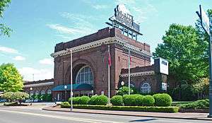
Terminal Station |
|
February 20, 1973
(#73001778) |
1434 Market St.
35°02′13″N 85°18′25″W / 35.036944°N 85.306944°W / 35.036944; -85.306944 (Terminal Station) |
Chattanooga |
|
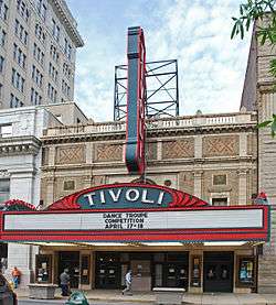
| 89 |
Tivoli Theater |
|
April 11, 1973
(#73001779) |
709 Broad St.
35°02′52″N 85°18′37″W / 35.047778°N 85.310278°W / 35.047778; -85.310278 (Tivoli Theater) |
Chattanooga |
|
| 90 |
Topside |
|
April 11, 1973
(#73001783) |
North of Signal Mountain off State Route 8 on Wilson Ave.
35°09′57″N 85°18′28″W / 35.165833°N 85.307778°W / 35.165833; -85.307778 (Topside) |
Signal Mountain |
|
| 91 |
Trigg-Smartt Building |
|
June 26, 1986
(#86001383) |
701-707 Broad St.
35°02′54″N 85°18′38″W / 35.048333°N 85.310556°W / 35.048333; -85.310556 (Trigg-Smartt Building) |
Chattanooga |
|
| 92 |
Trinity Methodist Episcopal Church |
|
February 29, 1980
(#80003826) |
McCallie Ave.
35°02′33″N 85°17′37″W / 35.0425°N 85.293611°W / 35.0425; -85.293611 (Trinity Methodist Episcopal Church) |
Chattanooga |
|
| 93 |
Turnbull Cone and Machine Company |
|
July 15, 1992
(#92000848) |
1400 Fort and W. 14th Sts.
35°02′22″N 85°18′52″W / 35.039444°N 85.314444°W / 35.039444; -85.314444 (Turnbull Cone and Machine Company) |
Chattanooga |
|
| 94 |
U.S. Post Office |
|
February 29, 1980
(#80003827) |
900 Georgia Ave.[7]
35°02′42″N 85°18′30″W / 35.045°N 85.308333°W / 35.045; -85.308333 (U.S. Post Office) |
Chattanooga |
|
| 95 |
Vulcan Archeological Site (40HA140) |
|
May 22, 1984
(#84003558) |
Address Restricted
|
Chattanooga |
|
| 96 |
W Road |
|
March 19, 1999
(#99000277) |
W Rd. from Spring St. east 0.4 miles
35°08′42″N 85°18′53″W / 35.145°N 85.314722°W / 35.145; -85.314722 (W Road) |
Walden |
|
| 97 |
Walnut Street Bridge |
|
February 23, 1990
(#90000300) |
Walnut St., over the Tennessee River
35°03′44″N 85°18′23″W / 35.062222°N 85.306389°W / 35.062222; -85.306389 (Walnut Street Bridge) |
Chattanooga |
Formerly a road bridge for automobiles and streetcars, was closed to motor vehicles in 1978 and was eventually converted to a pedestrian bridge. |
| 98 |
Wauhatchie Pike |
|
July 11, 2001
(#01000727) |
Old Wauhatchie Pike
35°01′10″N 85°20′22″W / 35.019444°N 85.339444°W / 35.019444; -85.339444 (Wauhatchie Pike) |
Lookout Mountain |
|
| 99 |
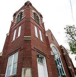
Wiley United Methodist Church |
|
August 1, 1979
(#79002443) |
504 Lookout St.
35°03′03″N 85°18′22″W / 35.050833°N 85.306111°W / 35.050833; -85.306111 (Wiley United Methodist Church) |
Chattanooga |
|
| 100 |
Frances Willard House |
|
February 29, 1980
(#80003828) |
615 Lindsay St.
35°02′58″N 85°18′18″W / 35.049444°N 85.305°W / 35.049444; -85.305 (Frances Willard House) |
Chattanooga |
|
| 101 |
Williams Island |
|
April 11, 1973
(#73001780) |
On Williams Island in the Tennessee River northwest of central Chattanooga[8]
35°05′00″N 85°20′45″W / 35.083333°N 85.345833°W / 35.083333; -85.345833 (Williams Island) |
Chattanooga |
|
| 102 |
Woodland Mound Archeological District |
|
May 22, 1984
(#84003562) |
Address Restricted
|
Chattanooga |
|
| 103 |
Wyatt Hall |
|
October 23, 1986
(#86002897) |
865 E. 3rd St.
35°02′59″N 85°17′40″W / 35.049722°N 85.294444°W / 35.049722; -85.294444 (Wyatt Hall) |
Chattanooga |
|