Tennessee State Route 8
| ||||
|---|---|---|---|---|
| Route information | ||||
| Maintained by TDOT | ||||
| Length | 75.43 mi (121.39 km) | |||
| Major junctions | ||||
| South end |
| |||
|
| ||||
| North end |
| |||
| Location | ||||
| Counties | Hamilton, Sequatchie, Van Buren, Warren | |||
| Highway system | ||||
| ||||


State Route 8 (SR 8) is a south–north route that connects Chattanooga to McMinnville in East & Middle Tennessee[1]
Route description
Hamilton County
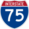
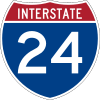
SR 8 begins in Hamilton County as the unsigned companion route to US 41/US 76 at the Georgia border in East Ridge, where they continue concurrent with Georgia State Route 3. As Ringgold Road, they head east and have an interchange with I-75 and go through downtown before entering the Bachman Tubes and entering Chattanooga, where it becomes East Main Street and having an interchange with I-24. There, SR 8 leaves US 41 at the western national terminus of US 76 and heads north, concurrent with US 11/US 64/US 72/SR 2. It then leaves the four routes and goes through downtown as Market Street and has another intersection with SR 2 and the short SR 316 and then a junction with SR 389 before crossing the Tennessee River and becoming Cherokee Boulevard. SR 8 then has an interchange with US 27/SR 29/SR 27, at the national southern terminus of US 127, which it becomes concurrent with along with SR 27, in Red Bank. They then come to a junction where SR 27 splits off and goes west (signed south) before winding its way up a mountain and going through Signal Mountain. US 127/SR 8 then go through Fairmount before crossing into Sequatchie County.
Sequatchie County
They then go through Lone Oak before meandering down a mountainside and entering a valley in Center Point, where they intersect SR 283. US 127/SR 8 then enter Dunlap and have an intersection with SR 28, which becomes the unsigned companion route of US 127. They go north through downtown before coming to an interchange with SR 111, where SR 8 separates from US 127/SR 28 and follows that route. SR 111/SR 8 wind their way through a narrow valley before having an intersection with SR 399. SR 8 soon leaves SR 111, becoming signed for the first time as a primary highway, and heads eastward to enter Van Buren County.
Van Buren and Warren Counties
SR 8 shortly runs through a remote area of Van Buren County Before crossing into Warren County. It then runs through some farmland and crosses a creek before junctioning with SR 127 and entering McMinnville. SR 8 then comes to an end at an intersection with SR 56 just west of downtown.
Major Junctions
Hamilton County


- Bachman Tubes under the East Ridge


- Market Street Bridge (Chief John Ross Bridge) over SR 58 and Tennessee River


Sequatchie County


Van Buren County
No major junctions
Warren County


See also
References
- ↑ Tennessee Atlas & Gazetteer (Map) (2004 ed.). DeLorme.