| [3] |
Name on the Register[4] |
Image |
Date listed[5] |
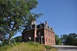
Location |
City or town |
Description |
|---|
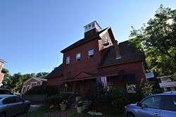
| 1 |
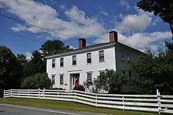
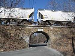
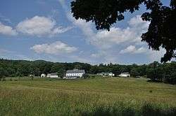
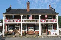
Ashland Gristmill and Dam |
|
December 10, 1979
(#79000317) |
Main St.
43°41′44″N 71°37′51″W / 43.695556°N 71.630833°W / 43.695556; -71.630833 (Ashland Gristmill and Dam) |
Ashland |
On the Squam River |
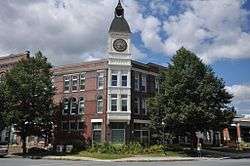
| 2 |
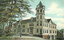
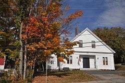
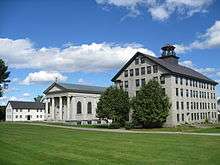
Ashland Junior High School |
|
April 8, 1983
(#83001137) |
12 School St.
43°41′50″N 71°38′06″W / 43.697222°N 71.635°W / 43.697222; -71.635 (Ashland Junior High School) |
Ashland |
Now a community center |
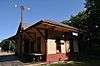
| 3 |
Ashland Railroad Station |
|
November 10, 1982
(#82000617) |
39 Depot St.
43°41′26″N 71°38′04″W / 43.690556°N 71.634444°W / 43.690556; -71.634444 (Ashland Railroad Station) |
Ashland |
Now a local museum |
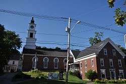
| 4 |
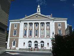
Ashland Town Hall |
|
March 24, 1983
(#83001138) |
10 Highland St.
43°41′48″N 71°37′57″W / 43.696667°N 71.6325°W / 43.696667; -71.6325 (Ashland Town Hall) |
Ashland |
|
| 5 |
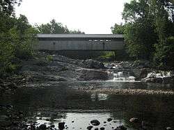
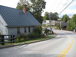
Bath Covered Bridge |
|
September 1, 1976
(#76000125) |
Off U.S. Route 302/NH 10
44°10′01″N 71°58′03″W / 44.166944°N 71.9675°W / 44.166944; -71.9675 (Bath Covered Bridge) |
Bath |
Over Ammonoosuc River |
| 6 |
Bedell Covered Bridge |
|
May 28, 1975
(#75002171) |
Crossed the Connecticut River between Haverhill and Newbury
44°02′42″N 72°04′27″W / 44.045°N 72.074167°W / 44.045; -72.074167 (Bedell Covered Bridge) |
Haverhill |
|
| 7 |
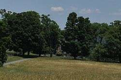
Boulderwood |
|
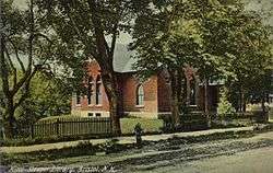
April 9, 2018
(#100002300) |
Address Restricted
|
Holderness |
|
| 8 |
Brick Store |
|
November 7, 1985
(#85002780) |
21 Lisbon Road
44°10′00″N 71°58′00″W / 44.166667°N 71.966667°W / 44.166667; -71.966667 (Brick Store) |
Bath |
|
| 9 |
Bristol Town Hall |
|
September 29, 2015
(#15000668) |
45 Summer St.
43°35′33″N 71°44′08″W / 43.59241°N 71.73553°W / 43.59241; -71.73553 (Bristol Town Hall) |
Bristol |
|
| 10 |
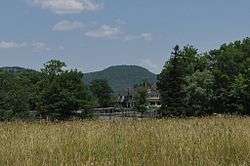
Burleigh Brae and Webster Boathouse |
|
August 15, 2012
(#12000505) |
near NH 113
43°45′43″N 71°33′40″W / 43.761882°N 71.561064°W / 43.761882; -71.561064 (Burleigh Brae and Webster Boathouse) |
Holderness |
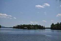
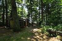
Part of the Squam Multiple Property Submission (MPS) |
| 11 |
Burt-Cheney Farm |
|
March 25, 1982
(#82001674) |
U.S. Route 302
44°17′33″N 71°45′24″W / 44.2925°N 71.756667°W / 44.2925; -71.756667 (Burt-Cheney Farm) |
Bethlehem |
|
| 12 |
Camp Carnes |
|
August 15, 2012
(#12000506) |
On an island in Carns Cove, Squam Lake
43°45′46″N 71°33′26″W / 43.7628°N 71.5572°W / 43.7628; -71.5572 (Camp Carnes) |
Holderness |
Part of the Squam MPS |
| 13 |
Camp Ossipee |
|
April 10, 2013
(#13000154) |
11 & 13 Porter Rd.
43°44′39″N 71°32′57″W / 43.744173°N 71.549195°W / 43.744173; -71.549195 (Camp Ossipee) |
Holderness |
Part of the Squam MPS |
| 14 |
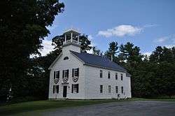
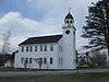
Canaan Meetinghouse |
|
March 24, 1972
(#72001598) |
Canaan St.
43°39′55″N 72°02′34″W / 43.66535°N 72.0429°W / 43.66535; -72.0429 (Canaan Meetinghouse) |
Canaan |
|
| 15 |
Canaan Street Historic District |
|
May 7, 1973
(#73000163) |
Canaan St.
43°39′56″N 72°02′32″W / 43.6656°N 72.0422°W / 43.6656; -72.0422 (Canaan Street Historic District) |
Canaan |
|
| 16 |
Daniel Carr House |
|
March 27, 1992
(#92000156) |
Northern side of Brier Hill Rd., 1.5 mi (2.4 km) from its junction with NH 10
44°06′32″N 72°00′11″W / 44.1089°N 72.0031°W / 44.1089; -72.0031 (Daniel Carr House) |
Haverhill |
|
| 17 |
Central Square Historic District |
|
March 24, 1983
(#83001139) |
2-27 Central Square, 1 Summer St., 1-3 N. Main St., and 2 S. Main St.
43°35′29″N 71°44′11″W / 43.591389°N 71.736389°W / 43.591389; -71.736389 (Central Square Historic District) |
Bristol |
|
| 18 |
Centre Village Meeting House |
|
June 6, 1985
(#85001197) |
NH 4A
43°35′24″N 72°06′38″W / 43.59°N 72.110556°W / 43.59; -72.110556 (Centre Village Meeting House) |
Enfield |
|
| 19 |
Chapel of the Holy Cross |
|
September 7, 2005
(#05000971) |
45 Chapel Ln.
43°45′31″N 71°40′31″W / 43.758611°N 71.675278°W / 43.758611; -71.675278 (Chapel of the Holy Cross) |
Holderness |
On the campus of the Holderness School |
| 20 |
Chocorua Island Chapel |
|
September 20, 2016
(#16000644) |
40 Chocorua Island, Squam Lake
43°45′20″N 71°32′34″W / 43.755550°N 71.542681°W / 43.755550; -71.542681 (Chocorua Island Chapel) |
Holderness |
|
| 21 |
Colburn Park Historic District |
|
January 10, 1986
(#86000782) |
N., S., E., and W. Park Sts., 3 Campbell St., 1 School St., 1 Bank St., and 9-10 Lebanon Mall
43°38′31″N 72°15′08″W / 43.641944°N 72.252222°W / 43.641944; -72.252222 (Colburn Park Historic District) |
Lebanon |
|
| 22 |
Dorchester Common Historic District |
|
March 7, 1985
(#85000477) |
Roughly bounded by N. Dorchester 0.2-mile (0.32 km) northwest of its intersection with NH 118
43°45′25″N 71°56′59″W / 43.756944°N 71.949722°W / 43.756944; -71.949722 (Dorchester Common Historic District) |
Dorchester |
|
| 23 |
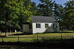
Dorchester Community Church |
|
November 25, 1980
(#80000284) |
Off NH 118
43°45′25″N 71°57′01″W / 43.756944°N 71.950278°W / 43.756944; -71.950278 (Dorchester Community Church) |
Dorchester |
|
| 24 |
Dow Academy |
|
August 31, 1982
(#82001675) |
Dow Ave.
44°13′32″N 71°44′53″W / 44.225556°N 71.748056°W / 44.225556; -71.748056 (Dow Academy) |
Franconia |
|
| 25 |
Enfield Center Town House |
|
July 17, 2017
(#100001318) |
1044 NH 4A
43°35′28″N 72°06′37″W / 43.591053°N 72.110371°W / 43.591053; -72.110371 (Enfield Center Town House) |
Enfield |
|
| 26 |
Enfield Shaker Historic District |
|
November 7, 1979
(#79000198) |
NH 4A
43°37′13″N 72°08′49″W / 43.620278°N 72.146944°W / 43.620278; -72.146944 (Enfield Shaker Historic District) |
Enfield |
|
| 27 |
Enfield Village Historic District |
|
April 19, 2010
(#10000186) |
Main St, U.S. Route 4, High St, Balti St, Shaker Hill Rd, Wells St, Stevens, Union, & Pillsbury Sts, Shedd & Mill St.
43°38′31″N 72°08′42″W / 43.641917°N 72.145078°W / 43.641917; -72.145078 (Enfield Village Historic District) |
Enfield |
|
| 28 |
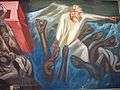
The Epic of American Civilization Murals |
|
February 27, 2013
(#13000283) |
6025 Baker-Berry Library
43°42′18″N 72°17′21″W / 43.705°N 72.2892°W / 43.705; -72.2892 (The Epic of American Civilization Murals) |
Hanover |
|
| 29 |
Felsengarten |
|
June 18, 1973
(#73002296) |
Southwest of Bethlehem on Lewis Hill Rd.
44°15′20″N 71°42′20″W / 44.255556°N 71.705556°W / 44.255556; -71.705556 (Felsengarten) |
Bethlehem |
|
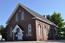
| 30 |
First Free Will Baptist Church and Vestry |
|
April 8, 1983
(#83001140) |
57 Main St.
43°41′42″N 71°37′59″W / 43.695°N 71.633056°W / 43.695; -71.633056 (First Free Will Baptist Church and Vestry) |
Ashland |
Currently the Ashland Baptist Church. |
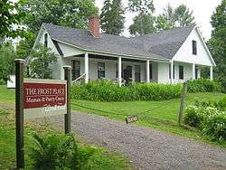
| 31 |
Frost Place |
|
November 30, 1976
(#76000126) |
South of Franconia off NH 116 on Ridge Rd.
44°12′46″N 71°45′27″W / 44.212778°N 71.7575°W / 44.212778; -71.7575 (Frost Place) |
Franconia |
|
| 32 |
Goodall-Woods Law Office |
|
August 26, 1980
(#80000285) |
Northeast of Bath on U.S. Route 302
44°10′35″N 71°56′40″W / 44.176389°N 71.944444°W / 44.176389; -71.944444 (Goodall-Woods Law Office) |
Bath |
|
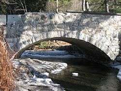
| 33 |
Great Hollow Road Stone Arch Bridge |
|
May 12, 1997
(#97000372) |
Great Hollow Rd. over Mink Brook, approximately 100 ft (30 m) north of its junction with Smith Ln.
43°41′13″N 72°14′00″W / 43.686944°N 72.233333°W / 43.686944; -72.233333 (Great Hollow Road Stone Arch Bridge) |
Hanover |
|
| 34 |
Abbie Greenleaf Library |
|
June 13, 2003
(#03000526) |
439 Main St.
44°13′36″N 71°44′43″W / 44.2267°N 71.7452°W / 44.2267; -71.7452 (Abbie Greenleaf Library) |
Franconia |
|
| 35 |
Hanover Town Library |
|
April 25, 1997
(#97000371) |
130 Etna Rd.
43°41′41″N 72°13′06″W / 43.694722°N 72.218333°W / 43.694722; -72.218333 (Hanover Town Library) |
Hanover |
|
| 36 |
Haverhill Corner Historic District |
|
August 27, 1987
(#87001415) |
NH 10 from N. Piermont to its bisection of NH 25 and Court St.
44°01′53″N 72°03′51″W / 44.0314°N 72.0642°W / 44.0314; -72.0642 (Haverhill Corner Historic District) |
Haverhill |
|
| 37 |
Haverhill-Bath Covered Bridge |
|
April 18, 1977
(#77000091) |
NH 135
44°09′16″N 72°02′12″W / 44.1544°N 72.0367°W / 44.1544; -72.0367 (Haverhill-Bath Covered Bridge) |
Woodsville and Bath |
Over the Ammonoosuc River |
| 38 |
Hebron Village Historic District |
|
March 7, 1985
(#85000492) |
Roughly bounded by the Hebron Village Cemetery, N. and W. Shore Rds., and Hobart Hill and Groton Rds.
43°41′38″N 71°48′21″W / 43.6939°N 71.8058°W / 43.6939; -71.8058 (Hebron Village Historic District) |
Hebron |
|
| 39 |
Hewitt House |
|
November 7, 1985
(#85002778) |
U.S. Route 4
43°38′41″N 72°08′37″W / 43.6448°N 72.1435°W / 43.6448; -72.1435 (Hewitt House) |
Enfield |
|
| 40 |
Holderness Free Library |
|
March 7, 1985
(#85000478) |
Junction of U.S. Route 3 and NH 113
43°43′55″N 71°35′18″W / 43.731944°N 71.588333°W / 43.731944; -71.588333 (Holderness Free Library) |
Holderness |
|
| 41 |
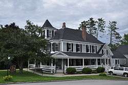
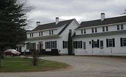
Holderness Inn |
|
December 13, 1984
(#84000523) |
U.S. Route 3
43°43′53″N 71°35′24″W / 43.731389°N 71.59°W / 43.731389; -71.59 (Holderness Inn) |
Holderness |
|
| 42 |
Jeremiah Hutchins Tavern |
|
September 7, 1984
(#84003194) |
Northeast of Bath on U.S. Route 302
44°10′41″N 71°56′40″W / 44.1781°N 71.9444°W / 44.1781; -71.9444 (Jeremiah Hutchins Tavern) |
Bath |
|
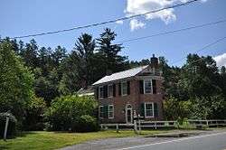
| 43 |
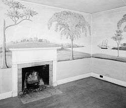
Moses Kent House |
|
June 7, 1984
(#84002808) |
River Road[6]
43°52′15″N 72°09′45″W / 43.8707°N 72.1624°W / 43.8707; -72.1624 (Moses Kent House) |
Lyme |
Noted for murals by Rufus Porter |
| 44 |
Edward H. Lane House |
|
December 8, 1980
(#80000286) |
16 Cottage St.
44°18′18″N 71°46′03″W / 44.305°N 71.7675°W / 44.305; -71.7675 (Edward H. Lane House) |
Littleton |
|
| 45 |
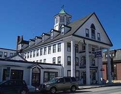
Lisbon Inn |
|
December 1, 1980
(#80000287) |
Main St.
44°12′47″N 71°54′46″W / 44.213056°N 71.912778°W / 44.213056; -71.912778 (Lisbon Inn) |
Lisbon |
|
| 46 |
Littleton Town Building |
|
May 7, 1973
(#73000164) |
1 Union St.
44°18′21″N 71°46′12″W / 44.305833°N 71.77°W / 44.305833; -71.77 (Littleton Town Building) |
Littleton |
|
| 47 |
Lovett's by Lafayette Brook |
|
March 11, 1982
(#82001676) |
South of Franconia on Profile Rd.
44°12′16″N 71°43′25″W / 44.204444°N 71.723611°W / 44.204444; -71.723611 (Lovett's by Lafayette Brook) |
Franconia |
|
| 48 |
Lyme Center Historic District |
|
March 31, 1987
(#86003381) |
34-55 Dorchester Rd.
43°47′58″N 72°07′35″W / 43.799444°N 72.126389°W / 43.799444; -72.126389 (Lyme Center Historic District) |
Lyme Center |
|
| 49 |
Lyme Common Historic District |
|
September 1, 1988
(#88001435) |
Dorchester Rd., John Tomson Way, On the Common; Pleasant and Union Sts., E. Thetford Rd., Main and Market Sts.
43°48′40″N 72°09′28″W / 43.8111°N 72.1578°W / 43.8111; -72.1578 (Lyme Common Historic District) |
Lyme |
|
| 50 |
Minot-Sleeper Library |
|
September 15, 1988
(#88001434) |
35 Pleasant Street
43°35′28″N 71°44′16″W / 43.590981°N 71.737799°W / 43.590981; -71.737799 (Minot-Sleeper Library) |
Bristol |
|
| 51 |
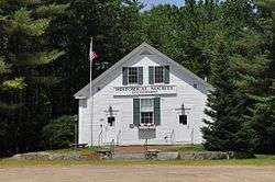
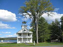
North Holderness Freewill Baptist Church-Holderness Historical Society Building |
|
September 4, 1986
(#86002171) |
Rt. 3
43°43′56″N 71°35′10″W / 43.7321°N 71.586°W / 43.7321; -71.586 (North Holderness Freewill Baptist Church-Holderness Historical Society Building) |
Holderness |
Listed on Owl Brook Road; moved to present location in 1994[7] |
| 52 |
Old Grafton County Courthouse |
|
April 29, 1982
(#82001677) |
1 Court St.
43°45′29″N 71°41′21″W / 43.758056°N 71.689167°W / 43.758056; -71.689167 (Old Grafton County Courthouse) |
Plymouth |
|
| 53 |
Orford Street Historic District |
|
August 26, 1977
(#77000163) |
Orford St. (NH 10) from NH 25A to Archertown Rd., including the cemetery to the east
43°54′16″N 72°08′07″W / 43.904444°N 72.135278°W / 43.904444; -72.135278 (Orford Street Historic District) |
Orford |
|
| 54 |
Owls Head |
|
September 29, 2015
(#15000669) |
289 W. Shore Rd.
43°40′43″N 71°47′23″W / 43.67872°N 71.78959°W / 43.67872; -71.78959 (Owls Head) |
Hebron |
|
| 55 |
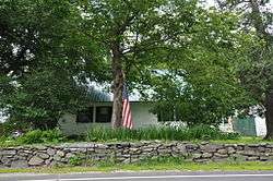
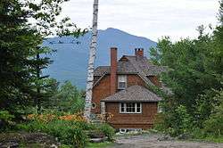
Norman and Marion Perry House |
|
September 25, 2012
(#12000821) |
352 Ellsworth Hill Road[8]
43°51′18″N 71°41′46″W / 43.8551°N 71.696°W / 43.8551; -71.696 (Norman and Marion Perry House) |
Campton |
c. 1960 Modernist house designed by Hugh Stebbins |
| 56 |
Piermont Bridge |
|
June 6, 2001
(#01000630) |
NH 25 over the Connecticut River at the Vermont state line
43°58′40″N 72°06′45″W / 43.977778°N 72.1125°W / 43.977778; -72.1125 (Piermont Bridge) |
Piermont |
Extends into Orange County, Vermont |
| 57 |
Plymouth Historic District |
|
March 14, 1986
(#86000343) |
Bounded by Court, Main, and Highland Sts.
43°45′26″N 71°41′17″W / 43.757222°N 71.688056°W / 43.757222; -71.688056 (Plymouth Historic District) |
Plymouth |
|
| 58 |
Rocks Estate |
|
September 7, 1984
(#84003197) |
West of Bethlehem on U.S. Route 302
44°16′52″N 71°44′03″W / 44.281111°N 71.734167°W / 44.281111; -71.734167 (Rocks Estate) |
Bethlehem |
|
| 59 |
Rockywold-Deephaven Camps |
|
June 14, 2013
(#13000382) |
Pinehurst Rd.
43°46′35″N 71°32′36″W / 43.7764°N 71.5432°W / 43.7764; -71.5432 (Rockywold-Deephaven Camps) |
Holderness |
Part of the Squam MPS |
| 60 |
The Samuel Morey Memorial Bridge |
|
December 8, 1997
(#97001523) |
NH 25A over the Connecticut River
43°54′25″N 72°08′23″W / 43.906944°N 72.139722°W / 43.906944; -72.139722 (The Samuel Morey Memorial Bridge) |
Orford |
Extends into Orange County, Vermont |
| 61 |
Sawyer-Medlicott House |
|
December 6, 1991
(#91001757) |
Junction of Bradford and River Rds.
43°58′40″N 72°06′21″W / 43.9778°N 72.1058°W / 43.9778; -72.1058 (Sawyer-Medlicott House) |
Piermont |
|
| 62 |
Shepard Hill Historic District |
|
October 8, 2014
(#14000843) |
109, 135, 177, 180, 200 Shepard Hill, 6, 19, 31, 33, 35, 41 Coxboro & all of Asquam Rds., 584 US 3
43°43′32″N 71°34′14″W / 43.7256°N 71.5706°W / 43.7256; -71.5706 (Shepard Hill Historic District) |
Holderness |
|
| 63 |
Sphinx Tomb |
|
March 17, 2005
(#05000173) |
Northeastern corner of the junction of E. Wheelock St. and Observatory Rd.[9]
43°42′13″N 72°17′06″W / 43.70357°N 72.28513°W / 43.70357; -72.28513 (Sphinx Tomb) |
Hanover |
|
| 64 |
Spring Hill Farm |
|
June 13, 2002
(#02000639) |
263 Meriden Rd.
43°37′30″N 72°13′31″W / 43.625°N 72.225278°W / 43.625; -72.225278 (Spring Hill Farm) |
Lebanon |
|
| 65 |
St. Mark's Episcopal Church |
|
December 13, 1984
(#84000522) |
6-8 Highland St.
43°41′48″N 71°37′57″W / 43.696667°N 71.6325°W / 43.696667; -71.6325 (St. Mark's Episcopal Church) |
Ashland |
|
| 66 |
Stone Arch Underpass |
|
September 12, 1985
(#85002190) |
Glen Rd.
43°38′03″N 72°18′21″W / 43.634167°N 72.305833°W / 43.634167; -72.305833 (Stone Arch Underpass) |
Lebanon |
|
| 67 |
Swiftwater Covered Bridge |
|
November 21, 1976
(#76000127) |
South of Bath on Valley Rd.
44°08′03″N 71°57′05″W / 44.134167°N 71.951389°W / 44.134167; -71.951389 (Swiftwater Covered Bridge) |
Bath |
Over the Wild Ammonoosuc River |
| 68 |
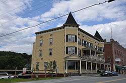
Thayer's Hotel |
|
March 9, 1982
(#82001678) |
136 Main St.
44°18′23″N 71°46′28″W / 44.306389°N 71.774444°W / 44.306389; -71.774444 (Thayer's Hotel) |
Littleton |
|
| 69 |
Trinity Church |
|
September 7, 1984
(#84003203) |
East of Plymouth on NH 175
43°45′24″N 71°40′11″W / 43.756667°N 71.669722°W / 43.756667; -71.669722 (Trinity Church) |
Holderness |
|
| 70 |
True Farm |
|
August 15, 2012
(#12000507) |
53, 64, 70 True Farm Rd., & 884 NH 113
43°45′46″N 71°33′49″W / 43.762749°N 71.563506°W / 43.762749; -71.563506 (True Farm) |
Holderness |
Part of the Squam MPS |
| 71 |
U.S. Post Office and Courthouse-Littleton Main |
|
July 17, 1986
(#86002251) |
134 Main St.[10]
44°18′26″N 71°46′30″W / 44.307222°N 71.775°W / 44.307222; -71.775 (U.S. Post Office and Courthouse-Littleton Main) |
Littleton |
|
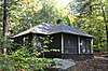
| 72 |
Watch Rock Camp |
|
December 24, 2013
(#13000973) |
Off NH 113 on the shore of Squam Lake
Coordinates missing |
Holderness |
Part of the Squam MPS |
| 73 |
Webster Estate |
|
June 9, 1989
(#89000448) |
NH 113
43°45′35″N 71°33′31″W / 43.759722°N 71.558611°W / 43.759722; -71.558611 (Webster Estate) |
Holderness |
|
| 74 |
Whipple House |
|
December 13, 1978
(#78000338) |
4 Pleasant St.
43°41′40″N 71°37′54″W / 43.6944°N 71.6318°W / 43.6944; -71.6318 (Whipple House) |
Ashland |
|
| 75 |
Woodsville Opera Building |
|
May 15, 1980
(#80000288) |
67 Central St.
44°09′08″N 72°02′18″W / 44.1522°N 72.0383°W / 44.1522; -72.0383 (Woodsville Opera Building) |
Woodsville |
|
.jpg)

.jpg)