National Register of Historic Places listings in DeSoto Parish, Louisiana
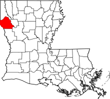
Location of DeSoto Parish in Louisiana
This is a list of the National Register of Historic Places listings in DeSoto Parish, Louisiana.
This is intended to be a complete list of the properties and districts on the National Register of Historic Places in DeSoto Parish, Louisiana, United States. The locations of National Register properties and districts for which the latitude and longitude coordinates are included below, may be seen in a map.[1]
There are 30 properties and districts listed on the National Register in the parish.
- This National Park Service list is complete through NPS recent listings posted October 4, 2018.[2]
Current listings
| [3] | Name on the Register[4] | Image | Date listed[5] | Location | City or town | Description |
|---|---|---|---|---|---|---|
| 1 | Allen House | July 28, 1988 (#88001154) |
About 650 yards (590 m) west of intersection between Smyrna Road and Philips Lane, and about 2.2 miles (3.5 km) southeast of Keachi 32°09′35″N 93°53′25″W / 32.15961°N 93.89031°W |
Keachi | ||
| 2 | Bank of Grand Cane | .jpg) |
February 11, 1988 (#88000105) |
8356 US 171 32°05′03″N 93°48′36″W / 32.08411°N 93.81003°W |
Grand Cane | Also a contributing property of Grand Cane Historic District since its creation on July 7, 1995.[6] |
| 3 | Buena Vista | January 19, 1989 (#88003197) |
On Buena Vista Road, about 550 yards (500 m) from its junction with Red Bluff Road and about 3.8 miles (6.1 km) southeast of Stonewall 32°14′01″N 93°47′37″W / 32.23352°N 93.7935°W |
Stonewall | ||
| 4 | Community Rosenwald School | .jpg) |
July 22, 2009 (#09000545) |
Along LA 3015, about 5.9 miles (9.5 km) northeast of Grand Cane 32°06′25″N 93°42′47″W / 32.10699°N 93.71302°W |
Grand Cane | |
| 5 | DeSoto Parish Courthouse | .jpg) |
January 22, 1987 (#86003677) |
101 Texas Street 32°02′19″N 93°42′38″W / 32.03867°N 93.71046°W |
Mansfield | Also a contributing property of Mansfield Historic District since its creation on October 27, 1988.[7] |
| 6 | Grand Cane Historic District | .jpg) |
July 7, 1995 (#95000815) |
Along US 171, roughly between Burrow Street and Graham Street 32°05′03″N 93°48′35″W / 32.08418°N 93.80983°W |
Grand Cane | The 1.5 acres (0.61 ha) area comprises a total of seven contributing properties, built between 1882 and 1939.[6] |
| 7 | Grand Cane United Methodist Church | .jpg) |
January 28, 1992 (#91002024) |
8446 US 171 32°04′54″N 93°48′33″W / 32.08167°N 93.80905°W |
Grand Cane | |
| 8 | International Boundary Marker | .jpg) |
April 13, 1977 (#77001463) |
On Louisiana-Texas border, at intersection of FM 31 and LA 765 32°02′03″N 94°02′34″W / 32.03408°N 94.04275°W |
Logansport | Extends into Panola County, Texas |
| 9 | Kansas City Southern Depot | January 19, 1989 (#88003198) |
Along Kansas City Southern railroad tracks, shortly south of Polk Street 32°02′12″N 93°42′01″W / 32.03673°N 93.70038°W |
Mansfield | ||
| 10 | Keachi Baptist Church | .jpg) |
October 20, 1988 (#88002039) |
About 100 yards (91 m) south of LA 172, shortly west of its intersection with Depot Road 32°11′19″N 93°54′34″W / 32.18848°N 93.90952°W |
Keachi | |
| 11 | Keachi Presbyterian Church | .jpg) |
June 30, 1988 (#88000981) |
Along LA 5, about 280 yards (260 m) east of its intersection with LA 789 32°11′19″N 93°54′11″W / 32.18853°N 93.90294°W |
Keachi | |
| 12 | Keachi Store | .jpg) |
October 20, 1988 (#88002036) |
Northwestern corner of LA 172 and LA 789 32°11′19″N 93°54′21″W / 32.18867°N 93.90594°W |
Keachi | |
| 13 | Keachi United Methodist Church | .jpg) |
July 14, 1988 (#88001046) |
Along LA 5, about 165 yards (151 m) east of its intersection with LA 789 32°11′19″N 93°54′14″W / 32.18861°N 93.90401°W |
Keachi | |
| 14 | Land's End Plantation | April 26, 1972 (#72001453) |
End of Parish Road 793, 0.5 miles (0.80 km) north of Red Bluff Road, about 5 miles (8.0 km) southeast of Stonewall 32°14′50″N 93°44′49″W / 32.2472°N 93.74687°W |
Stonewall | Plantation house was completely destroyed by fire in 1989.[8] | |
| 15 | Liberty Lodge No. 123, F&AM | .jpg) |
January 13, 1989 (#88003136) |
Southwestern corner of LA 172 and LA 5 32°11′18″N 93°54′22″W / 32.18841°N 93.90602°W |
Keachi | |
| 16 | Longstreet Rosenwald School | 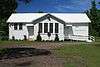 |
July 22, 2009 (#09000546) |
Along Louisiana Highway 5, about 1.6 miles (2.6 km) north of Longstreet 32°07′18″N 93°56′33″W / 32.12164°N 93.94261°W |
Longstreet | |
| 17 | Mansfield Battle Park | .jpg) |
April 13, 1973 (#73002131) |
15149 LA 175, about 2.8 miles (4.5 km) southeast of Mansfield 32°00′39″N 93°39′54″W / 32.01091°N 93.66498°W |
Mansfield | |
| 18 | Mansfield Historic District | .jpg) |
October 27, 1988 (#88002067) |
Texas Street and Adams Street around Courthouse Square 32°02′18″N 93°42′38″W / 32.03845°N 93.71043°W |
Mansfield | The 3 acres (1.2 ha) area comprises a total of 9 contributing properties built between 1905 and 1928.[7] |
| 19 | Mundy-McFarland House | December 6, 1979 (#79003120) |
200 Welsh Street 32°02′09″N 93°42′46″W / 32.03577°N 93.71269°W |
Mansfield | ||
| 20 | Myrtle Hill Plantation House | December 4, 1974 (#74002185) |
On Myrtle Hill Road, about 3.6 miles (5.8 km) southeast of Gloster 32°09′41″N 93°46′05″W / 32.16139°N 93.76802°W |
Gloster | ||
| 21 | The Oaks | January 19, 1989 (#88003203) |
Along LA 172, about 2 miles (3.2 km) west of Keachi 32°10′59″N 93°56′21″W / 32.18316°N 93.93912°W |
Keachi | ||
| 22 | Prude House | July 14, 1988 (#88001048) |
Along LA 5, about 3 miles (4.8 km) southwest of Keachi 32°08′51″N 93°55′24″W / 32.14755°N 93.92322°W |
Keachi | ||
| 23 | Roseneath | January 13, 1989 (#88003137) |
5030 LA 5, about 2.8 miles (4.5 km) southeast of Gloster 32°10′35″N 93°46′24″W / 32.17641°N 93.77339°W |
Gloster | ||
| 24 | Thomas Scott House | November 6, 1986 (#86003131) |
About 450 yards (410 m) north of LA 5 and about 3.5 miles (5.6 km) east of Gloster 32°10′51″N 93°45′32″W / 32.18092°N 93.75879°W |
Gloster | ||
| 25 | Spell House | July 14, 1988 (#88001047) |
Along LA 5, about 0.5 miles (0.80 km) southwest of Keachi 32°10′59″N 93°54′43″W / 32.18314°N 93.91181°W |
Keachi | ||
| 26 | Stribling House | May 11, 1989 (#89000403) |
Along US 84, about 9.7 miles (15.6 km) southwest of Mansfield 31°58′33″N 93°50′48″W / 31.97571°N 93.84674°W |
Mansfield | ||
| 27 | Swearingen House | November 17, 1988 (#88002658) |
Along LA 5, about 0.77 miles (1.24 km) east of Keachi 32°11′21″N 93°53′33″W / 32.18924°N 93.89253°W |
Keachi | ||
| 28 | U.S. Post Office | .jpg) |
January 12, 1983 (#83000497) |
100 North Jefferson Street 32°02′17″N 93°42′32″W / 32.03809°N 93.70889°W |
Mansfield | |
| 29 | Williams House | .jpg) |
July 22, 1994 (#94000682) |
407 Texas Street 32°02′19″N 93°42′28″W / 32.03862°N 93.70771°W |
Mansfield | |
| 30 | Wood Park | January 21, 1983 (#83000498) |
End of Addison Road, about 1.2 miles (1.9 km) south of LA 175 and about 4.3 miles (6.9 km) southeast of Mansfield 31°59′13″N 93°39′29″W / 31.98681°N 93.65816°W |
Mansfield | Also known as Glassell-Turner House. |
See also
| Wikimedia Commons has media related to National Register of Historic Places in DeSoto Parish, Louisiana. |
References
- ↑ The latitude and longitude information provided in this table was derived originally from the National Register Information System, which has been found to be fairly accurate for about 99% of listings. For about 1% of NRIS original coordinates, experience has shown that one or both coordinates are typos or otherwise extremely far off; some corrections may have been made. A more subtle problem causes many locations to be off by up to 150 yards, depending on location in the country: most NRIS coordinates were derived from tracing out latitude and longitudes from USGS topographical quadrant maps created under the North American Datum of 1927, which differs from the current, highly accurate WGS84 GPS system used by most on-line maps. Chicago is about right, but NRIS longitudes in Washington are higher by about 4.5 seconds, and are lower by about 2.0 seconds in Maine. Latitudes differ by about 1.0 second in Florida. Some locations in this table may have been corrected to current GPS standards.
- ↑ "National Register of Historic Places: Weekly List Actions". National Park Service, United States Department of the Interior. Retrieved on October 4, 2018.
- ↑ Numbers represent an ordering by significant words. Various colorings, defined here, differentiate National Historic Landmarks and historic districts from other NRHP buildings, structures, sites or objects.
- ↑ National Park Service (2009-03-13). "National Register Information System". National Register of Historic Places. National Park Service.
- ↑ The eight-digit number below each date is the number assigned to each location in the National Register Information System database, which can be viewed by clicking the number.
- 1 2 "Grand Cane Historic District" (PDF). State of Louisiana's Division of Historic Preservation. with a photo and two maps
- 1 2 "Mansfield Historic District" (PDF). State of Louisiana's Division of Historic Preservation. Retrieved May 4, 2018. with a photo and three maps
- ↑ "The Historic New Orleans Collection Quarterly" (PDF). XIII (1). Winter 1995. p. 11. Retrieved May 3, 2018.


Municipalities and communities of DeSoto Parish, Louisiana, United States | ||
|---|---|---|
| City | | |
| Towns | ||
| Villages | ||
| CDPs | ||
| Other unincorporated communities | ||
This article is issued from
Wikipedia.
The text is licensed under Creative Commons - Attribution - Sharealike.
Additional terms may apply for the media files.