National Register of Historic Places listings in Cass County, North Dakota
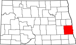
Location of Cass County in North Dakota
This is a list of the National Register of Historic Places listings in Cass County, North Dakota.
This is intended to be a complete list of the properties and districts on the National Register of Historic Places in Cass County, North Dakota, United States. The locations of National Register properties and districts for which the latitude and longitude coordinates are included below, may be seen in a map.[1]
There are 36 properties and districts listed on the National Register in the county. Another five properties were once listed but have been removed.
| Adams | Barnes | Benson | Billings | Bottineau | Bowman | Burke | Burleigh | Cass | Cavalier | Dickey | Divide | Dunn | Eddy | Emmons | Foster | Golden Valley | Grand Forks | Grant | Griggs | Hettinger | Kidder | La Moure | Logan | McHenry | McIntosh | McKenzie | McLean | Mercer | Morton | Mountrail | Nelson | Oliver | Pembina | Pierce | Ramsey | Ransom | Renville | Richland | Rolette | Sargent | Sheridan | Sioux | Slope | Stark | Steele | Stutsman | Towner | Traill | Walsh | Ward | Wells | Williams |
- This National Park Service list is complete through NPS recent listings posted October 11, 2018.[2]
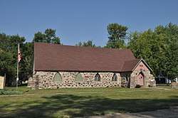
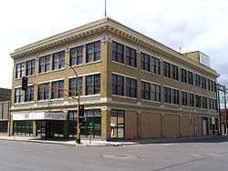
Current listings


Former listings
| [3] | Name on the Register | Image | Date listed | Date removed | Location | City or town | Summary |
|---|---|---|---|---|---|---|---|
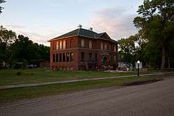
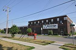
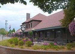
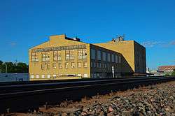
| 1 | Burlington Northern Depot | August 29, 1977 (#77001024) | December 6, 2016 | Woodard Avenue 47°00′17″N 97°13′09″W / 47.004722°N 97.219167°W |
Amenia | ||
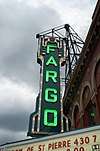
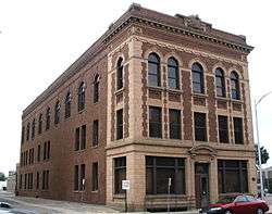
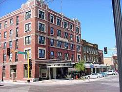
| 2 | Cole Hotel | May 9, 1983 (#83001928) | October 21, 2009 | 401-407 Northern Pacific Ave. 46°52′34″N 97°47′03″W / 46.8761°N 97.7842°W |
Fargo | ||
| 3 | Fargo and Southern Depot | April 14, 1975 (#75001303) | Unknown | 1101 2nd Ave. N. |
Fargo | ||
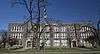
| 4 | Gethsemane Episcopal Cathedral | February 19, 1980 (#80002909) | February 25, 1991 | 204 S. 9th St. |
Fargo | ||
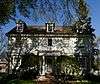
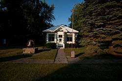
| 5 | Chesebro Smith House | 1986 (#86003744) | September 23, 2004 | 1337 Broadway |
Fargo |
See also
| Wikimedia Commons has media related to National Register of Historic Places in Cass County, North Dakota. |
References
- ↑ The latitude and longitude information provided in this table was derived originally from the National Register Information System, which has been found to be fairly accurate for about 99% of listings. For about 1% of NRIS original coordinates, experience has shown that one or both coordinates are typos or otherwise extremely far off; some corrections may have been made. A more subtle problem causes many locations to be off by up to 150 yards, depending on location in the country: most NRIS coordinates were derived from tracing out latitude and longitudes from USGS topographical quadrant maps created under the North American Datum of 1927, which differs from the current, highly accurate WGS84 GPS system used by most on-line maps. Chicago is about right, but NRIS longitudes in Washington are higher by about 4.5 seconds, and are lower by about 2.0 seconds in Maine. Latitudes differ by about 1.0 second in Florida. Some locations in this table may have been corrected to current GPS standards.
- ↑ "National Register of Historic Places: Weekly List Actions". National Park Service, United States Department of the Interior. Retrieved on October 11, 2018.
- 1 2 Numbers represent an ordering by significant words. Various colorings, defined here, differentiate National Historic Landmarks and historic districts from other NRHP buildings, structures, sites or objects.
- ↑ National Park Service (2008-04-24). "National Register Information System". National Register of Historic Places. National Park Service.
- ↑ The eight-digit number below each date is the number assigned to each location in the National Register Information System database, which can be viewed by clicking the number.
| Topics | |
|---|---|
| Lists by states |
|
| Lists by insular areas | |
| Lists by associated states | |
| Other areas | |
| |
Municipalities and communities of Cass County, North Dakota, United States | ||
|---|---|---|
| Cities | | |
| Townships | ||
| CDPs | ||
| Unincorporated communities | ||
| Footnotes | ‡This populated place also has portions in an adjacent county or counties | |
This article is issued from
Wikipedia.
The text is licensed under Creative Commons - Attribution - Sharealike.
Additional terms may apply for the media files.