Ayr, North Dakota
| Ayr, North Dakota | |
|---|---|
| City | |
 Grain equipment in Ayr | |
 | |
| Coordinates: 47°2′31″N 97°29′31″W / 47.04194°N 97.49194°WCoordinates: 47°2′31″N 97°29′31″W / 47.04194°N 97.49194°W | |
| Country | United States |
| State | North Dakota |
| County | Cass |
| Area[1] | |
| • Total | 0.08 sq mi (0.21 km2) |
| • Land | 0.08 sq mi (0.21 km2) |
| • Water | 0 sq mi (0 km2) |
| Elevation | 1,204 ft (367 m) |
| Population (2010)[2] | |
| • Total | 17 |
| • Estimate (2016)[3] | 17 |
| • Density | 210/sq mi (81/km2) |
| Time zone | UTC-6 (Central (CST)) |
| • Summer (DST) | UTC-5 (CDT) |
| ZIP code | 58007 |
| Area code(s) | 701 |
| FIPS code | 38-04020 |
| GNIS feature ID | 1027775[4] |
Ayr is a city in Cass County, North Dakota, United States. The population was 17 at the 2010 census.[5] Ayr was founded in 1883.
Geography
Ayr is located at 47°02′31″N 97°29′31″W / 47.041850°N 97.491831°W.[6]
According to the United States Census Bureau, the city has a total area of 0.08 square miles (0.21 km2), all of it land.[1]
Demographics
| Historical population | |||
|---|---|---|---|
| Census | Pop. | %± | |
| 1930 | 106 | — | |
| 1940 | 107 | 0.9% | |
| 1950 | 104 | −2.8% | |
| 1960 | 81 | −22.1% | |
| 1970 | 48 | −40.7% | |
| 1980 | 42 | −12.5% | |
| 1990 | 19 | −54.8% | |
| 2000 | 23 | 21.1% | |
| 2010 | 17 | −26.1% | |
| Est. 2016 | 17 | [3] | 0.0% |
| U.S. Decennial Census[7] 2014 Estimate[8] | |||
2010 census
As of the census[2] of 2010, there were 17 people, 9 households, and 4 families residing in the city. The population density was 212.5 inhabitants per square mile (82.0/km2). There were 10 housing units at an average density of 125.0 per square mile (48.3/km2). The racial makeup of the city was 100.0% White.
There were 9 households of which 11.1% had children under the age of 18 living with them, 44.4% were married couples living together, and 55.6% were non-families. 55.6% of all households were made up of individuals and 22.2% had someone living alone who was 65 years of age or older. The average household size was 1.89 and the average family size was 3.00.
The median age in the city was 56.3 years. 23.5% of residents were under the age of 18; 0.1% were between the ages of 18 and 24; 17.7% were from 25 to 44; 23.6% were from 45 to 64; and 35.3% were 65 years of age or older. The gender makeup of the city was 41.2% male and 58.8% female.
2000 census
As of the census of 2000, there were 23 people, 11 households, and 7 families residing in the city. The population density was 279.5 people per square mile (111.0/km2). There were 13 housing units at an average density of 158.0 per square mile (62.7/km2). The racial makeup of the city was 86.96% White, and 13.04% from two or more races.
There were 11 households out of which 9.1% had children under the age of 18 living with them, 63.6% were married couples living together, and 27.3% were non-families. 27.3% of all households were made up of individuals and 18.2% had someone living alone who was 65 years of age or older. The average household size was 2.09 and the average family size was 2.38.
In the city, the population was spread out with 13.0% under the age of 18, 4.3% from 18 to 24, 21.7% from 25 to 44, 17.4% from 45 to 64, and 43.5% who were 65 years of age or older. The median age was 50 years. For every 100 females, there were 76.9 males. For every 100 females age 18 and over, there were 100.0 males.
The median income for a household in the city was $46,875, and the median income for a family was $139,068. Males had a median income of $33,750 versus $0 for females. The per capita income for the city was $55,567. None of the population and none of the families were below the poverty line.
References
- 1 2 "US Gazetteer files 2010". United States Census Bureau. Archived from the original on 2012-01-24. Retrieved 2012-06-14.
- 1 2 "American FactFinder". United States Census Bureau. Retrieved 2012-06-14.
- 1 2 "Population and Housing Unit Estimates". Retrieved June 9, 2017.
- ↑ "US Board on Geographic Names". United States Geological Survey. 2007-10-25. Retrieved 2008-01-31.
- ↑ "2010 Census Redistricting Data (Public Law 94-171) Summary File". American FactFinder. United States Census Bureau. Archived from the original on 21 July 2011. Retrieved 2 May 2011.
- ↑ "US Gazetteer files: 2010, 2000, and 1990". United States Census Bureau. 2011-02-12. Retrieved 2011-04-23.
- ↑ United States Census Bureau. "Census of Population and Housing". Archived from the original on May 12, 2015. Retrieved July 21, 2013.
- ↑ "Population Estimates". United States Census Bureau. Retrieved June 3, 2015.
External links
| Wikivoyage has a travel guide for Ayr (North Dakota). |
Municipalities and communities of Cass County, North Dakota, United States | ||
|---|---|---|
| Cities | 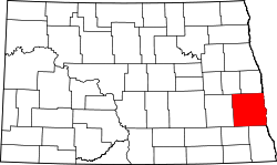 | |
| Townships | ||
| CDPs | ||
| Unincorporated communities | ||
| Footnotes | ‡This populated place also has portions in an adjacent county or counties | |
| Counties | ||
|---|---|---|
| Main cities | ||
| Surrounding areas |
| |
‡ - county seat | ||