Frontier, North Dakota
| Frontier, North Dakota | |
|---|---|
| City | |
 Street in Frontier | |
 Location of Frontier, North Dakota | |
| Coordinates: 46°48′1″N 96°50′0″W / 46.80028°N 96.83333°WCoordinates: 46°48′1″N 96°50′0″W / 46.80028°N 96.83333°W | |
| Country | United States |
| State | North Dakota |
| County | Cass |
| Area[1] | |
| • Total | 0.19 sq mi (0.49 km2) |
| • Land | 0.19 sq mi (0.49 km2) |
| • Water | 0 sq mi (0 km2) |
| Elevation | 906 ft (276 m) |
| Population (2010)[2] | |
| • Total | 214 |
| • Estimate (2016)[3] | 208 |
| • Density | 1,100/sq mi (440/km2) |
| Time zone | UTC-6 (Central (CST)) |
| • Summer (DST) | UTC-5 (CDT) |
| ZIP code | 58104 |
| Area code(s) | 701 |
| FIPS code | 38-28720 |
| GNIS feature ID | 1037276[4] |
Frontier is a city in Cass County, North Dakota, United States. The population was 214 at the 2010 census.[5] Frontier is located south of the city of Fargo and is located roughly six miles southwest of that city's downtown. Frontier was founded in 1976. Since its founding the adjacent city of Fargo, ND has grown to the point where it almost complete encompasses Frontier's city limits. Only a small gap on the city's southwest corner keeps Frontier from being a complete enclave community within Fargo's border.
Geography
Frontier is located at 46°48′1″N 96°50′0″W / 46.80028°N 96.83333°W (46.800343, -96.833370).[6]
According to the United States Census Bureau, the city has a total area of 0.19 square miles (0.49 km2), all of it land.[1]
Demographics
| Historical population | |||
|---|---|---|---|
| Census | Pop. | %± | |
| 1980 | 160 | — | |
| 1990 | 218 | 36.3% | |
| 2000 | 273 | 25.2% | |
| 2010 | 214 | −21.6% | |
| Est. 2016 | 208 | [3] | −2.8% |
| U.S. Decennial Census[7] 2015 Estimate[8] | |||
2010 census
As of the census[2] of 2010, there were 214 people, 75 households, and 67 families residing in the city. The population density was 1,126.3 inhabitants per square mile (434.9/km2). There were 76 housing units at an average density of 400.0 per square mile (154.4/km2). The racial makeup of the city was 98.6% White, 0.9% African American, and 0.5% from two or more races. Hispanic or Latino of any race were 0.5% of the population.
There were 75 households of which 33.3% had children under the age of 18 living with them, 88.0% were married couples living together, 1.3% had a female householder with no husband present, and 10.7% were non-families. 10.7% of all households were made up of individuals and 4% had someone living alone who was 65 years of age or older. The average household size was 2.85 and the average family size was 3.03.
The median age in the city was 43.5 years. 20.6% of residents were under the age of 18; 8.8% were between the ages of 18 and 24; 22.4% were from 25 to 44; 43.8% were from 45 to 64; and 4.2% were 65 years of age or older. The gender makeup of the city was 50.9% male and 49.1% female.
2000 census
As of the census of 2000, there were 273 people, 78 households, and 73 families residing in the city. The population density was 1,522.5 people per square mile (585.6/km²). There were 78 housing units at an average density of 435.0 per square mile (167.3/km²). The racial makeup of the city was 99.27% White and 0.73% African American. Hispanic or Latino of any race were 1.10% of the population.
There were 78 households out of which 62.8% had children under the age of 18 living with them, 87.2% were married couples living together, 3.8% had a female householder with no husband present, and 6.4% were non-families. 3.8% of all households were made up of individuals and 1.3% had someone living alone who was 65 years of age or older. The average household size was 3.50 and the average family size was 3.59.
In the city, the population was spread out with 35.5% under the age of 18, 8.1% from 18 to 24, 27.8% from 25 to 44, 27.8% from 45 to 64, and 0.7% who were 65 years of age or older. The median age was 35 years. For every 100 females, there were 105.3 males. For every 100 females age 18 and over, there were 109.5 males.
The median income for a household in the city was $67,813, and the median income for a family was $68,438. Males had a median income of $42,917 versus $20,938 for females. The per capita income for the city was $21,611. None of the families and 1.6% of the population were living below the poverty line.
References
- 1 2 "US Gazetteer files 2010". United States Census Bureau. Archived from the original on 2012-07-14. Retrieved 2012-06-14.
- 1 2 "American FactFinder". United States Census Bureau. Retrieved 2012-06-14.
- 1 2 "Population and Housing Unit Estimates". Retrieved June 9, 2017.
- ↑ "US Board on Geographic Names". United States Geological Survey. 2007-10-25. Retrieved 2008-01-31.
- ↑ "2010 Census Redistricting Data (Public Law 94-171) Summary File". American FactFinder. United States Census Bureau. Archived from the original on 21 July 2011. Retrieved 2 May 2011.
- ↑ "US Gazetteer files: 2010, 2000, and 1990". United States Census Bureau. 2011-02-12. Retrieved 2011-04-23.
- ↑ United States Census Bureau. "Census of Population and Housing". Archived from the original on May 12, 2015. Retrieved July 21, 2013.
- ↑ "Population Estimates". United States Census Bureau. Archived from the original on October 19, 2016. Retrieved July 16, 2016.
Municipalities and communities of Cass County, North Dakota, United States | ||
|---|---|---|
| Cities | 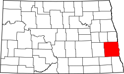 | |
| Townships | ||
| CDPs | ||
| Unincorporated communities | ||
| Footnotes | ‡This populated place also has portions in an adjacent county or counties | |
| Counties | ||
|---|---|---|
| Main cities | ||
| Surrounding areas |
| |
‡ - county seat | ||