Landscape
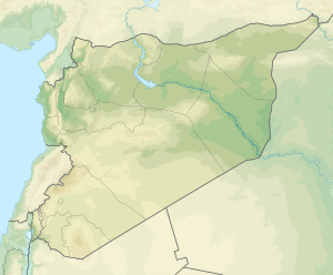
Mount Simeon is part of the Limestone Massif in the western part of the Aleppo plateau. It is located about 20 km northwest of Aleppo. The mountain runs for 50 km from north to south with a width range of 20–40 km and average elevation of 500–600 m. The highest point is Sheikh Barakāt (876 m) in the southern part of the mountain.
The valley of River ʻIfrīn runs between Mount Simeon and Mount Kurd to the west. Aʻzāz valley marks the northern boundary of the mountain, beyond which lies the Aʻzāz plain and Mount Barṣa (Barṣāyā) on the Aintab plateau. The valley of river Quweiq runs along the eastern side of the mountain. South of the mountain lie the Dāna and Atarib plains. Old routes connecting Qinnasrin to Antioch run through these plains to the ʻIfrīn valley at its westward turn and separate Mount Simeon from Ḥārim Mountains to the south.
|
|---|
|
|
|---|
| Jabal Samaan Subdistrict |
- Aleppo
- Abtin
- Assan
- Ayn al-Kabira
- Azzan
- Duwayr al-Zaytun
- Haddadin
- Hilan
- Hreibel
- Kafr Saghir
- Khan Tuman
- Maghayer Khan Tuman
- Maratat al-Muslimiyah
- al-Muslimiyah
- al-Muslimiyah al-Shamaliyah
- Qarras
- Rasm Assan
- Saqlaya
- Siefat
- Tell Shair Samaan
- Tell Shughayb
- al-Dhahabiyah
- al-Wadihi
|
|---|
| Tell al-Daman Subdistrict |
- Tell al-Daman
- Abu Rweil
- Ameriyeh
- Arjel
- Atshana Sharqiya
- Atshana Gharbiya
- Ballas
- Ballas al-Jadida
- Batranah
- Burda
- Buwaida Saghira
- Deir Saliba
- Hmeidi
- Hober
- Jubb Aleis
- Kafr Obeid
- al-Mintar
- Mreiqes
- Oweinat Kabira
- Rasm al-Mofakker
- Tabara al-Khusheir
- Um al-Karamel
|
|---|
| Haritan Subdistrict | |
|---|
| Darat Izza Subdistrict |
- Darat Izza
- Bshantara
- Basrtun
- Bishqatin
- Kafrantin
- al-Hoteh
- Hur
- Injarah
- Qabtan al-Jabal
- al-Sakhriyah
- Taqad
|
|---|
| al-Hadher Subdistrict | |
|---|
| al-Zirbah Subdistrict |
- al-Zirbah
- Abad
- Arada
- Banes
- Barnah
- Barqum
- Bawabiyah
- Humayrah
- Huweir al-Eiss
- Jazraya
- Jubb Kas
- Kassibeh
- Othmaniya Kabira
- Rasm al-Eiss
- Talafeh
- Tell Allush
- Tell Hidyah
- Zitan
- Ziyara Samaan
|
|---|
| Zammar Subdistrict | |
|---|
|
| |
|
|
|---|
| Afrin Subdistrict | |
|---|
| Bulbul Subdistrict |
- Bulbul
- Burj Haider
- Darmashkanli
- Deir Ballut
- Fafertin
- Jalbul
- Kimar
- Karzahayel
|
|---|
| Jandairis Subdistrict | |
|---|
| Maabatli Subdistrict | |
|---|
| Rajo Subdistrict | |
|---|
| Sharran Subdistrict | |
|---|
| Shaykh al-Hadid Subdistrict | |
|---|
|
|
|
|
|
|
|---|
| Dayr Hafir Subdistrict | |
|---|
| Kuweires Sharqi Subdistrict | |
|---|
| Rasm Harmil al-Imam Subdistrict | |
|---|
|
|
|
|
|
|---|
| As-Safira Subdistrict | |
|---|
| Banan Subdistrict | |
|---|
| al-Hajib Subdistrict | |
|---|
| Khanasir Subdistrict | |
|---|
| Tell Aran Subdistrict | |
|---|
|
|