Caloundra (suburb)
| Caloundra Sunshine Coast, Queensland | |||||||||||||||
|---|---|---|---|---|---|---|---|---|---|---|---|---|---|---|---|
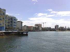 Caloundra waterfront, 2008 | |||||||||||||||
 Caloundra | |||||||||||||||
| Coordinates | 26°47′56″S 153°07′59″E / 26.799°S 153.133°ECoordinates: 26°47′56″S 153°07′59″E / 26.799°S 153.133°E | ||||||||||||||
| Population | 3,917 (2016 census)[1] | ||||||||||||||
| • Density | 1,004/km2 (2,600/sq mi) | ||||||||||||||
| Postcode(s) | 4551 | ||||||||||||||
| Area | 3.9 km2 (1.5 sq mi) | ||||||||||||||
| Location |
| ||||||||||||||
| LGA(s) | Sunshine Coast Region | ||||||||||||||
| County | Canning | ||||||||||||||
| Parish | Bribie | ||||||||||||||
| State electorate(s) | Caloundra | ||||||||||||||
| Federal Division(s) | Fisher | ||||||||||||||
| |||||||||||||||
Caloundra is a suburb of the Sunshine Coast, Queensland, Australia,[2] including the central business district of the Caloundra urban centre, which is located on Bulcock Street. At the 2016 Australian Census, the suburb recorded a population of 3,917.[1]
Heritage listings
The suburb of Caloundra has a number of heritage-listed sites, including:
- Bowman Road: Tripcony Hibiscus Caravan Park[3]
Education
Caloundra contains the following schools within its boundaries:
- Caloundra State School (1889)
- Caloundra State High School (1967)
- Caloundra Christian College (1983)
Caloundra is also home to a campus of the Sunshine Coast Institute of TAFE.
Shopping
- Stockland Caloundra
- Caloundra Village Shopping Centre
Parks and recreation
- Bulcock Beach (patrolled by Ithaca–Caloundra City Life Saving Club) and Clarke Place Park
- Central Park (includes Caloundra Tennis Centre, which hosts the Caloundra International)
- Ben Bennett Botanical Park
- Bicentennial Park
- Lighthouse Park
- Roy Henzell Park
Other facilities
- Caloundra Hospital[4]
- Caloundra bus station
- Caloundra Golf Club
- Council service centre for Sunshine Coast Region
- A range of accommodation from backpackers to resort hotels
References
- 1 2 Australian Bureau of Statistics (27 June 2017). "Caloundra (State Suburb)". 2016 Census QuickStats. Retrieved 29 March 2018.

- ↑ "Caloundra - suburb in Sunshine Coast Region (entry 48556)". Queensland Place Names. Queensland Government. Retrieved 29 June 2017.
- ↑ "Tripcony Hibiscus Caravan Park (entry 602708)". Queensland Heritage Register. Queensland Heritage Council. Retrieved 14 July 2013.
- ↑ Department of Health (Queensland). "Sunshine Coast Health Service District - Caloundra Health Service". Retrieved 21 June 2011.
External links


This article is issued from
Wikipedia.
The text is licensed under Creative Commons - Attribution - Sharealike.
Additional terms may apply for the media files.