Maroochydore (suburb)
| Maroochydore Sunshine Coast, Queensland | |||||||||||||||
|---|---|---|---|---|---|---|---|---|---|---|---|---|---|---|---|
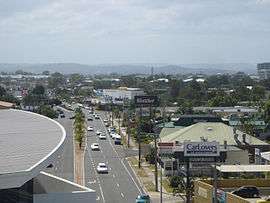 Aerodrome Road, 2006 | |||||||||||||||
 Maroochydore | |||||||||||||||
| Coordinates | 26°39′18″S 153°05′35″E / 26.655°S 153.093°ECoordinates: 26°39′18″S 153°05′35″E / 26.655°S 153.093°E | ||||||||||||||
| Population | 16,800 (2016 census)[1] | ||||||||||||||
| • Density | 1,388/km2 (3,596/sq mi) | ||||||||||||||
| Postcode(s) | 4558 | ||||||||||||||
| Area | 12.1 km2 (4.7 sq mi) | ||||||||||||||
| Location |
| ||||||||||||||
| LGA(s) | Sunshine Coast Region | ||||||||||||||
| County | Canning | ||||||||||||||
| Parish | Mooloolah | ||||||||||||||
| State electorate(s) | Maroochydore, Buderim | ||||||||||||||
| Federal Division(s) | Fairfax | ||||||||||||||
| |||||||||||||||
Maroochydore is a suburb of the Sunshine Coast, Queensland, Australia, and is the central suburb of the Maroochydore urban centre.
Maroochydore contains a popular surf beach. The Maroochy River's southern bank forms a virtually unbroken stretch of parkland and picnic spots in the area known as Cotton Tree. An oceanway encourages sustainable travel by pedestrians and cyclists along the beaches.
Maroochydore is also a major commercial area of the Sunshine Coast with most shopping precincts located in the central business district. It is home to the Sunshine Plaza[2] shopping centre and the Sunshine Coast's major bus interchange for TransLink services on Sunshine Coast.
References
- ↑ Australian Bureau of Statistics (27 June 2017). "Maroochydore (State Suburb)". 2016 Census QuickStats. Retrieved 18 April 2018.

- ↑ http://www.sunshineplaza.com/
This article is issued from
Wikipedia.
The text is licensed under Creative Commons - Attribution - Sharealike.
Additional terms may apply for the media files.